
Download
3D Flyover
Add to list
More
7.4 km
~1 hrs 55 min
265 m
Loop
“A quiet Pentland loop where still waters, steep grassy slopes, and wide valley views feel wonderfully wild.”
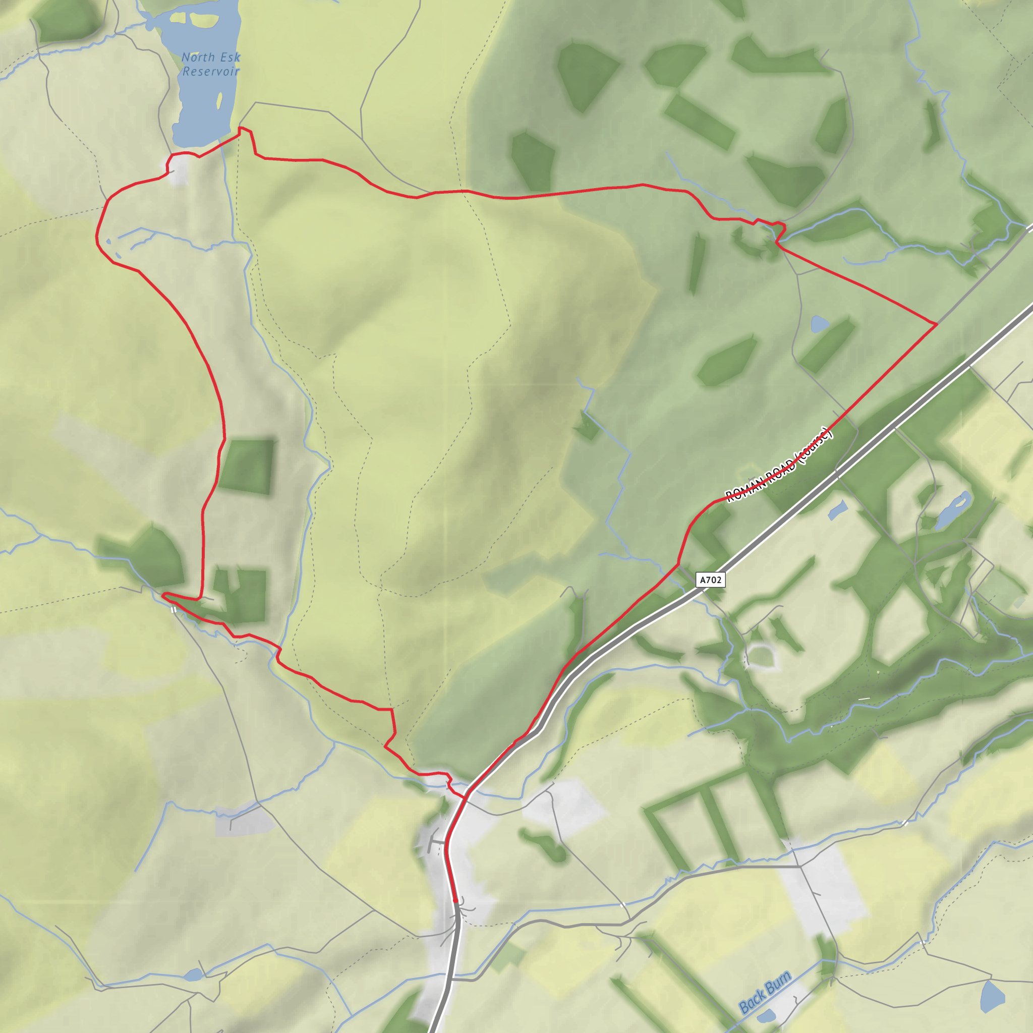
This medium-difficulty loop explores one of the quieter corners of the Pentland Hills, combining a peaceful reservoir approach with a steeper hill section over Patie’s Hill and open views across the upper North Esk valley. At roughly 7 km / 4.3 miles with around 300 m / 985 ft of ascent, it is a compact outing, but it feels bigger than the numbers suggest because the route mixes estate tracks, rougher hill paths, and a sustained climb above the water. The usual starting point is the small car park in the former quarry at Carlops, near Carlops Village Hall on Main Street, Carlops, West Linton EH26 9NF; Carlops is widely used as the access point for walks to North Esk Reservoir and the surrounding hills. (eskvalleytrust.org)
From the start, the route heads out of Carlops on a clear track toward Fairliehope and the reservoir. The opening section is straightforward and gives you time to settle in before the climbing begins. Expect a gradual rise through pastoral ground and open hill country, with the broad Pentland skyline ahead and the valley of the North Esk beginning to open out. This first stretch is usually the easiest underfoot, making it a good place to find a rhythm and check your line on HiiKER before the route becomes more exposed. A reasonable guide is around 2.5 to 3 km / 1.6 to 1.9 miles from Carlops to the reservoir area, with much of the ascent gained gently rather than all at once. (walkhighlands.co.uk)
What the route feels like on the ground
North Esk Reservoir is the visual centerpiece of the walk. The water sits in a quiet, high setting beneath rounded Pentland slopes, and the atmosphere here is often more remote than you might expect for such a short loop. After reaching the reservoir, the route turns into a more hill-focused outing. The climb toward Patie’s Hill is the section that gives the walk its medium rating: it can be steep in places, grassy underfoot, and more tiring in wet or windy conditions. If the ground is saturated, the slope can feel slippery, and in mist the broad hill terrain can make line-finding less obvious, so this is the point where careful navigation matters most. (walkhighlands.co.uk)
Once higher up, the reward is a wide outlook over the North Esk valley, the reservoir basin, and neighboring Pentland tops. The hill itself is not especially rugged, but the openness means weather is a bigger factor than distance. Strong wind, low cloud, or winter ice can make a short route feel much more serious. Hikers should be prepared for boggy patches, wet grass, and occasional indistinct trods rather than expecting a fully engineered trail throughout. (eskvalleytrust.org)
The descent and return leg loop back toward Fairlie Hope and Carlops. This section often feels quicker, but tired legs can make the downhill grassy ground awkward, especially after rain. Trekking poles can be useful here, though the route is still manageable for most regular walkers with decent footwear. Because grazing land and moorland are part of the landscape, it is sensible to expect sheep, possibly cattle on lower ground, and seasonal sensitivities around lambing and ground-nesting birds. Sticking to established paths helps protect habitat and reduces disturbance. (eskvalleytrust.org)
Landmarks, wildlife, and landscape character
The reservoir itself has both scenic and historical importance. North Esk Reservoir was built in 1850 by Penicuik mill owners to regulate river flow for the paper mills farther down the valley, and the engineer was Thomas Stevenson, father of Robert Louis Stevenson. What now feels like a quiet upland landscape was once tied directly to the industrial life of the Esk valley. As the mills disappeared, the reservoir area took on more of a wildlife and recreation role. (eskvalleytrust.org)
This part of the Pentlands is also notable for its natural history. The area around North Esk Reservoir is designated as a Site of Special Scientific Interest for both biological and geological interest, including unusual rock exposures west of Patie’s Hill. The upper North Esk is one of the river’s source areas, and the mix of moorland, rough grassland, burns, and reservoir margins supports upland birdlife and a quieter, less manicured feel than some of the busier Pentland routes. Depending on season and luck, hikers may spot raptors overhead, small moorland birds, and the usual mix of sheep-dotted hillsides and heather-fringed ground. (eskvalleytrust.org)
There is also a deeper historical layer to the wider region.
Surfaces
Unknown
Asphalt
Dirt
Unpaved
Comments and Reviews
User comments, reviews and discussions about the North Esk Reservoir, Patie's Hill and Fairlie Hope Loop, Scotland.
average rating out of 5
0 rating(s)
