
Download
3D Flyover
Add to list
More
8.9 km
~2 hrs 11 min
238 m
Loop
“Woodland hush gives way to windswept ridge views and ancient hillfort intrigue above Peebles.”
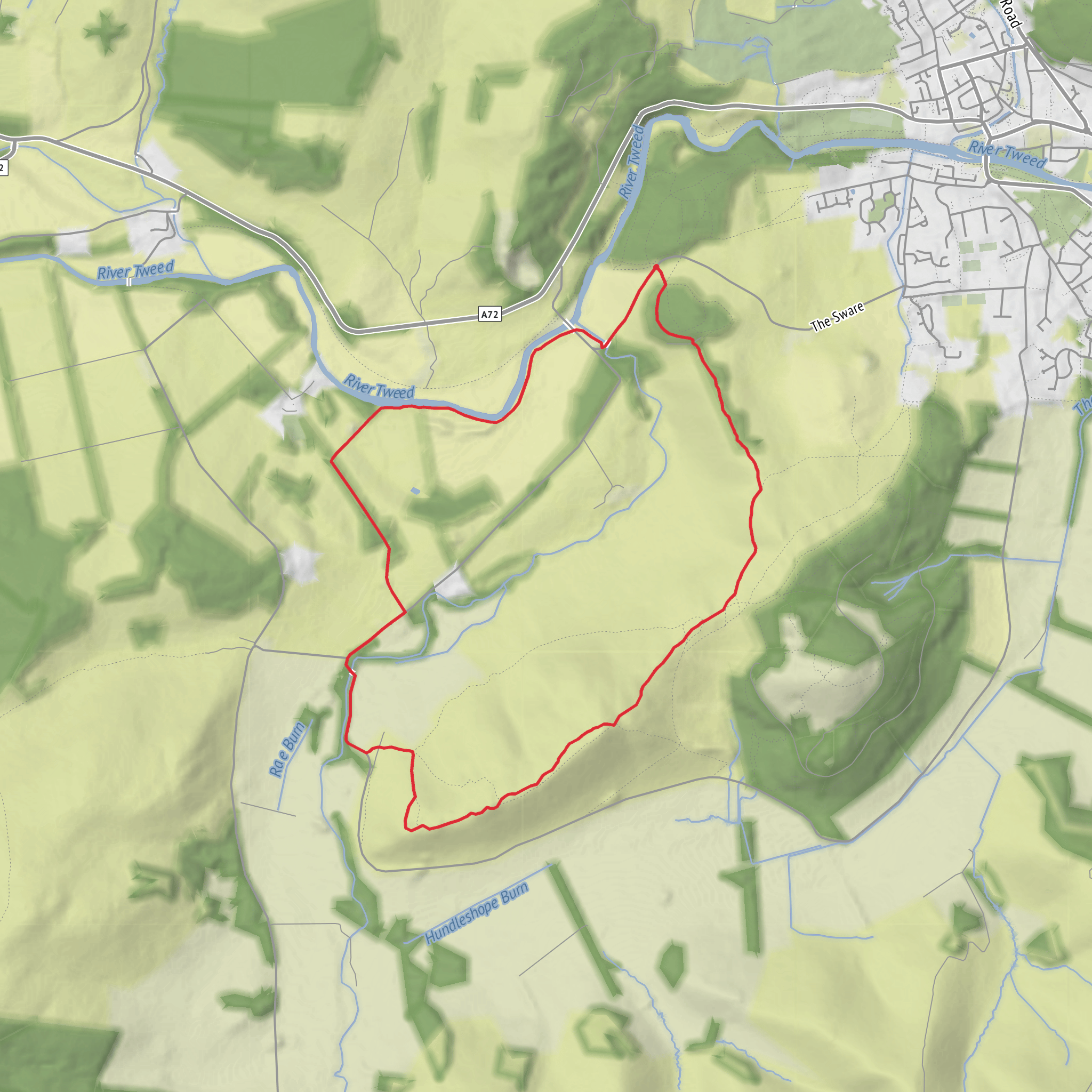
This medium-grade loop explores the wooded slopes above Peebles before climbing onto the open ridge of Cademuir Hill, where broad views over the Tweed Valley are matched by some of the area’s most intriguing prehistoric remains. At around 9 km / 5.6 miles with roughly 200 m / 656 ft of ascent, it is a manageable half-day outing, but it feels bigger than the numbers suggest because the route mixes forest tracks, steeper hill paths, and more exposed ground on the ridge. The start is best understood as being near Cademuir Forest car park, Bonnington Road, Peebles, EH45 9HH, about 1.5 miles / 2.4 km south of central Peebles. Forestry and Land Scotland notes that this is the main access point for the forest and that parking is free. (forestryandland.gov.scot)
From the outset, expect a gentle introduction through mixed woodland rather than an immediate climb. Cademuir is known for its larch and pine forest, and the lower section usually feels sheltered and quiet, with wide gravel tracks helping you settle into the walk before the route steepens. Forestry and Land Scotland describes the forest as peaceful and highlights panoramic views from the summit area, while local Tweed Valley visitor information also points to the forest’s reputation for wildlife watching. (forestryandland.gov.scot)
Climbing through the forest
The ascent tends to build gradually over the first few kilometres, then becomes more sustained as the route leaves the easier lower tracks and works uphill toward the ridge. On a loop of this length and elevation, most of the climbing is concentrated in the middle third of the walk, so it is worth pacing yourself early. Even though the total ascent is only about 200 m / 656 ft, some sections can feel steeper underfoot, especially if the ground is damp or churned up after forestry traffic. Forestry and Land Scotland specifically warns that timber haulage and loading operations can take place on forest roads here, so hikers should stay alert around working areas and only pass machinery when signalled to do so. (forestryandland.gov.scot)
Navigation is usually straightforward on the main forest roads, but it becomes more important once you branch onto smaller hill paths and begin linking the woodland with the fort and ridge sections. For planning and on-the-ground route checking, HiiKER is the tool to rely on, especially where multiple tracks intersect in the forest or where informal paths split across the hillside.
As height is gained, the character of the walk changes noticeably. The enclosed woodland gives way to more open slopes and wider sightlines across Peebles, the River Tweed, and the surrounding hills of the Borders. This transition is one of the strengths of the route: it combines a sheltered forest walk with a more expansive upland feel without requiring a very long day. The ridge around Cademuir Hill is well known for its views over the Tweed Valley Forest Park, part of a wider forest landscape that includes Glentress and Cardrona. (forestryandland.gov.scot)
Cademuir fort and the ridge
The historical highlight is the fort on Cademuir Hill. Canmore records the fort at about 1,050 ft / 320 m above sea level on a rocky knoll near the south-west end of the elongated summit ridge, and notes that it is one of the forts in the area incorporating chevaux de frise into its defences, a prehistoric obstacle made from upright stones intended to hinder attackers. Trove also identifies Cademuir Hill as a prehistoric fort landscape with additional archaeological features in the surrounding area. (canmore.org.uk)
That history gives this walk more depth than a standard forest circuit. You are not just climbing to a viewpoint; you are moving through a landscape that was strategically important long before modern paths and forestry roads existed. The fort’s position makes sense as soon as you reach the higher ground: the ridge commands extensive views over Upper Tweeddale, and the defensive siting would have allowed people to monitor movement through the valley. Some older accounts refer to multiple camps or fortified sites on Cademuir, which reflects the broader archaeological significance of the hill rather than a single isolated feature. (canmore.org.uk)
The ridge section is often the most memorable part of the loop. Expect a more open, wind-exposed feel here than in the forest below. In clear weather, the views stretch across Peebles and toward the surrounding hills; in poor weather, the same openness can make the route feel more serious, so an extra layer and waterproofs are sensible even on a relatively short outing. Underfoot, paths may be rougher and muddier than the lower tracks, and short uneven sections around the fort area deserve care
Surfaces
Unknown
Asphalt
Dirt
Comments and Reviews
User comments, reviews and discussions about the Monorbridge Wood, Cademuir fort and Tweed Valley Loop, Scotland.
average rating out of 5
0 rating(s)
