Download
3D Flyover
Add to list
More
15.0 km
~3 hrs 30 min
296 m
Loop
“A spacious southern Pentlands circuit of grassy ridges, boggy moor, and big-sky summit views.”
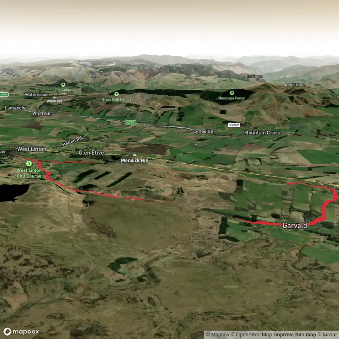
This medium-difficulty loop explores the quieter southern Pentlands, linking broad grassy ridges, open moorland, and a handful of rounded summits for a day out of roughly 15 km / 9.3 miles with about 300 m / 985 ft of ascent. The terrain is more about steady hillwalking than technical difficulty, but it can feel bigger than the numbers suggest because sections cross exposed, sometimes pathless or faintly trodden ground where wet weather can turn the moor boggy and slow progress. A comparable Ramblers route in the same area describes open farmland, moorland, occasional poorly marked ground, and 360-degree views from the tops, with Dunsyre Road at Garvald used as the start area. (ramblers.org.uk)
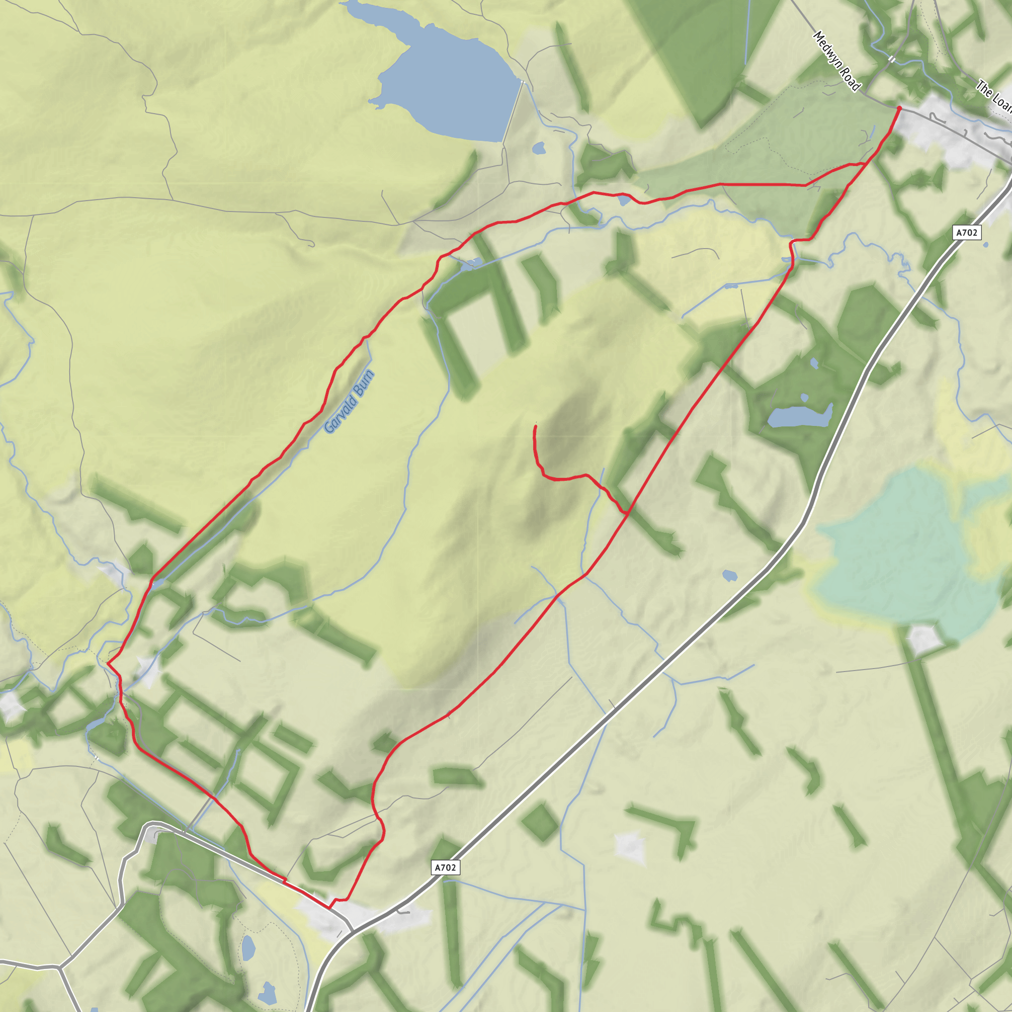
The start is best understood as being near Dunsyre Road, Garvald, near Garvald Home Farm, South Lanarkshire, Scotland, close to the southern end of the Pentland Hills and not far from the small village of Dunsyre. One published walk in this area gives the starting point as Dunsyre Road, Garvald, postcode EH46 7HQ, which is a useful landmark for planning even if exact parking arrangements vary by route. (ramblers.org.uk)
By car, most hikers approach from Edinburgh or the central belt via the A702 and local roads toward Garvald/Dunsyre. Roads here are rural, narrow in places, and passing spots may be limited, so it is worth arriving early and parking considerately. By public transport, this is much less straightforward than the northern Pentlands: the Pentland Way guidance notes that there is no bus service directly at Dunsyre, and that walkers usually need to connect via Dolphinton and then walk onward toward Garvald Home Farm. Other local sources also indicate that Dunsyre itself has no regular bus service, making a car the most practical option for most people. (pentlandfriends.org.uk)
What the route feels like
Expect a gentle-to-moderate opening over pastoral ground before the route begins climbing onto more open hill country. The southern Pentlands have a softer, broader character than some rockier upland areas in Scotland: long grassy shoulders, peatier patches, heather, rushes, and wide skies dominate the day. The climbing is usually spread across several rises rather than one single sustained haul, so the route tends to alternate between easy walking, short steeper pulls, and flatter connecting ridges.
Mendick Hill is one of the key high points and is known for its trig point and expansive views across the Pentlands and into the Borders on a clear day. From there, the loop typically continues over similarly rounded ground toward Sandy Hill and Upper Cairn, with the appeal lying in the sense of space rather than dramatic crags. In good visibility, this is a very scenic circuit; in mist, the same broadness can make the hills feel featureless, so careful navigation matters. The Pentland Hills Regional Park contains around 10,000 hectares and roughly 100 km / 62 miles of paths, but not every southern hill route is waymarked to the same standard as the more popular access points. (stevenfallon.co.uk)
Approximate effort breakdown for a 15 km / 9.3 mile version of the loop: - first 3 to 4 km / 1.9 to 2.5 miles: easier approach walking, often on estate tracks, farm access, or grassy paths - middle 6 to 8 km / 3.7 to 5 miles: the main hill section, including the bulk of the ascent and the most exposed ground - final 3 to 4 km / 1.9 to 2.5 miles: descent and return, often quicker underfoot unless conditions are wet
Terrain, navigation, and preparation
Although the route is rated medium, preparation should lean toward full hillwalking kit rather than casual walking gear. The main things to expect are: - boggy or saturated ground after rain - faint or intermittent paths on open moor - wind exposure on the ridges - poor visibility in low cloud, especially around the broader tops - livestock and working farmland near the
Surfaces
Unknown
Gravel
Grass
Asphalt
Comments and Reviews
User comments, reviews and discussions about the Mendick Hill, Sandy Hill and Upper Cairn Loop, Scotland.
average rating out of 5
0 rating(s)
