Download
Preview
Add to list
More
19.6 km
~5 hrs 5 min
703 m
Loop
“Ancient drove roads lead into vast, boggy Borders ridges where effort meets history and sweeping solitude.”
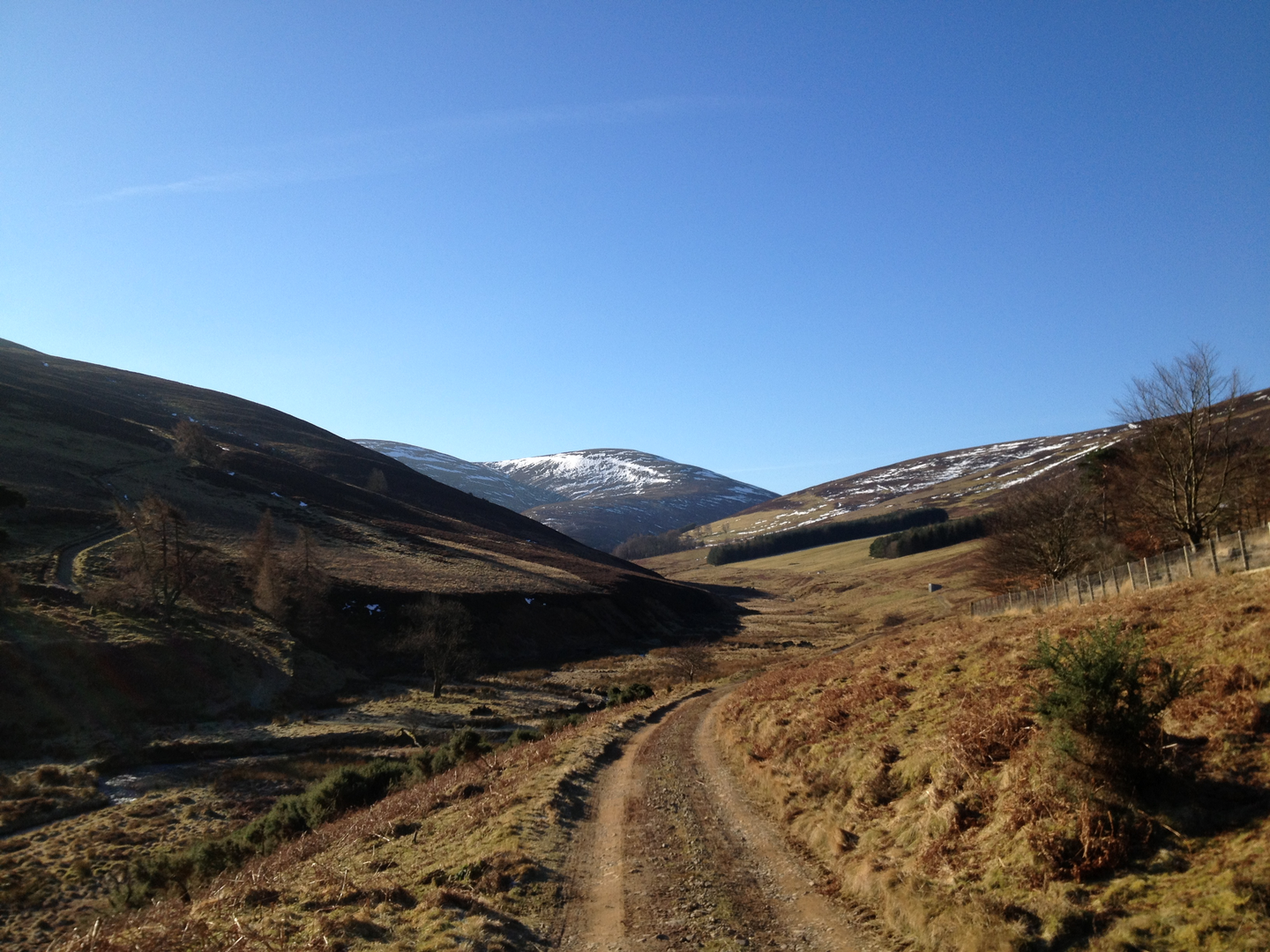
This is a big, open Borders circuit over rolling moorland ridges rather than a tightly engineered path walk, and that shapes the whole day. Expect roughly 20 km / 12.5 miles with around 700 m / 2,300 ft of ascent, though closely related versions of the same circuit are often recorded a little longer and higher depending on which tops and return line are included. The usual start is at the end of Glen Road, Peebles, near the lay-by and track entrance by the Haystoun Burn / Gypsy Glen access, grid reference NT259392. That places the hike head just southeast of central Peebles, near the road end at Glen Road, Peebles, EH45. (walkhighlands.co.uk)
The route begins gently enough on estate track and old hill access lines, but it quickly turns into a broad upland outing where the ground can be rough, wet and energy-sapping. Even in good weather, this is not a casual stroll: the “medium” rating fits strong walkers with hill fitness, but the combination of distance, exposure, peat, and occasionally faint paths means it can feel harder than the numbers suggest. Several route descriptions for the wider horseshoe specifically note rough moorland tracks and paths, with very boggy sections, especially once you are beyond the more obvious approach lines. (walkhighlands.co.uk)
The opening climb follows the line of an old drove road, a historic route once used to move livestock across the Borders. That old road is one of the most distinctive features of the day: long stone walls, gates, and a clear sense that this landscape was shaped as much by movement and grazing as by geology. ScotWays identifies the Gypsy Glen Drove Road as part of a historic drove-road network linking into wider cross-Borders routes, which gives the first section real historical depth rather than it being just a practical ascent line. (scotways.com)
Route character and what to expect
From Glen Road, the track heads out past the burn and climbs steadily with widening views back over Peebles and the Tweed valley. Early on, the gradients are manageable and the route can feel deceptively straightforward. As height is gained, the landscape opens into classic Borders hill country: rounded tops, heather, rough grasses, peat hags in places, and long fence lines that often help with orientation. Kirkhope Law is usually the first notable high point on this line, reached after the old drove road leaves the more enclosed lower ground behind. From there, the route continues onto Birkscairn Hill, where the hillwalking starts to feel more committing and the views become broader and more remote in character. (walkhighlands.co.uk)
Birkscairn Hill sits at about 661 m / 2,169 ft, and the onward ridge toward Dun Rig gives the walk its best sense of scale. Dun Rig itself rises to about 744 m / 2,441 ft on the larger horseshoe routes and is one of the key high summits above Glensax. If your version of the loop includes it, this is the high point of the day and the place where the route feels most expansive, with long views across the Moorfoot Hills, Tweeddale, and deeper into the Southern Uplands in clear weather. (stevenfallon.co.uk)
Underfoot, the main thing to prepare for is inconsistency. Some stretches are on clear hill paths or ATV tracks, but others are faint, heathery, or bog-soft. After rain, the moor can hold water well, and even in drier spells there may be peaty patches that slow progress. Good waterproof footwear is important, and gaiters are often worthwhile. Because the ridges are broad and rounded rather than sharply defined, poor visibility can make navigation more serious than the terrain first suggests. For planning and on-route checking, use HiiKER and do not rely on a single visible trod continuing all the way.

Surfaces
Unknown
Asphalt
Comments and Reviews
User comments, reviews and discussions about the Kirkhope Law, Birkscairn Hill and Dun Rig Loop, Scotland.
average rating out of 5
0 rating(s)