Download
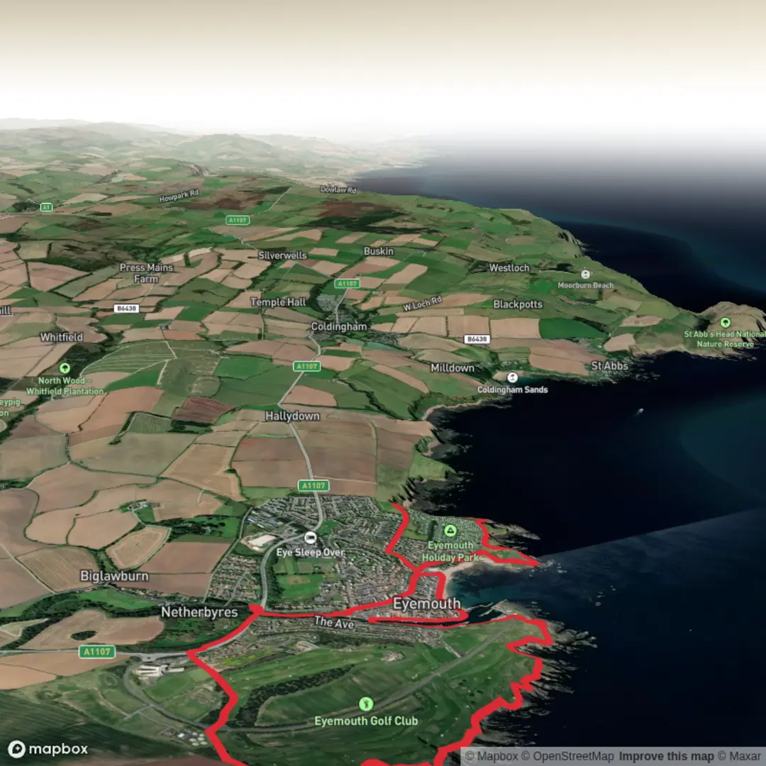
3D Flyover
Add to list
More
8.6 km
~1 hrs 52 min
88 m
Loop
“Harbour history, wild cliffs, and a tranquil loch make this Eyemouth loop quietly captivating.”
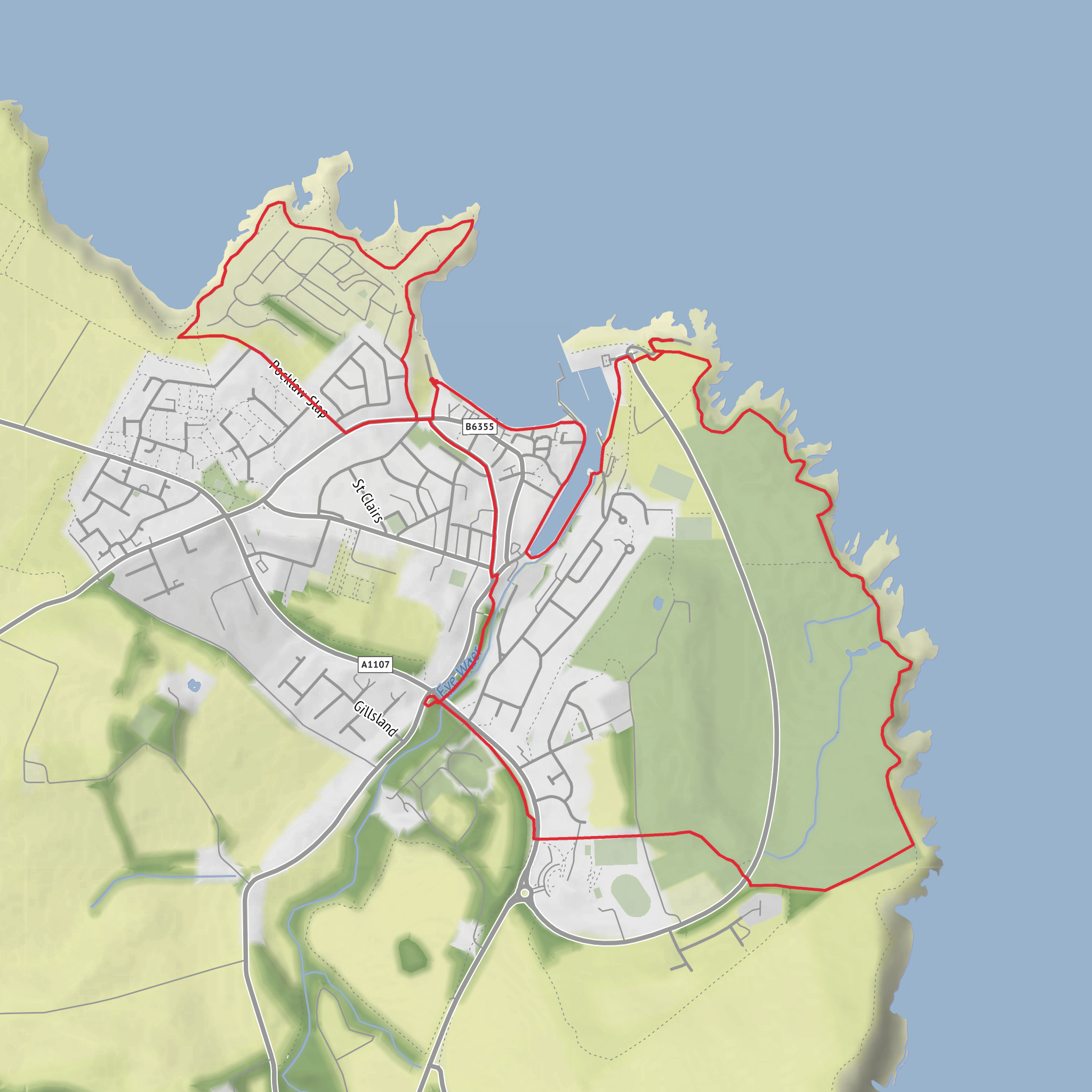
This easy coastal-and-country loop near Eyemouth packs a lot into roughly 9 km / 5.6 miles, with only about 100 m / 330 ft of ascent, so it suits walkers looking for a relaxed half-day outing rather than a strenuous hike. The route combines harbour heritage, open cliff-top walking, a quiet inland loch, and a short stretch of rugged shoreline atmosphere around Killiedraught Bay. Expect a mix of pavements, firm paths, grassy sections, and some potentially uneven coastal ground, especially if conditions are wet. The walk is generally straightforward, but the cliff-edge sections deserve care in wind or rain, and it is worth checking the route in HiiKER before setting out. Eyemouth Fort and the harbour area are established landmarks for the start, and the nearest practical start point is around Gunsgreen House, Gunsgreen Quay, Eyemouth, TD14 5SD, or the nearby Harbour View public parking area on the east side of the harbour. (visitberwickshirecoast.co.uk)
Getting to the start is fairly simple for a small Borders coastal town. By car, Eyemouth lies just off the A1 via the A1107, around 8 miles / 13 km north of Berwick-upon-Tweed and about 12 km / 7.5 miles south-east of Reston. For parking, Gunsgreen Quay itself is permit-controlled, but nearby free public parking is shown at Harbour View, and longer-stay alternatives have also been identified around Gunsgreenhill. By public transport, Eyemouth is linked by Borders Buses service 253, which serves Eyemouth and Reston Station; Reston is the nearest railhead for onward bus connections into town. Because rural timetables can change, it is sensible to confirm the latest train and bus times before travel. (earthwise.bgs.ac.uk)
The opening part of the loop is rich in local history. Eyemouth Fort stands on a headland above the harbour and marks one of the most historically important points on the walk. The fort originated during the mid-16th century conflicts known as the Rough Wooing, and the site later developed into a major artillery fortification associated with English, Scottish, and French military history. Today, what remains is largely earthwork and landscape rather than towering masonry, so this is a place to appreciate shape, position, and strategic views rather than expecting a fully intact castle. From here, the outlook over the harbour and North Sea helps explain why the site mattered so much. (trove.scot)
Along the coast to Killiedraught Bay
From the fort and harbour, the route heads out toward the coast on a short circular section that gives a fine sense of Eyemouth’s meeting point between town and sea. The paths around Killiedraught Bay are among the most scenic parts of the loop, with views north toward the Berwickshire coast and south back to the harbour. This bay is not just attractive; it is also geologically notable. The coastal rocks around Eyemouth include folded Silurian greywackes and siltstones, and nearby features such as Elgy Loch and Killiedraught Bay reflect the area’s complex structure and volcanic history. For walkers, that translates into dramatic rocky edges, textured cliff scenery, and a coastline that feels much wilder than the modest distance might suggest. (scotlandstartshere.com)
This section is usually the one to treat with the most respect. In calm weather it is an easy and enjoyable coastal ramble, but exposed edges, gusty winds, and slippery grass can quickly change the feel of the walk. Good footwear is enough for most people, though after rain the grassy and earth paths may become slick. If visibility is poor, keeping an eye on your position in HiiKER is useful where paths split or become less distinct near open ground. (scotlandstartshere.com)
Wildlife can be one of the quiet highlights here. The cliffs and sea views create good conditions for spotting seabirds, especially outside the busiest town section, and the mix of rough grassland, scrub, and shoreline can also bring gulls, waders, and seasonal coastal bird activity. Offshore, keep an eye on the water as the Berwickshire coast is well known for marine life, even if sightings are never guaranteed. The inland part of the loop around Elgy Loch adds a calmer contrast, with more sheltered habitat and a different feel from the exposed coast.
Surfaces
Unknown
Asphalt
Grass
Unpaved
Gravel
Concrete
Paved
Comments and Reviews
User comments, reviews and discussions about the Eyemouth Fort, Elgy Loch and Killiedraught Bay Loop, Scotland.
average rating out of 5
0 rating(s)
