
Download
3D Flyover
Add to list
More
13.7 km
~3 hrs 44 min
605 m
Loop
“A wild Perthshire circuit unfolds from shimmering lochside calm to boggy, wind-brushed upland solitude.”
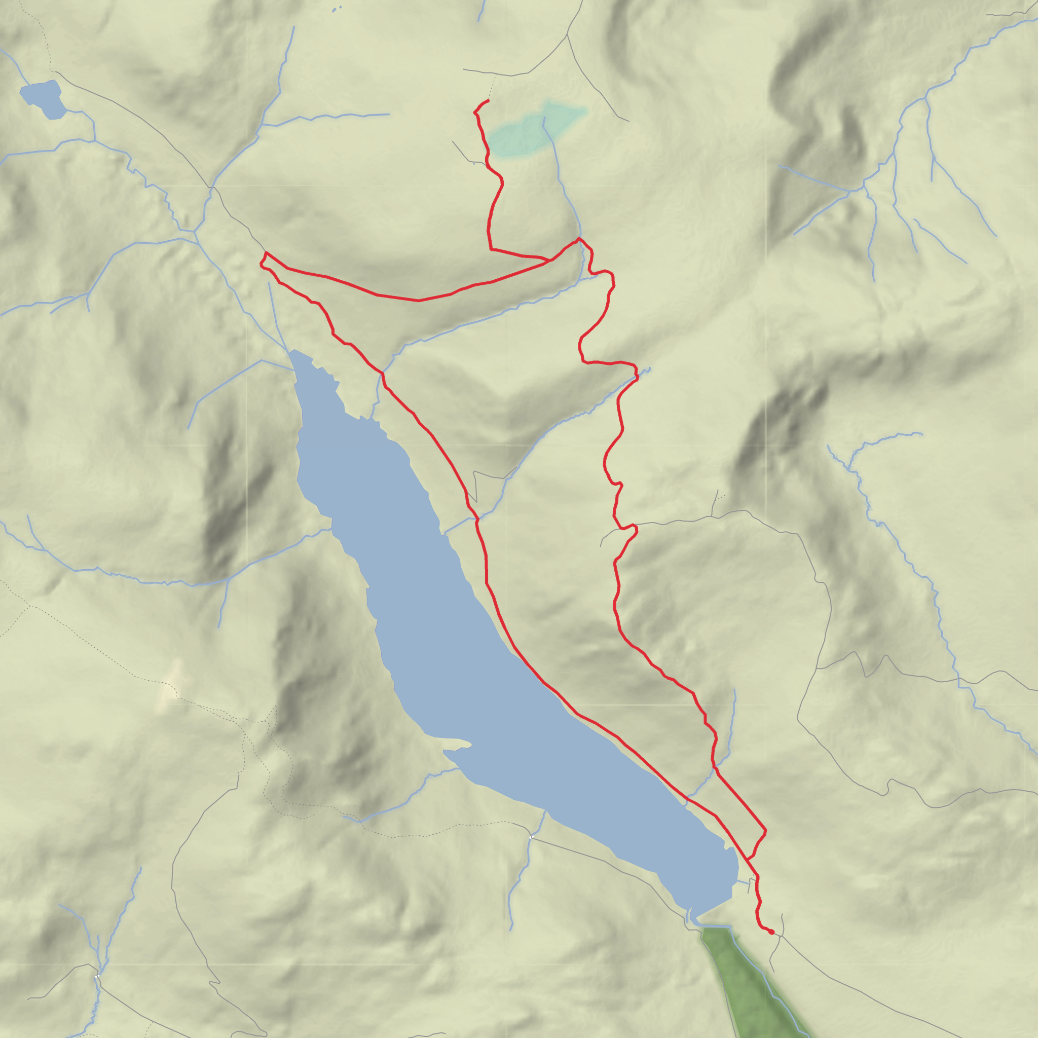
This is a medium-difficulty hill-and-reservoir circuit in Perthshire that combines a long approach beside Loch Turret with a broad upland crossing over Auchnafree Hill and a return on estate tracks. Although your details list the walk at around 14 km, the commonly described full loop from the dam car park is closer to 18.25 km / 11.25 miles with about 623 m / 2,044 ft of ascent, so it is worth planning for the longer figure unless you are intentionally using a shortened variation. (walkhighlands.co.uk)
The route starts at the Loch Turret dam car park, just below the dam at Loch Turret, northwest of Crieff, Perth and Kinross. The start is usually described by grid reference NN820264, and the nearest practical landmark is Loch Turret Dam, Crieff PH7 4LD. Loch Turret itself lies about 8.7 km / 5.4 miles northwest of Crieff at the head of Glen Turret. (walkhighlands.co.uk)
From the outset, expect a remote feel rather than a busy waymarked outing. The first section uses a good track beside the eastern side of the reservoir, making for a relatively straightforward warm-up. This part is scenic rather than steep, with the long water body stretched through a glacial trench and the crags across the loch giving the walk a much bigger mountain character than the modest starting elevation suggests. Loch Turret is a freshwater reservoir about 3.6 km / 2.2 miles long, sitting at roughly 358 m / 1,175 ft above sea level. (en.wikipedia.org)
After roughly 4.5 km / 2.8 miles, near the head of the loch, the route turns sharply right and begins the main climb onto the southern slopes of Auchnafree Hill. This is where the day changes character. The easy lochside progress gives way to a more sustained ascent on estate tracks, with increasingly wide views back over the reservoir and across to Ben Chonzie and the surrounding Perthshire hills. The climb is not especially technical, but it is steady enough that wind, rain, or low cloud can make it feel much more serious than the “medium” rating suggests. (walkhighlands.co.uk)
Terrain and navigation
Most of the route uses good land-rover or estate tracks, but the upper mountain section is less defined. Near the high ground, the track becomes rougher and fainter, and the final approach to the summit cairn can feel vague in mist. The plateau around Auchnafree Hill is known for being boggy and featureless away from the tracks, and the onward section toward Choinneachain Hill can be rough, wet, and pathless if you cut directly across instead of sticking to the longer tracked line. That means this is a walk where strong navigation matters, especially in poor visibility; if you are checking the route in advance or following it on the day, use HiiKER carefully and do not rely on obvious footpath definition once you leave the main lower tracks. (walkhighlands.co.uk)
Underfoot, hikers should be ready for a mix of compact track, wetter moorland, heather, and peatier ground higher up. Even in drier weather, the plateau can hold water, and after prolonged rain the bog factor rises quickly. Waterproof footwear, spare warm layers, and enough food and water for a longer hill day are sensible. Because the route is exposed for long stretches, wind chill can be significant at any time of year. (walkhighlands.co.uk)
Landmarks, landscape, and wildlife
One of the defining landmarks is Loch Turret Dam itself. Glen Turret has been dammed for water supply since the 1860s, and the present earth dam dates to 1963. The reservoir holds back a substantial volume of water and gives the walk its distinctive opening and closing scenery. (walkhighlands.co.uk)
The landscape tells a much older story than the dam. Loch Turret occupies an ice-carved glacial trench, and the hummocky ground near the head of the loch is associated with glacial
Comments and Reviews
User comments, reviews and discussions about the Auchnafree Hill, Loch Turret and Rock Cairn Loop, Scotland.
average rating out of 5
0 rating(s)

