Download
3D Flyover
Add to list
More
10.4 km
~3 hrs 18 min
730 m
Out and Back
“Schiehallion offers a striking, weather-shaped climb from heather slopes to a rugged, cloud-brushed summit.”
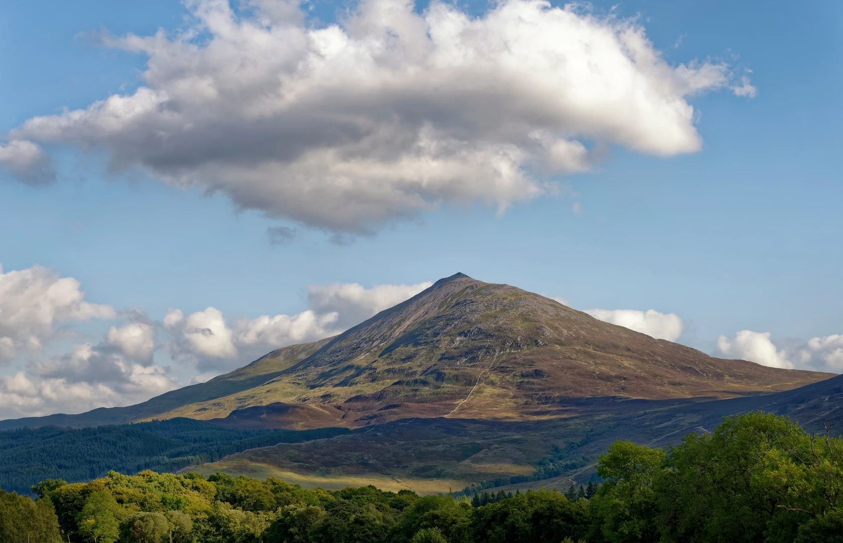
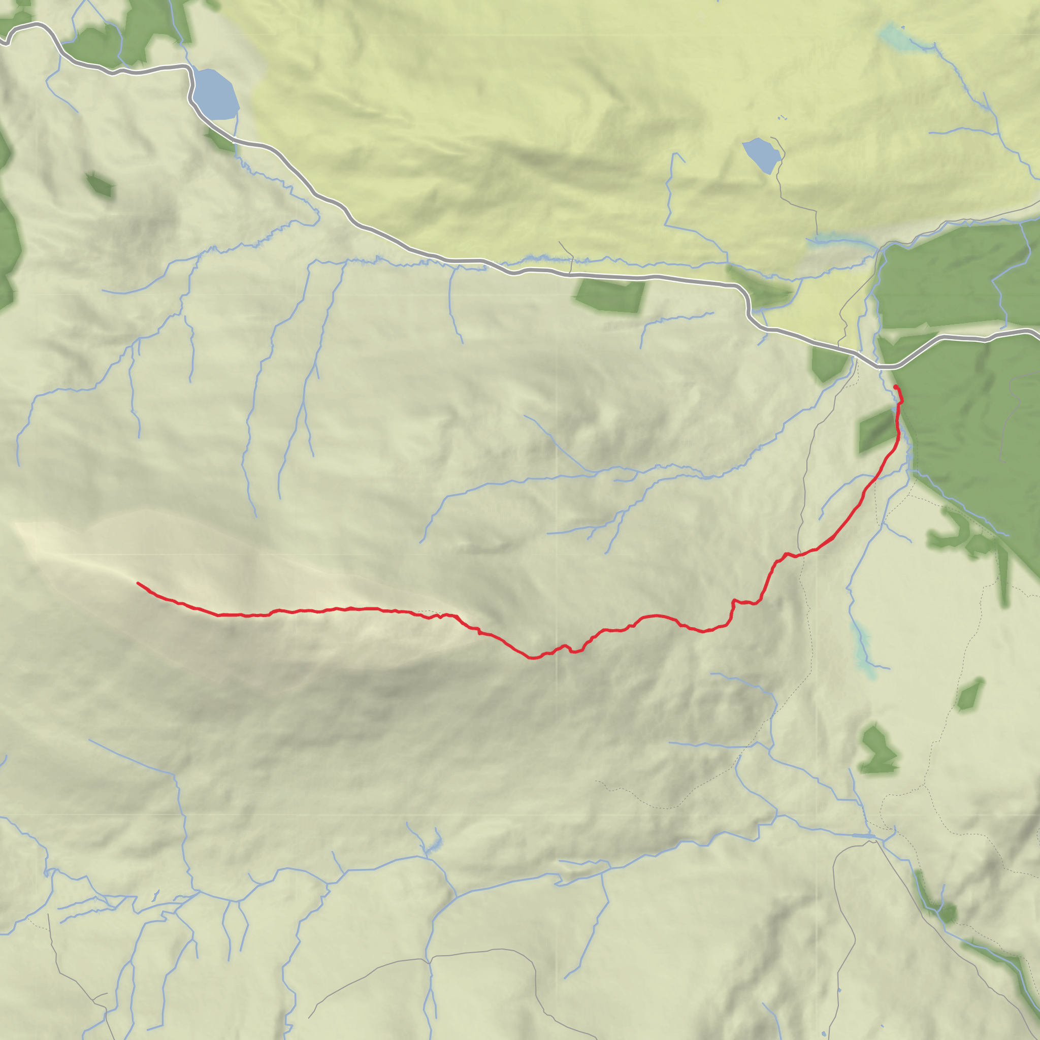
This is a short but serious mountain outing on one of Scotland’s most recognizable peaks, with roughly 10 km / 6.2 miles of walking and about 700 m / 2,300 ft of ascent depending on exactly where you start and how much wandering you do near the summit. The usual start is the Braes of Foss car park, a well-known trailhead on the minor road signed for Schiehallion off the B846 between Aberfeldy and Tummel Bridge, near Kinloch Rannoch, Perthshire, Scotland. The mountain itself rises to 1,083 m / 3,553 ft and is famous for its near-symmetrical profile, which makes it look deceptively straightforward from a distance. (forestryandland.gov.scot)
The route begins on an excellent engineered path that climbs steadily across open hillside. Early on, the gradient is manageable rather than brutal, and the broad track makes the first section feel more approachable than the overall “Difficult” rating suggests. That rating becomes more understandable higher up, where the terrain grows rougher, the weather can change quickly, and the summit approach involves looser, more awkward ground. Even on a clear day, this is still a mountain environment where wind, mist, and cold can turn a simple ascent into a much more committing walk. Schiehallion’s name is often interpreted in ways that reflect its wild, weather-catching character, and the summit is frequently wrapped in cloud. (walkhighlands.co.uk)
What to expect on the ascent
From the car park, the path climbs through heather moorland and open upland terrain, with views opening behind you toward Loch Rannoch and the surrounding Perthshire hills as height is gained. A useful way to think about the route is in three parts: a well-built lower path, a higher ridge approach, and a final rocky summit section. The lower and middle sections are generally clear underfoot, but the upper mountain becomes stonier and more exposed. The maintained path was realigned in response to heavy erosion caused by the hill’s popularity, so it is important to stay on the main line rather than cutting corners. (outdoorscot.co.uk)
At around the halfway point of the climb, the mountain’s shape becomes more obvious and the views widen dramatically. On a fine day, this is where the route starts to feel less like a hill path and more like a true mountain ascent. The summit ridge is broad in places, but the final approach is not a simple stroll: the last section is known for boulders and rougher footing, and in mist it can feel much less obvious than the lower path. Hikers should be prepared for slower progress here, especially on descent when tired legs make uneven rocks more awkward. (walkhighlands.co.uk)
Navigation, terrain, and hazards
Although the route is popular and the main ascent path is usually easy to follow in good visibility, Schiehallion should not be underestimated. The biggest issues are often rapid weather change, strong wind, poor visibility, and the awkward boulder field near the top. In cloud, the summit area can become disorienting, and the descent line is easier to miss than many expect. Checking the route carefully in HiiKER before setting out is a sensible step, especially if low cloud is forecast. (walkhighlands.co.uk)
The mountain is also extremely busy in good weather, and the trailhead can fill early. The main Braes of Foss car park is relatively small, with overflow parking available farther along the road. Because of the popularity of the route, an early start is often the best option for both parking and a quieter ascent. (forestryandland.gov.scot)
In wet or windy conditions, expect the hike to feel significantly harder than the numbers suggest. The path can be slick, the upper rocks greasy, and the summit much colder than the glen below. Even though the round trip is only around 10 km / 6.2 miles, this is not a casual walk; allow enough time for a steady ascent, a careful summit section, and an unhurried descent.
Landmarks, nature, and wildlife
One of the most notable landmarks on the route is the mountain itself: Schiehallion’s elegant cone is one of the classic silhouettes in Scotland. As you climb, the surrounding landscape opens toward Loch Rannoch, Glen Lyon, and a wide spread of Highland hills. The mountain sits in a nationally important upland landscape with moorland, montane habitats, and broad panoramic viewpoints. (outdoorscot.co.uk)
The lower slopes are characterized by heather, grasses, and moorland vegetation, while higher up the terrain becomes more austere and rocky. Wildlife sightings can vary with season and
Comments and Reviews
User comments, reviews and discussions about the Schiehallion, Scotland.
average rating out of 5
0 rating(s)
