Download
3D Preview
Add to list
More
12.1 km
~4 hrs
948 m
Out and Back
“A tough Highland loop with soaring ridges, sweeping Loch Tay views, and a true mountain feel.”
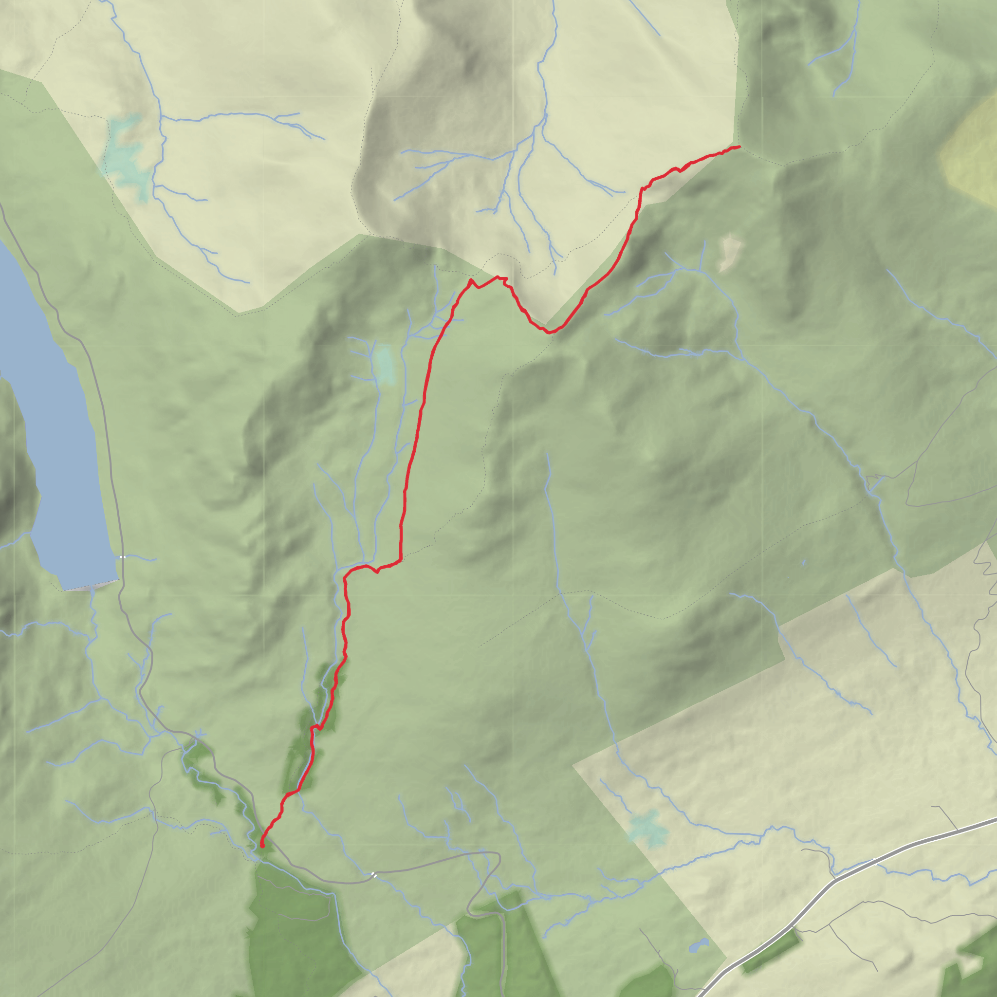
This difficult loop over Beinn Ghlas and Ben Lawers packs a lot into roughly 12 km / 7.5 miles, with about 1,000 m / 3,280 ft of ascent. It starts from the Ben Lawers car park on the minor mountain road between Loch Tay and Glen Lyon, within Ben Lawers National Nature Reserve, managed by the National Trust for Scotland. The usual start point is the Ben Lawers car park near Loch Tay, Killin, Perth and Kinross, rather than a street address in the usual sense, as the trailhead sits high on a rural pass road. (nts.org.uk)
The route is a classic high-level outing: a steady but unrelenting climb onto Beinn Ghlas, followed by a ridge walk to Ben Lawers, the highest mountain in the central Highlands at 1,214 m / 3,983 ft. Although the distance is not especially long, the elevation gain, exposure to wind and weather, and the sustained nature of the ascent make it a serious mountain day. Expect a well-used path for much of the route, but do not mistake that for an easy walk; in poor visibility, the broad upper slopes and ridge can still demand careful navigation, and HiiKER is the right tool to have ready before setting out. (walkhighlands.co.uk)
Getting to the start
By car, most hikers approach from the Loch Tay side on the minor road that climbs above the loch toward Glen Lyon. The trail begins at the Ben Lawers car park, which the National Trust for Scotland notes is available for visitors, though it is not suitable for coaches or large campervans. The access road is narrow and mountainous, so allow extra time and drive cautiously, especially in poor weather or outside summer conditions. (nts.org.uk)
By public transport, the nearest practical hub is usually Killin or the wider Loch Tay area, but direct access to the high trailhead is limited. The National Trust for Scotland advises checking public transport options in advance, and many walkers using buses will need a taxi for the final approach to the car park. (nts.org.uk)
The opening section begins immediately with uphill work. From the car park, the path climbs north-northeast before bending toward the broad shoulder of Beinn Ghlas. Over the first 2 to 3 km / 1.2 to 1.9 miles, much of the day’s effort is front-loaded, with a strong, continuous ascent on a clear mountain path. Early on, views open across Loch Tay and into the surrounding Perthshire hills, and this lower section can feel deceptively straightforward in calm weather. (bdhc.org.uk)
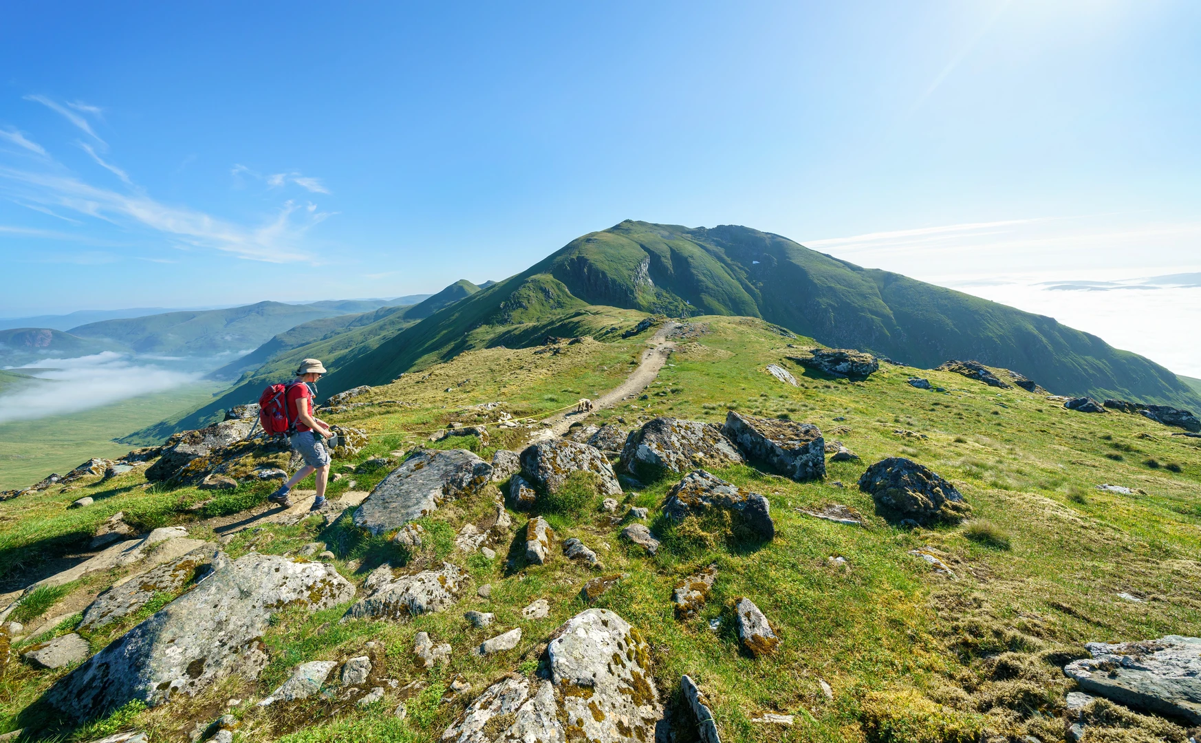
As height is gained, the terrain becomes more open and more exposed. Beinn Ghlas, at about 1,103 m / 3,619 ft, is often reached after the main initial climb, and it serves as both a summit in its own right and a dramatic reveal point for Ben Lawers beyond. This is one of the defining moments of the route: only from Beinn Ghlas does the full bulk of Ben Lawers come properly into view. (walkhighlands.co.uk)
On the ridge and upper mountain
From Beinn Ghlas, the route continues along the connecting ridge to Ben Lawers. The distance between the two tops is not great, but there is a descent and re-ascent that can feel more tiring than it looks on paper, especially if strong winds are funnelling across the ridge. Allow roughly another 2 km / 1.2 miles to move between the summits, with additional ascent that contributes to the overall 1,000 m / 3,280 ft total. The path is generally obvious in good conditions, but cloud can reduce the sense of scale and make pacing harder than expected. (walkhighlands.co.uk)
Ben Lawers itself is the high point of the route and one of Scotland’s most celebrated Munros. The summit area is notable not only for its panoramic views over Loch Tay, Glen Lyon, and the wider Lawers range, but also for its geology: the mountain has conspicuous rock slope failures that have shaped parts of the summit landscape and created sheltered niches for wildlife. (en.wikipedia.org)
The descent usually retraces the ridge back over Beinn Ghlas before dropping to the car park, creating a demanding out-and-back style loop experience centered on the two summits. On the return, the long descent can be hard on knees and ankles, particularly if the path is wet, loose, or busy. Trekking poles can be useful here, and extra care is needed if rain has made the stone and worn sections slick.
Nature, wildlife, and what to look for
Ben Lawers National Nature Reserve is one of the botanical highlights of the Scottish Highlands. The reserve
Surfaces
Unknown
Ground
Wood
Asphalt
Comments and Reviews
User comments, reviews and discussions about the Beinn Ghlas and Ben Lawers Loop, Scotland.
average rating out of 5
0 rating(s)
