Download
Preview
Add to list
More
3.8 km
~53 min
81 m
Loop
“A breezy coastal loop with ancient cairns, seabird drama, and sweeping island views above wild cliffs.”
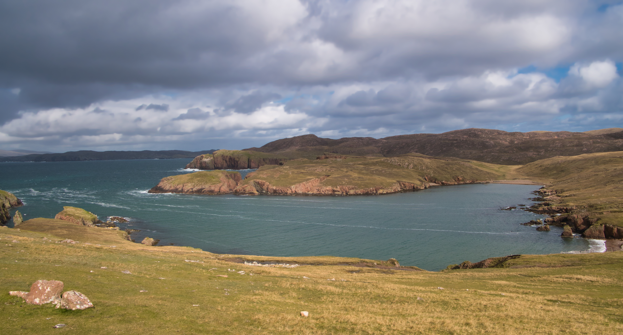
This medium-grade loop on Rousay packs a lot into a short outing: roughly 3.8 to 4 km / 2.4 to 2.5 miles, about 100 m / 330 ft of ascent, and a notably exposed headland setting with wide views over the North Isles and along one of the island’s most dramatic stretches of coast. The route begins at the small parking area near Faraclett Farm, just south of Faraclett Head, which is the clearest landmark for the hike start. Official route notes place the start at the small parking place near the farm of Faraclett, a short distance off the minor road. (orkney.com)
The walking is varied for such a short circuit. You begin by heading uphill through gates and across open fields before reaching rougher ground on the headland. The terrain is a mix of grassy pasture, faint hill track, and rough coastal heath, with sections that can be wet underfoot. Although the distance is modest, the route feels more serious than the numbers suggest because the headland is highly exposed to wind and weather, and some sections run above steep grassy slopes and cliffs. That exposure is a big part of the appeal, but it is also the main reason the walk sits comfortably in the medium category. (orkney.com)
What to expect on the route
From the parking area near Faraclett Farm, the route climbs gently through a couple of gates and across fields, gaining height early without ever becoming especially strenuous. After about 0.5 to 1 km / 0.3 to 0.6 miles, the views begin to open across the Holm of Scockness toward Egilsay, including the distinctive tower of St Magnus Church in the distance. Soon after, the route crosses a drystone dyke by a stile and continues on a line marked by wooden posts. (orkney.com)
As the loop develops, the landscape changes from grazed farmland to heather-clad hillside and maritime heath. Around the kissing gate, roughly 1.5 km / 0.9 miles into the walk, you pass the remains of a pair of chambered cairns, one of the most memorable features on the route. From there the path continues northwest with increasingly expansive views west along Saviskaill Bay and toward the terraced slopes of Kierfea Hill. (orkney.com)
Near the outer part of the headland, the route bends northeast and then branches toward the large stone cairn that marks the northern summit area of Faraclett Head. This is the visual high point of the walk, with open sea to the west and north and island views stretching toward Westray, Eday, Stronsay, and Sanday on a clear day. The return leg crosses back over open ground toward Faraclett, closing the loop through more pasture and gates. (orkney.com)
Landmarks, wildlife, and landscape
Faraclett Head sits within one of Rousay’s most important coastal landscapes. The area around Quendal-Brings and Faraclett forms the second-largest coastal heath designated as a Site of Special Scientific Interest in Orkney, recognised for both birdlife and plant communities. The cliffs support seabirds including guillemot, kittiwake, fulmar, razorbill, puffin, black guillemot, and shag, while the wider heath and moorland support species such as Arctic tern, Arctic skua, great skua, snipe, curlew, and short-eared owl. (orkney.gov.uk)
In summer, this can be an excellent short walk for birdwatching, with constant movement offshore and above the cliffs. The same exposure that creates the huge views also makes this a place where birds use the updrafts along the coast. Hikers should give nesting birds plenty of space, especially in the breeding season, and keep dogs under close control around livestock and sensitive wildlife areas. (orkney.gov.uk)
The plant life is also a highlight. Official route notes mention heather and seasonal wildflowers such as red lousewort, bog asphodel, and devil’s-bit scabious along the hillside. More broadly, the Rousay SSSI is noted for maritime grassland, maritime heath, inland heath

Comments and Reviews
User comments, reviews and discussions about the Rousay – Faraclett Head Loop, Scotland.
average rating out of 5
0 rating(s)