Download
3D Flyover
Add to list
More
5.3 km
~1 hrs 4 min
8 m
Loop
“A breezy Stronsay loop blends lochside wildlife, rugged shores, and big-sky coastal solitude.”
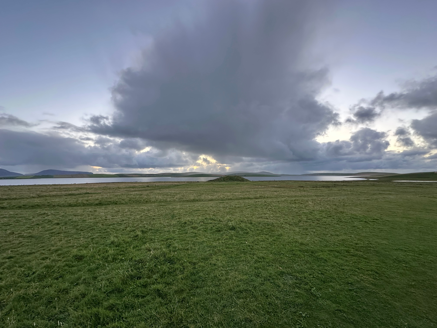
This easy coastal loop on Stronsay explores one of the island’s quieter corners, linking the low headlands of the Point of Freyageo and Tor Ness with the lochside ground around Lea Shun. Although the elevation gain is negligible—about 0 m / 0 ft overall—the walk still feels varied because it moves between open farmland, wetland margins, low sea cliffs, shingle and sandy shore, and broad views over the North Isles seascape. Expect a route of roughly 5 km / 3.1 miles, with mostly gentle walking on grassy tracks and informal coastal paths rather than engineered trail surfaces. (wherecanwewalk.com)
The start is best described as near Holland Farm, Holland, Stronsay, Orkney, a useful landmark on the island’s west side close to Lea Shun and Tor Ness. Lea Shun lies beside the hamlet of Holland and near Tor Ness, making Holland Farm the clearest practical reference point for planning arrival and parking. (wherecanwewalk.com)
From the outset, the character of the walk is open and exposed. Stronsay is a low-lying island shaped by the sea, and this part of the route reflects that perfectly: wide skies, little shelter, and a constant sense of coastline rather than inland hillwalking. Because the terrain is almost flat, this is a good option for walkers wanting a shorter outing without steep climbs, but “easy” here should not be mistaken for fully straightforward in all conditions. Grass can be wet, peat can soften after rain, and coastal sections may be rougher underfoot than the distance suggests. (orkney.com)
What the route feels like
The first part of the loop is typically the gentlest, crossing farmland and wet ground near Lea Shun. This loch is one of the key natural features of the walk, and the surrounding habitat gives the route much of its wildlife interest. The shorter Holland Farm circuit reaches a bird hide beside the loch, while the longer extension continues on toward Tor Ness and the Sand of Crook, which aligns well with a 5 km-class outing such as this one. (wherecanwewalk.com)
Around 1 to 2 km / 0.6 to 1.2 miles into the walk, the landscape opens toward the coast. The Point of Freyageo and nearby geos create a more rugged shoreline than the inland fields suggest at first glance. Here the walking can become less tidy underfoot, with uneven grassy edges, occasional wet patches, and some rougher coastal ground where you will want to watch footing near cliff rims and eroded edges. The cliffs here are not mountainous, but they are serious enough to demand care, especially in wind or when the grass is slick. (wherecanwewalk.com)
Continuing toward Tor Ness, roughly 3 to 4 km / 1.9 to 2.5 miles into the outing depending on the exact line taken, the route becomes more distinctly maritime. You can expect views over low cliffs and shore platforms, with the sea never far away. The return side of the loop brings in the shore near the Sand of Crook, where the terrain may alternate between firmer grassy margins and softer, more uneven coastal ground. Because the route is nearly level, pacing is usually relaxed, but allow extra time for birdwatching, photography, and careful movement on wet sections. (wherecanwewalk.com)
Landmarks, wildlife, and what to look out for
Lea Shun is the standout inland feature. In summer, the loch supports breeding ducks including pintail and shelduck, while herons feed here and waders such as redshank use the surrounding wetlands. In winter, the loch attracts whooper swans, geese, and flocks of wigeon. The area is also noted for otters, which visit the loch to feed. (wherecanwewalk.com)
Closer to the coast, the route adds another set of species and habitats. Common seals are associated with the small beach overlooked by the hide near Holland Farm, and the coastal extension toward Tor Ness is known for fulmars nesting on the low cliffs, with **eider

Comments and Reviews
User comments, reviews and discussions about the Point of Freyageo, Tor Ness and Lea Shun Loop, Scotland.
average rating out of 5
0 rating(s)