
Whiting Bay to Brodick Bay via Kingscross Point, Lamlash Bay and Clauchlands Point
Download
3D Flyover
Add to list
More
17.6 km
~3 hrs 47 min
162 m
Point to Point
“A sea-swept journey between Arran’s storied bays, blending gentle horizons with wilder coastal moods.”
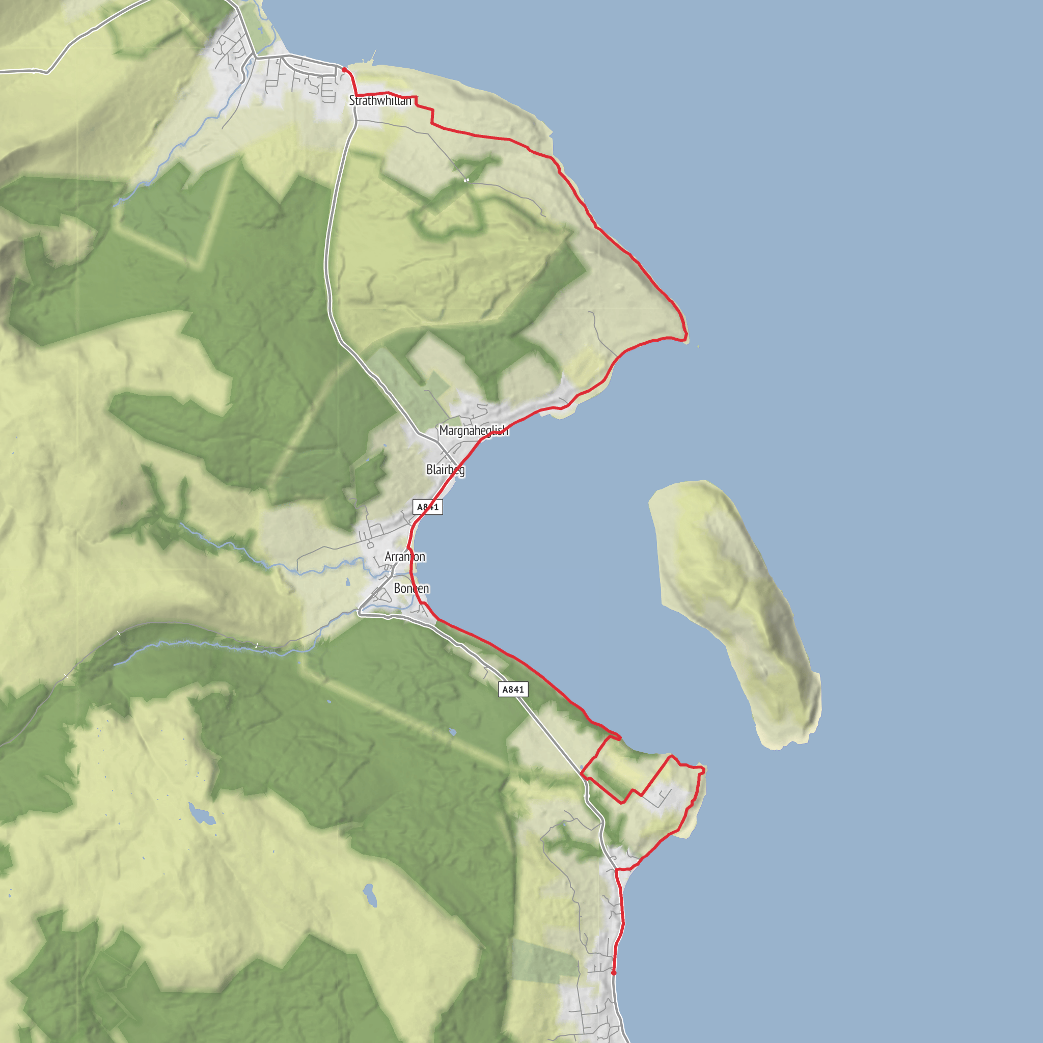
This easy coastal walk links three of Arran’s best-known bays in a long, mostly low-level outing of about 18 km / 11.2 miles, with roughly 200 m / 656 ft of ascent spread gently through the day. It begins near the seafront at Whiting Bay, close to the village centre and the Whiting Bay Parish Church / shore road area at the north end of the bay, then follows the coast north around Kingscross Point, across Lamlash Bay, and onward around Clauchlands Point before finishing in Brodick Bay near the ferry terminal and village amenities. The route is generally straightforward, but the length means it still feels like a full day out rather than a short promenade. (walkhighlands.co.uk)
Most hikers will find the terrain varied rather than difficult: village pavements and minor roads leaving Whiting Bay, shore-side tracks and grassy paths around the headlands, and rougher coastal sections north of Lamlash where the path can be uneven, stony, or muddy after rain. Although the elevation gain is modest, there are repeated small rises and dips around the points, especially near Clauchlands, so sturdy footwear is still a good idea. In wet or windy weather, exposed coastal stretches can feel more serious than the difficulty rating suggests, and care is needed on slippery rock, eroded edges, and any beach sections affected by tide or sea spray. Walkers planning the day should check the route line in HiiKER before setting out. (walkhighlands.co.uk)
Getting to the start
For hikers arriving without a car, the simplest approach is to travel to Brodick Pier, Arran’s main ferry port and bus hub, then take the island bus south to Whiting Bay. Current visitor transport information for Arran notes that buses radiate from Brodick Pier and that the 323 serves Whiting Bay, with services generally coordinated around ferry arrivals. That makes this route especially convenient as a one-way walk, since you finish back in Brodick rather than needing to retrace your steps. (visitarran.com)
If driving, most walkers leave the car in Brodick and use the bus to reach Whiting Bay, avoiding the need for a return transfer at the end. Brodick is the island’s main arrival point by ferry and has the broadest range of parking, shops, cafés, and public facilities. Whiting Bay itself is reached by the island’s main east-coast road, and the walk starts near the village seafront rather than at a remote trailhead. (ayrshirescotland.com)
Along Whiting Bay and around Kingscross Point
Leaving Whiting Bay, the route heads north through the village and out toward the coast near Sandbraes and the church, then bends seaward on quieter lanes toward Kingscross Point. This opening section is gentle and accessible, with broad views back across Whiting Bay and out into the Firth of Clyde. The coastline here has a more open, pastoral character than the rockier ground farther north, and it is a good place to settle into the rhythm of the walk before the longer middle section. (walkhighlands.co.uk)
Kingscross Point is one of the defining landmarks of the day, marking the southern entrance to Lamlash Bay. The headland has long been a notable coastal reference point, and there is also archaeological interest in the area, including a standing stone associated with Kingscross Point. Historically, these east-coast points mattered not only as landmarks for local travel but also as markers for seaborne movement around Arran, where settlements were closely tied to sheltered bays and landing places. (themodernantiquarian.com)
Lamlash Bay, Holy Isle, and marine life
Once around Kingscross Point, the walk opens into the broad sweep of Lamlash Bay, with Holy Isle dominating the view offshore. This is one of the most scenic parts of the route: a long, curving bay framed by low headlands, village shoreline, and constant sea views. Distances here can be deceptive because the bay is wide and open, so Lamlash may appear closer than it is. The walking remains fairly easy, but the cumulative mileage begins to build through this middle section. (arrancoast.com)
Lamlash is one of Arran’s largest villages and has long been valued for its sheltered anchorage. The bay is enclosed by Kingscross Point to the south and Clauchlands Point to the north, creating a natural harbour-like setting that has shaped
AI Planner
Days planned around your pace, with somewhere to stay each night.
Surfaces
Unknown
Asphalt
Unpaved
Grass
Comments and Reviews
User comments, reviews and discussions about the Whiting Bay to Brodick Bay via Kingscross Point, Lamlash Bay and Clauchlands Point, Scotland.
average rating out of 5
0 rating(s)


