Download
Preview
Add to list
More
9.6 km
~2 hrs 35 min
407 m
Loop
“A windswept Shetland loop of peat, lochs, and sea-lit horizons rewards confident walkers with wild solitude.”
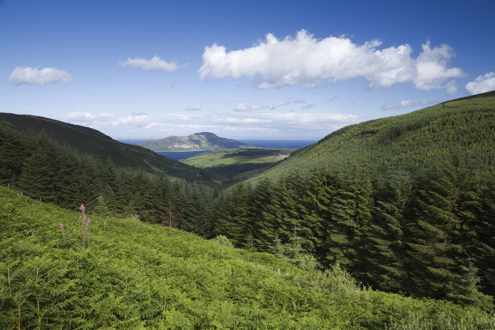
This medium-rated loop is a classic Shetland moorland outing: around 10 km / 6.2 miles with roughly 400 m / 1,312 ft of ascent, enough climbing to feel substantial without becoming a full mountain day. Expect a route that mixes open hillside, peat-rich ground, lochside walking, and broad views rather than engineered trail. In dry weather it can feel pleasantly wild and spacious; after rain, the same ground can become soft, boggy, and energy-sapping, so waterproof footwear and gaiters are often more useful here than on a firmer mainland path. Shetland’s walking terrain is often less about steep technical difficulty and more about exposure, wet ground, and the need for confident route-finding. (walkhighlands.co.uk)
The walk lies in Shetland’s Northmavine area, a part of Mainland known for open moor, lochs, and striking geology. The nearest widely recognised landmark for the start is the Mavis Grind area, the narrow isthmus that links Northmavine to the rest of Mainland Shetland; it is barely about 100 feet wide at its narrowest point and is also noted for its geological interpretation point. If your mapping only shows remote moorland names, using Mavis Grind or nearby Northmavine road access as your approach reference is the most practical way to plan the journey. (geograph.org.uk)
What the walk feels like
From the outset, this is the kind of route where the landscape quickly becomes the main event. The climb is usually gradual at first and then more sustained as the loop gains height above the lochs. With 400 m / 1,312 ft of ascent spread over 10 km / 6.2 miles, the effort tends to come in repeated rises rather than one single punishing pull. On a medium day out like this, many hikers should allow roughly 3.5 to 5 hours depending on ground conditions, navigation stops, and weather. Comparable Shetland routes of similar length often take longer than the distance alone suggests because rough, pathless, or boggy sections slow progress. (walkhighlands.co.uk)
Uri Loch is likely to be one of the quieter, more atmospheric sections of the circuit, with the water set against open moor and rounded hills. Lochs in Shetland often attract breeding and visiting birds, and even when wildlife is not immediately obvious, the sense of space is a major part of the experience. Around freshwater and wet moor you may see waders and waterfowl, while the wider Shetland landscape is especially renowned for seabirds, seals, otters, and occasional marine mammals along coastal areas. Even inland, birdlife can be a highlight, particularly in spring and summer. (walkhighlands.co.uk)
Tigvein and the surrounding high ground should bring the best of the wider views. On clear days, Northmavine’s hills and lochs create a layered landscape of dark water, peatland browns, and sea light in the distance. Because Shetland’s highest ground is modest in absolute height but very exposed, wind can be a bigger factor than elevation. A day that feels calm near the road can be markedly harsher once you are out on the open hill, so pack for windchill even in summer. (walkhighlands.co.uk)
Terrain, navigation, and what to watch for
The main challenges here are likely to be underfoot conditions and navigation rather than scrambling. Shetland routes commonly involve faint paths, grassy trods, wet peat, and occasional tussocky sections, and that can make a 10 km / 6.2 mile loop feel longer than expected. After prolonged rain, expect saturated ground around loch margins and flatter moorland sections. In mist, the broad, open nature of the terrain can make direction less obvious than it first appears. HiiKER is the navigation tool to have ready, but it is wise to

Surfaces
Unknown
Asphalt
Paved
Gravel
Comments and Reviews
User comments, reviews and discussions about the Uri Loch and Tigvein Loop, Scotland.
average rating out of 5
0 rating(s)