
Download
3D Flyover
Add to list
More
12.3 km
~3 hrs
331 m
Loop
“Above Lamlash, Sithein’s airy moorland and Holy Isle views make this loop feel thrillingly expansive.”
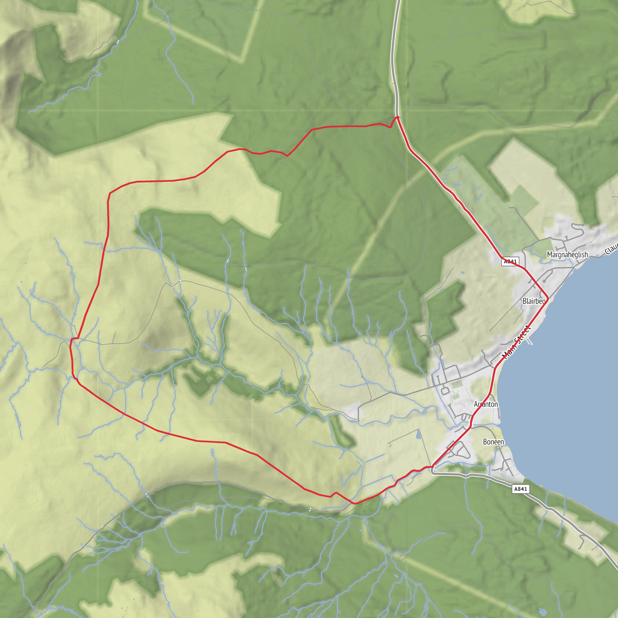
This medium-grade loop on the Isle of Arran gives you a very satisfying mix of moorland height, quiet inland road walking, and wide coastal views over Lamlash Bay, all packed into roughly 12 km / 7.5 miles with about 300 m / 985 ft of ascent. It is the kind of route that feels bigger than the numbers suggest, because the climb onto Sithein quickly opens the landscape and the return along The Ross and back toward Lamlash keeps changing character. Expect a half-day outing for most walkers, longer if you stop often for views or in wet conditions. The high point, Sithein, rises to about 373 m / 1,224 ft. (mapcarta.com)
The walk is best understood as a circuit above and behind Lamlash, with the start most sensibly placed near Lamlash village and the municipal parking area by Lamlash Pier, A841, Lamlash, Isle of Arran. That is the nearest clear landmark and practical access point for visitors arriving without detailed local coordinates. Lamlash lies on Arran’s east coast, around 3 miles / 4.8 km south of Brodick, the island’s main ferry port. (britainexpress.com)
Getting there is straightforward by island standards. From the mainland, most visitors come via the CalMac ferry to Brodick, then continue by local bus to Lamlash; bus 323 connects from the ferry terminal and takes about 10 minutes to Lamlash Pier. Rail-and-ferry travel from Glasgow via Ardrossan Harbour is a standard public transport approach to Arran, and once on the island the bus network links the coastal villages well. One important planning detail for this route is that The Ross itself does not have a regular bus service, so if you start or finish away from central Lamlash you should not rely on being able to catch transport on that road. Drivers can bring a car to Arran, but roads are often narrow and winding, with walkers, cyclists, sheep, and deer all common on or beside the carriageway. (filestore.cicerone.co.uk)
What the route feels like
The outing begins gently enough from Lamlash, but the character changes once you leave the village edge and start climbing toward the shoulder of Sithein. The ascent is where the route earns its medium rating: not especially long, but enough to raise the heart rate, especially if the ground is wet or the wind is pushing across the open hillside. On a route of this length and ascent, most walkers will notice the effort in the first half rather than the second. The climb is rewarded quickly by expanding views back over Lamlash Bay, Holy Isle, and the east coast of Arran. On a clear day, this is one of those walks where the sea remains part of the experience even while you are inland. The Ross road is known for open views toward Holy Isle and, in broader circuits nearby, even as far as Ireland in very clear weather. (forestryandland.gov.scot)
Sithein itself is not a dramatic mountain summit in the Arran sense, but that is part of its appeal. Instead of a rocky scramble or a huge summit cone, you get a rounded upland viewpoint with a strong sense of space. The terrain around here can feel exposed in poor weather, so even on a modest-distance day it is worth carrying a waterproof layer, warm clothing, and enough food and water for a few unplanned hours out. If low cloud drops, the route can feel much less obvious across open ground, so checking the line carefully on HiiKER before setting out is sensible.
Landmarks, scenery, and wildlife
The most memorable visual landmark throughout much of the walk is Holy Isle, sitting across Lamlash Bay. The island has shaped the identity of Lamlash for centuries, and it gives the whole route a strong coastal backdrop even though the walk itself climbs inland. Lamlash is arranged around a broad sheltered bay, and from higher ground the contrast between village, sea, and hill is especially striking. (britainexpress.com
Surfaces
Unknown
Asphalt
Comments and Reviews
User comments, reviews and discussions about the Sithein, The Ross and Lamlash Bay Loop, Scotland.
average rating out of 5
0 rating(s)



