Download
Preview
Add to list
More
10.6 km
~3 hrs 35 min
879 m
Loop
“A wild Arran mountain day of waterfalls, granite tors, and airy ridges for confident hillwalkers.”
This is a compact but serious Arran mountain day: roughly 11 km / 6.8 miles with about 900 m / 2,950 ft of ascent, packed into steep ground, rough ridge travel, and a lot of exposure to wind and weather. Although the mileage is not especially long, the climb is sustained and the terrain becomes increasingly rugged above the glen, so it suits confident hillwalkers with solid fitness, good mountain judgment, and careful navigation skills. The route starts at the car park off the A841 by North Sannox Bridge in North Glen Sannox, just west of Sannox on the Isle of Arran. A useful nearby landmark and address for planning is North Sannox Bridge / North Glen Sannox car park, near Sannox, Isle of Arran, KA27 8JD. (walkhighlands.co.uk)
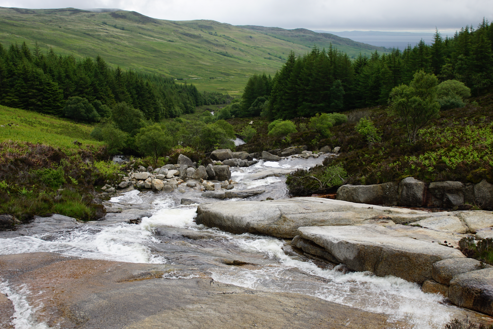
The opening section is comparatively gentle. From the car park, the path heads beside the North Sannox Burn on a well-built track through woodland and then out toward the open glen. This lower stretch is one of the most attractive parts of the day for anyone who enjoys water, rock, and changing vegetation: the burn forms waterfalls, pools, and lively cascades, and the glen walls begin to rise dramatically ahead. Walkhighlands notes good paths lower down before the route becomes partly pathless higher up, which is a good indication of how the day develops. (walkhighlands.co.uk)
As height is gained, the landscape opens quickly and the mountain architecture of northern Arran becomes the main event. Caisteal Abhail is one of Arran’s Corbetts and is widely known for the “Sleeping Warrior” profile seen from the Ayrshire coast. Its summit area is crowned by striking granite tors, while the deep notch of Ceum na Caillich, the Witch’s Step, cuts into the east ridge and gives the mountain much of its character. On a loop that also includes Suidhe Fhearghas, expect a more varied outing than the standard out-and-back ascent: broad glen approaches, steep grassy and rocky climbing, airy ridge sections, and wide views over Lochranza, the Firth of Clyde, and the higher Arran peaks including A’ Chir, Beinn Tarsuinn, and Cir Mhòr. (walkhighlands.co.uk)
What the climb feels like
The first 2 to 3 km / 1.2 to 1.9 miles are the easiest underfoot, with the route following the glen inward on clear ground. After that, the effort ramps up. Once above the forest edge and onto the open hillside, the ascent becomes much steeper and more committing. On this loop, the climb toward Suidhe Fhearghas typically feels like the first real test: grassy slopes can be slick when wet, and the line onto the ridge can be vague in mist. Even when the ground is not technical, it is often uneven, with heather, stones, and short sections where hands may be useful for balance. (walkhighlands.co.uk)
From Suidhe Fhearghas, the ridge scenery becomes more dramatic. The Witch’s Step area is the feature most walkers will be watching for. It is a narrow rocky cleft and a famous landmark on Arran, but it is not a place to treat casually in poor weather or high wind. Depending on the exact line of the loop, some parties admire it rather than tackle its most awkward ground directly. If visibility is poor, route-finding around the ridge and summit tors becomes much more serious than the distance alone suggests. HiiKER is the navigation tool to have prepared in advance, and it is worth carrying a fully downloaded route and backup mapping before leaving the glen. (arranmountainfestival.co.uk)
The final approach to Caisteal Abhail is memorable rather than straightforward. The summit tors look imposing from below, and the mountain has several rocky features that can mislead tired walkers into drifting off line. Walkhighlands describes a bypass path around the main summit tor on the easier ascent line; on a loop, that same kind of care is needed to stay on the most sensible ground. In clear weather, the summit is a superb viewpoint. In cloud, it can feel confusing and exposed. (walkhighlands.co.uk)
Terrain, hazards, and preparation
“Difficult” is an appropriate rating here because the challenge comes from more than just ascent. The route combines steep climbing, rough upland terrain, and sections where the path is

Surfaces
Unknown
Unpaved
Comments and Reviews
User comments, reviews and discussions about the North Glen Sannox, Caisteal Abhail and Suidhe Fhearghas Loop, Scotland.
average rating out of 5
0 rating(s)