Loch Ranza, Glen Chalmadale, North Glen Sannox, Sail an Im and Torr Nead an Eoin
Download
3D Preview
Add to list
More
19.5 km
~5 hrs 9 min
764 m
Loop
“From castle shores to wind-brushed ridges, this Arran circuit feels wild, varied, and rewarding.”
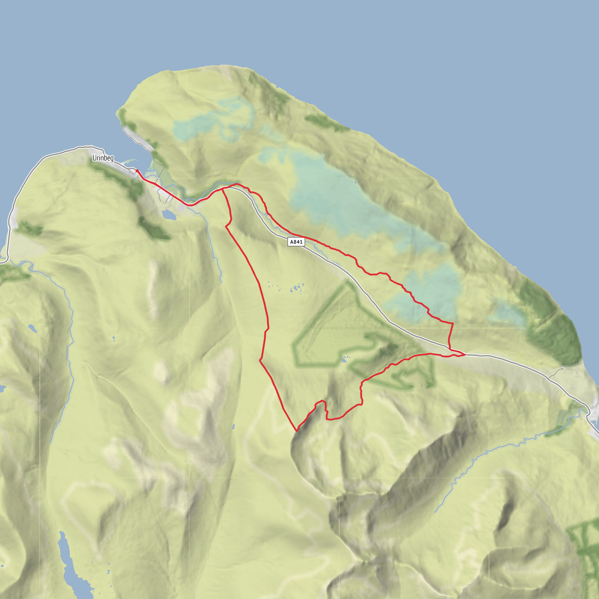
This medium-grade circuit in the north of Arran packs a lot into roughly 19 km / 11.8 miles, with about 800 m / 2,625 ft of ascent. It begins near Lochranza village and Lochranza Castle, on the north end of the Isle of Arran, and links the quiet road through Glen Chalmadale with the wilder interior of North Glen Sannox before climbing onto the broad ridge of Sail an Im and the lower viewpoint of Torr Nead an Eoin. Lochranza itself is the nearest clear landmark and practical trailhead area, with the castle, ferry terminal, and village road network all serving as obvious reference points. (historicenvironment.scot)
The outing is best thought of as a long hill circuit rather than a simple path walk. Although the overall difficulty is often described as medium, that rating assumes decent weather, solid fitness, and comfort on rough hill terrain. The mileage is moderate, but the route includes a mix of quiet tarmac, estate or glen tracks, wet ground, open moor, and steeper hill sections where the line can become less obvious in mist. After rain, parts of North Glen Sannox can be boggy, and the higher ground around Sail an Im can feel much more serious than the numbers suggest because of exposure to wind and cloud. For navigation, carrying the route on HiiKER is the most sensible way to keep track of junctions, contour lines, and the descent line back toward Lochranza. (arranmountainfestival.co.uk)
Getting to the start
If travelling by car, the usual approach is to reach Arran by ferry to Brodick, then drive north on the A841 through Sannox and over the Boguillie road toward Lochranza. Lochranza is also served by the seasonal Claonaig–Lochranza CalMac route, which can be useful if approaching from Kintyre. Public transport on Arran is workable: buses connect Brodick with Lochranza, and island transport information notes regular services between the main villages. For a hike starting near Lochranza, the most practical drop-off is around Lochranza Castle / Lochranza Ferry Terminal / village center, depending on where you intend to begin the circuit. Ferry timetables and bus connections should always be checked close to travel day, especially because Arran services can change seasonally. (visitarran.com)
Parking is generally associated with village roadside areas, the ferry vicinity, or nearby informal parking spots rather than a large dedicated mountain trailhead. If you are planning a linear variation or need a backup exit, North Sannox also has a known car park and picnic area used for access into the glen. (walkhighlands.co.uk)
What the route feels like
From Lochranza, the early section is comparatively gentle as the route heads through Glen Chalmadale, a glen whose name is linked to Norse settlement history on Arran. This opening stretch gives a softer introduction to the day: road or track walking, open views back toward Loch Ranza, and a strong sense of the island’s layered landscape where sea loch, pasture, woodland, and mountain all sit close together. The surrounding slopes rise quickly, and even before the main climb begins, the skyline hints at the rougher country ahead. Historical notes tied to Lochranza and Glen Chalmadale point to both medieval and Norse associations, reinforcing how long this corridor has been used as a route through the north of the island. (arran-campsite.com)
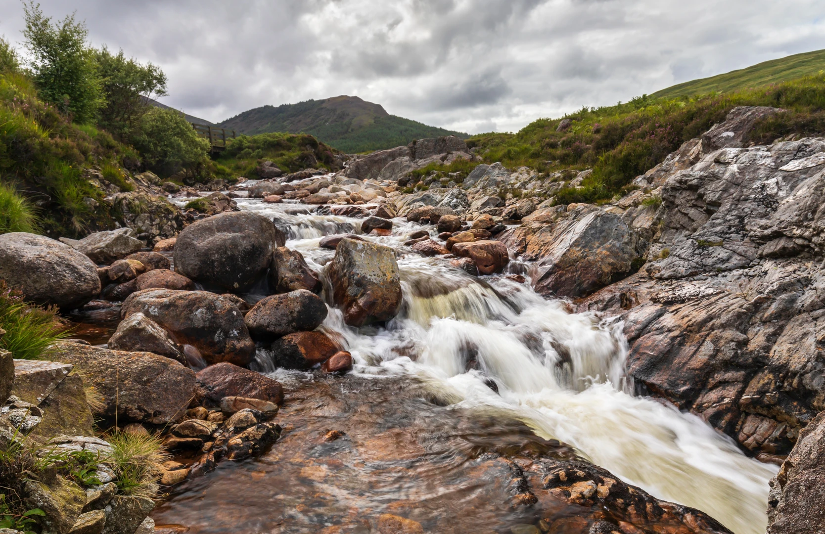
As the route turns into North Glen Sannox, the character changes noticeably. The glen is narrower, more dramatic, and much more mountain-like, with the burn cutting through the landscape and steeper slopes closing in. A well-made path exists on some lower sections, especially near the
Surfaces
Unknown
Asphalt
Unpaved
Comments and Reviews
User comments, reviews and discussions about the Loch Ranza, Glen Chalmadale, North Glen Sannox, Sail an Im and Torr Nead an Eoin, Scotland.
average rating out of 5
0 rating(s)
