Download
Preview
Add to list
More
16.5 km
~4 hrs 6 min
487 m
Loop
“A richly varied Arran circuit threads castle views, quiet glen, wild moor, and a windswept coast.”
This medium-grade loop on the north-west side of Arran combines a sheltered glen, open moorland, a long coastal return, and some of the island’s most characterful historic scenery. At roughly 16 km / 10 miles with around 500 m / 1,640 ft of ascent, it is a route that asks for steady fitness rather than technical skill, but the mix of rough hill paths, wet ground, and exposed sections means it still deserves proper preparation. The start is best understood as being near Lochranza Village Hall, Lochranza, Isle of Arran, close to the village centre and within walking distance of Lochranza Castle and the ferry terminal. (arranartsheritagetrail.com)
The opening section is usually gentle and helps ease you into the day. From Lochranza, the route heads south-west toward the mouth of Gleann Diomhan, with views back across Loch Ranza to the ruined castle on its peninsula and, on clear days, across the Kilbrannan Sound toward Kintyre. The first few kilometres are often the easiest underfoot, following tracks or paths into the glen before the climbing begins in earnest. Expect the ascent to build gradually rather than hit all at once, with the route gaining much of its height as it leaves the lower glen and works onto higher ground above the coast. (historicenvironment.scot)
Terrain and what to expect
For a hike of this length, the variety is one of its biggest strengths. Lower down, the glen can feel enclosed and green, with burns, bracken, rough grass, and patches of boggier ground after rain. Higher up, the landscape becomes more open and exposed, with broader views over the north Arran coast and a stronger sense of remoteness. Even though the total ascent is moderate by mountain standards, 500 m / 1,640 ft spread across uneven terrain can feel more demanding than the numbers suggest. Waterproof footwear is a sensible choice, and gaiters can be useful in wetter periods.
Navigation needs attention once away from the village and road. In mist, the transition from glen to open hillside can make line-finding less obvious, especially where paths fade into sheep trods or wet grass. HiiKER is the best tool to have ready before setting out, and it is worth downloading the route for offline use because signal can be unreliable on Arran’s quieter western side.
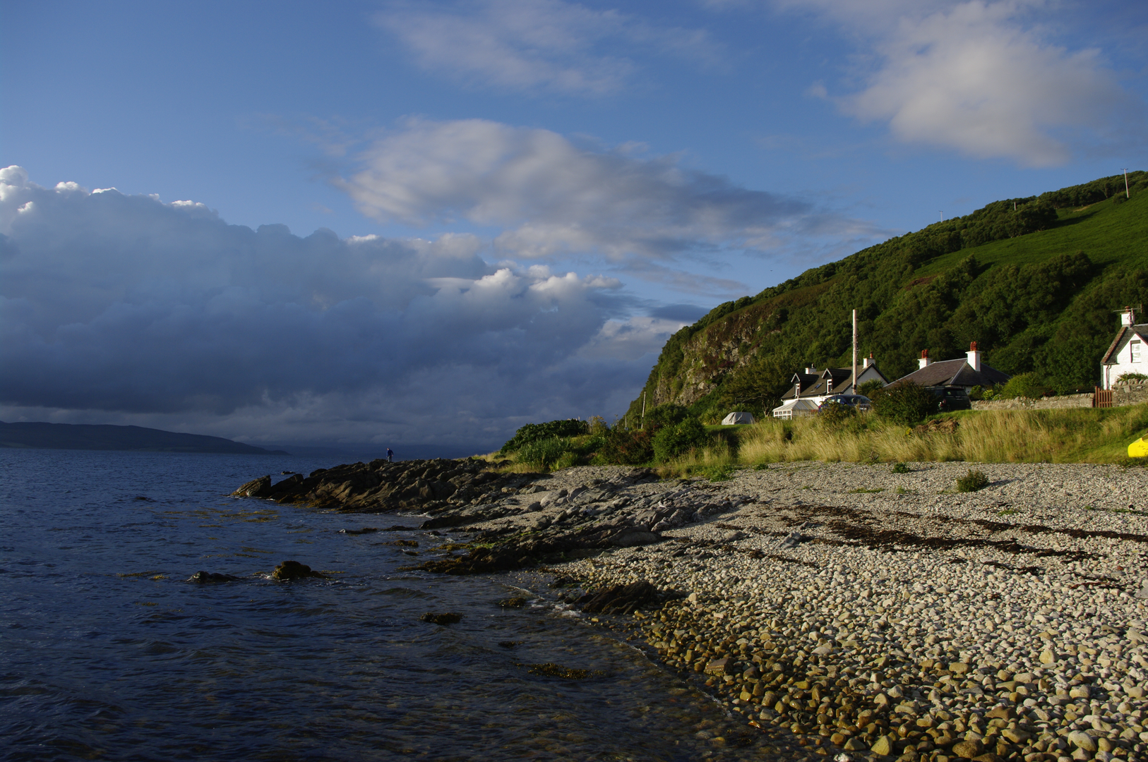
The coastal return via Catacol Bay changes the character of the walk again. After the upland section, the descent brings you back toward the sea and the road near Catacol, where the bay opens out with broad shore views and a more settled landscape. This latter part can feel easier physically, but after 10 km / 6.2 miles or more, road or track walking still adds fatigue to the legs, especially in wind or rain. Catacol lies a few miles south-west of Lochranza on the A841 and is known for its beach and the steep-sided glen behind it. (en.wikipedia.org)
Landmarks, wildlife, and local character
One of the standout landmarks near the start is Lochranza Castle, a picturesque ruined tower house set on a promontory in Loch Ranza. It is one of Arran’s best-known historic sites and is traditionally associated with Robert the Bruce, who is said to have visited before his successful campaign for the Scottish throne. Even if the route does not pass directly through the castle grounds, it gives the opening and closing stages of the walk a strong sense of place. (historicenvironment.scot)
Lochranza itself is one of Arran’s most scenic villages, sitting at the island’s northern tip, and the wider area reflects Arran’s reputation as “Scotland in miniature,” with coast, moor, glen, and mountain all compressed into a relatively short circuit. Around Catacol, the human landscape becomes part of the attraction too. The village is known for the “Twelve Apostles”, a terrace of distinctive 19th-century fishermen’s cottages facing the bay, and the shoreline here gives broad views west and north along the coast. (en.wikipedia.org)
Nature on this route is likely to be as memorable as the scenery. Around Loch Ranza and the coast, keep an eye out for seabirds and shorebirds, while the glen and hillside can hold raptors, smaller songbirds, and the usual mix of sheep and deer that shape much of Arran’s upland landscape. In quieter stretches, red deer may be seen on the slopes, especially early or late in the day. The Catacol area is also notable botanically: Arran is the only place where the very rare Catacol whitebeam is found. (en.wikipedia.org)
Planning, access, and practicalities
By car, most walkers approach via the A841 to Lochranza. Parking

Surfaces
Unpaved
Asphalt
Unknown
Gravel
Comments and Reviews
User comments, reviews and discussions about the Loch Ranza, Gleann Diomhan and Catacol Bay Loop, Scotland.
average rating out of 5
0 rating(s)