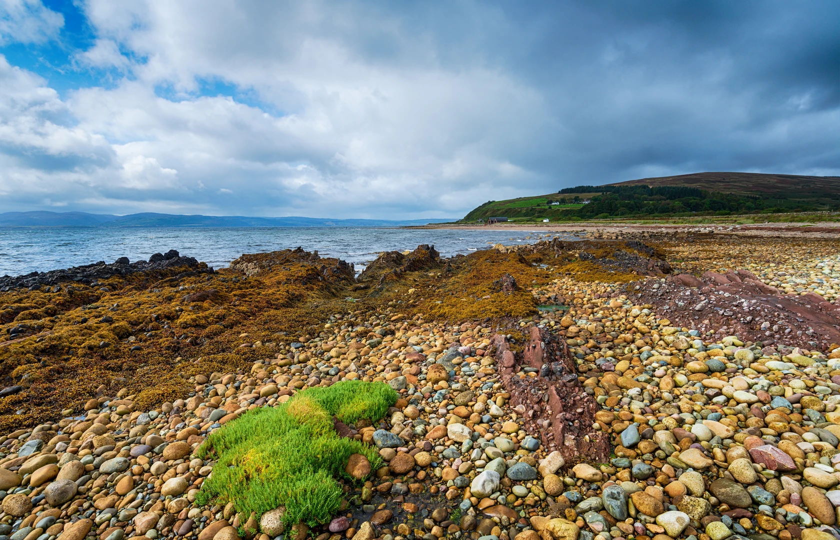
Loch Lorsa, Loch Tanna, Cnoc Breac, Sail Chalmadale and Loch Sail Chalmadale Loop
Download
3D Flyover
Add to list
More
16.9 km
~3 hrs 58 min
363 m
Loop
“A wild Arran loop of lonely lochs, granite burns, and boggy moorland rewards determined walkers.”
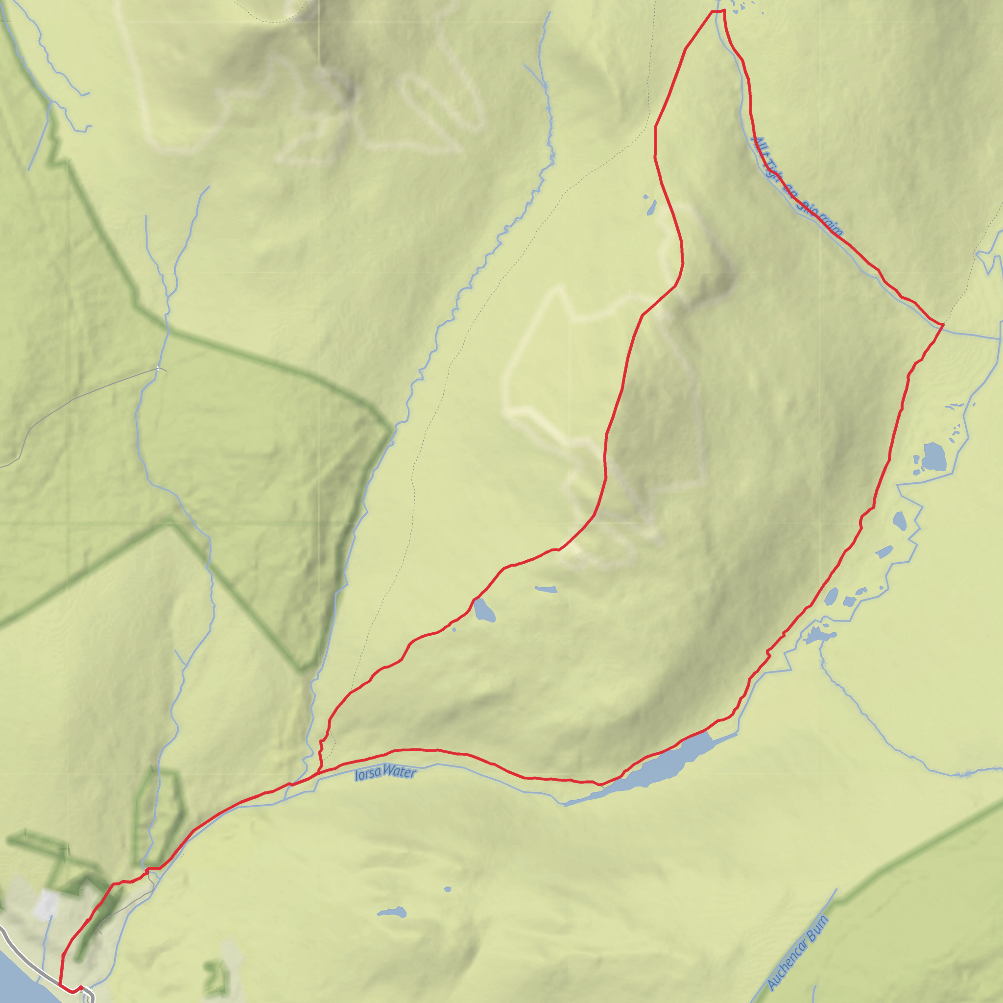
This 17 km / 10.6 mile loop on the Isle of Arran links some of the island’s loneliest western landscapes: Catacol, Glen Catacol, Loch Tanna, Cnoc Breac, Sail Chalmadale, Loch Sail Chalmadale, and the long exit through Glen Iorsa. With around 400 m / 1,312 ft of ascent overall, it sits comfortably in the medium bracket on paper, but the feel of the day is often tougher than the numbers suggest because much of the route crosses rough, boggy, pathless or only faintly tracked ground. Loch Tanna is widely described as Arran’s largest and most remote freshwater loch, and the western hills around it have a notably wild, empty character compared with the busier Goatfell side of the island. (walkhighlands.co.uk)
The most practical trailhead landmark is Catacol Bridge, Catacol, Isle of Arran, on the A841 at the south end of Catacol Bay. Walkhighlands identifies the start as the car park by Catacol Bridge with grid reference NR909489, which is a much more useful real-world starting point than an unnamed coordinate. (walkhighlands.co.uk)
By car, drive to Arran via the main ferry arrival point at Brodick, then follow the A841 north and west around the island to Catacol. Arran also has a second ferry terminal at Lochranza, and Catacol lies only a few miles south of Lochranza on the west side of the island, so either ferry can work depending on sailing plans. For public transport, Arran’s bus network connects from Brodick Pier, and VisitArran notes that route 324 runs north via Lochranza to Blackwaterfoot; Catacol is on that west-side corridor. Walkhighlands also specifically notes “Bus to Catacol” for the Loch Tanna start. (visitarran.com)
The opening section is usually the most straightforward. From Catacol Bridge, the route heads inland on the signed path for Gleann Diomhan and Loch Tanna, following the Abhainn Mòr through heather, rocky knolls, and open glen scenery. Early progress is on an obvious hill path, but even here the ground can be wet and uneven. As the glen narrows and rises, the river begins to spill over broad granite slabs, creating rapids and small waterfalls that become one of the day’s first major visual highlights. (walkhighlands.co.uk)
Terrain and route character
This is not a smooth, fast loop. The approach to Loch Tanna is described as rough, bouldery, and very boggy in places, and the combined Catacol–Sail Chalmadale line includes long stretches of pathless, rough and boggy terrain, with only intermittent faint tracks. Expect tussocks, wet moor, slow footing, and sections where pace drops sharply. The route around Sail Chalmadale also includes a steep descent and awkward bouldery ground near the granite slabs below the summit. (walkhighlands.co.uk)
For a medium-rated day, the main challenge is not steep climbing but navigation and underfoot effort. In clear weather, the broad shapes of the glens and lochs help, but in mist the moorland can become confusing. If using digital navigation, plan the route carefully in HiiKER before setting out and have the track downloaded for offline use. The western Arran hills are exposed, and route-finding errors here can cost a lot of time and energy.
Loch Tanna arrives as the first big objective, roughly around the mid-point of the outward leg from Catacol. The loch sits in a remote basin between the western hills and has a stark, open feel, with broad moorland, muted rock tones, and very little sign of habitation. Walkhighlands notes
Surfaces
Unknown
Gravel
Unpaved
Asphalt
Ground
Comments and Reviews
User comments, reviews and discussions about the Loch Lorsa, Loch Tanna, Cnoc Breac, Sail Chalmadale and Loch Sail Chalmadale Loop, Scotland.
average rating out of 5
0 rating(s)
