
Download
3D Flyover
Add to list
More
20.6 km
~4 hrs 44 min
369 m
Point to Point
“A sweeping Arran crossing of sea views, forest quiet, and Glenashdale Falls for prepared walkers.”
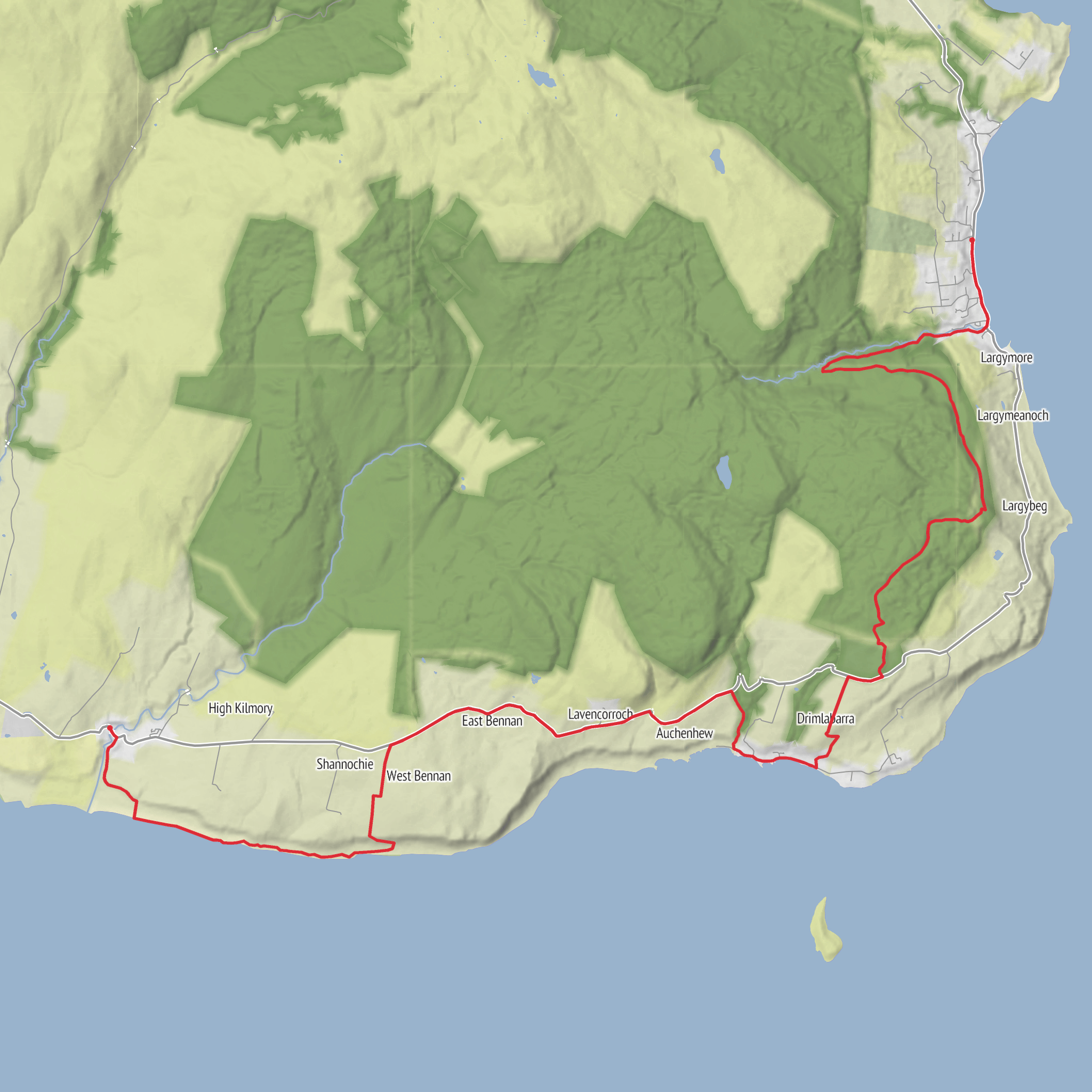
This point-to-point walk across the southern half of Arran links the small settlement of Lagg with Whiting Bay on a gentler inland line, taking in open coastal scenery early on, higher forestry tracks above the shore, and one of the island’s standout natural landmarks at Glenashdale Falls. At around 21 km / 13 miles with roughly 400 m / 1,300 ft of ascent, it is a long day rather than a technically difficult one, and the “easy” rating makes most sense for hikers who are comfortable with the distance and with several sustained ups and downs rather than steep mountain terrain. The finish is near Ashdale Bridge at the south end of Whiting Bay, the usual access point for Glenashdale Falls. (walkhighlands.co.uk)
The route begins near Lagg Hotel, Lagg, Isle of Arran, the best-known landmark at the southern end of this stage, and finishes near Ashdale Bridge, Whiting Bay, Isle of Arran, beside the signed access for Glenashdale Falls and the small parking areas on either side of the bridge. (walkhighlands.co.uk)
For anyone planning logistics, this is one of the more straightforward linear walks on Arran because both ends are served by the island road network and bus services. Most visitors reach Arran first by ferry to Brodick, then continue south by road. For public transport, buses run to Whiting Bay and also connect communities along the island’s main road, making it practical to leave a car at one end or walk the route in one direction and return by bus. If driving, the usual approach is to park in Whiting Bay near Ashdale Bridge or arrange a vehicle drop near Lagg, then use the bus to position for the start. (visitscotland.com)
The first part of the walk is relatively low-lying and undemanding underfoot compared with the rougher coastal alternative around Bennan Head and Dippen Head. That matters because this inland variation is specifically used to avoid the more awkward scrambling, boulder fields, and tide-sensitive sections found on the harder coastal line of the Arran Coastal Way. If you are choosing between options, this is the better pick for steadier footing, simpler route-finding, and a more relaxed pace over a full day. (walkhighlands.co.uk)
What the route feels like
From Lagg, the walk heads northward through the quieter southern landscapes of Arran, where farmland, shore-edge views, and scattered houses give way to a more elevated inland section. Around Kildonan, views open across the sea toward Pladda and Ailsa Craig, and this stretch can feel very exposed in windy weather even though the gradients remain moderate. After leaving the coast road behind, the route climbs on tracks and signed footpaths into forestry, where the walking becomes more enclosed but generally easier to follow. (walkhighlands.co.uk)
The middle miles are defined by long forest-road traverses rather than dramatic climbing. Expect a steady gain in height rather than one big ascent, with the total elevation spread across the day. There are sections through harvested or replanted forestry, so the landscape can alternate between sheltered woodland and more open, worked ground with wide views back out to sea. On clear days, there are good outlooks toward Holy Island and across Whiting Bay. (walkhighlands.co.uk)
Near the latter part of the route, a signed turn for Glenashdale Falls marks the most memorable natural feature of the day. The descent leads to a viewing area and then to the main platform overlooking the falls, a dramatic double cascade known in Gaelic as Eas a’ Chrannaig, dropping about 45 m / 140 ft. This is one of Arran’s best-known waterfalls and a genuine highlight, especially after the quieter forestry miles that come before it. (walkhighlands.co.uk)
From the falls, the path drops more steeply toward Whiting Bay. This final descent deserves a little care, particularly after rain, because roots, damp rock, and loose surface material can make it more slippery than the rest of the route. The finish comes out near the southern end of the village, close to Ashdale Bridge. (walkhighlands.co.uk)
Terrain, pacing, and what to prepare for
Although the route is not especially steep, 21 km / 13 miles is still a substantial
AI Planner
Days planned around your pace, with somewhere to stay each night.
Surfaces
Unknown
Asphalt
Unpaved
Ground
Sand
Gravel
Dirt
Grass
Wood
Comments and Reviews
User comments, reviews and discussions about the Lagg to Whiting Bay via Auchenhew and Glenashdale Falls, Scotland.
average rating out of 5
0 rating(s)



