
Download
3D Flyover
Add to list
More
11.8 km
~3 hrs 18 min
568 m
Loop
“Heathery ridges, boggy moorland and rounded Arran summits make this a compact, characterful adventure.”
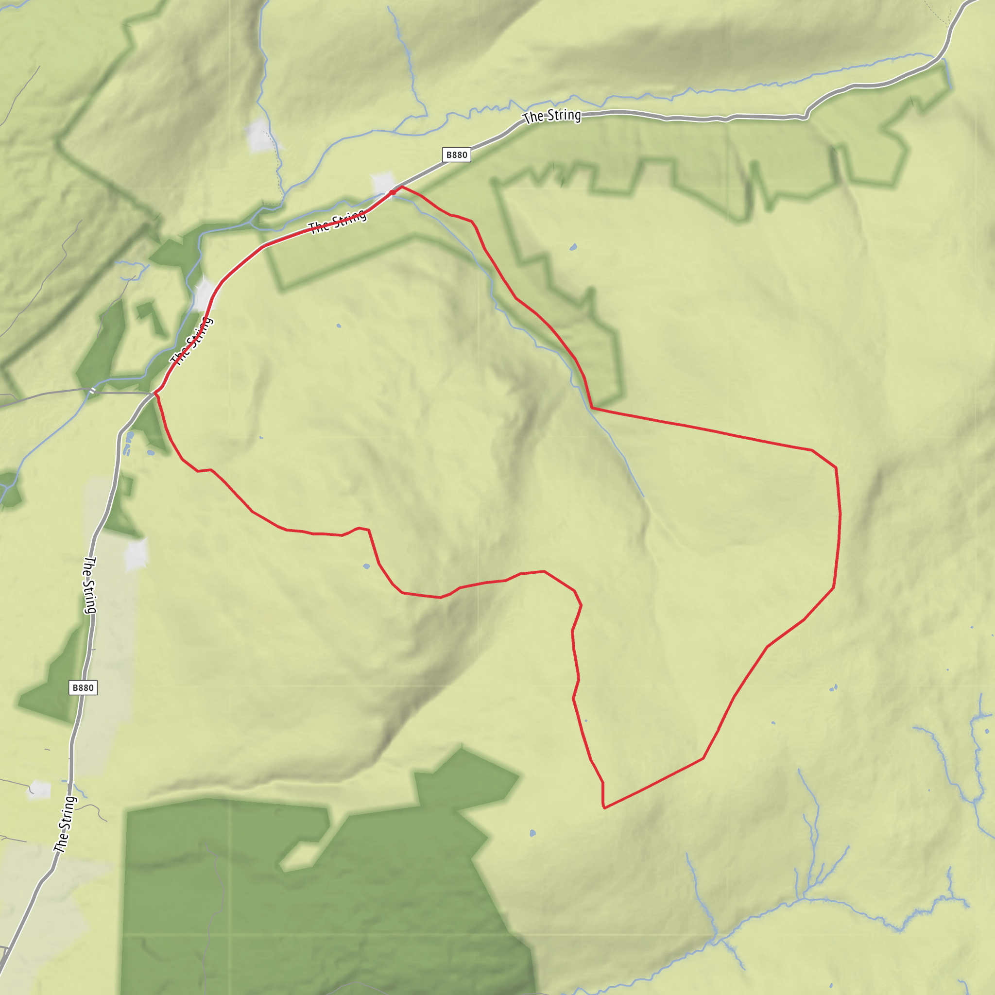
This 12 km / 7.5 mile loop with around 600 m / 1,970 ft of ascent is a compact but rewarding hill circuit in the centre-west of the Isle of Arran, starting near Glenloig Bridge on the B880 String Road, close to the Glenloig forestry car park between Brodick and Blackwaterfoot. The route links a line of rounded but characterful hills—A’ Chruach, Beinn Bhreac and Ard Bheinn—through open moorland, heathery ridges and rough upland ground, with a generally medium overall difficulty but several features that can make it feel harder than the numbers suggest: faint paths, wet peat, uneven tussocky sections, and exposed ground if wind or cloud moves in. The public transport spine across this part of Arran uses the String Road corridor from Brodick to Blackwaterfoot, and Brodick is the island’s main ferry port and bus hub, with buses running across the B880 as part of Arran’s island network. (walkhighlands.co.uk)
The start is best understood as being near Glenloig Bridge / Glenloig forestry car park on the B880 String Road, Isle of Arran, rather than an isolated coordinate-only trailhead. If arriving by car, the usual approach is to take the CalMac ferry to Brodick, then drive west on the B880 String Road toward Blackwaterfoot until reaching the Glenloig area; parking is limited, so care is needed not to obstruct forestry access or passing places. If using public transport, travel first to Brodick Ferry Terminal, then use the bus service that crosses the String Road toward Blackwaterfoot; because island timetables can be seasonal and ferry-linked, it is worth checking the latest connections before setting out. (walkhighlands.co.uk)
The opening section usually begins on forestry tracks or rough access ground before breaking out onto open hillside. That transition is important for pacing: the first kilometre or two can feel straightforward, but once above the trees the route becomes much more of a hillwalk than a path walk. Expect soft ground after rain, patches of bog, and occasional route ambiguity where the line over the moor is more obvious on mapping than on the ground. Hikers planning the day should allow extra time for navigation and use HiiKER to study the shape of the loop, escape options, and the spacing between summits before setting off. (walkhighlands.co.uk)
Climbing onto A’ Chruach
A’ Chruach is the easternmost high point on the ridge named in older route descriptions of this circuit, and it gives the walk its first real
Surfaces
Unknown
Asphalt
Comments and Reviews
User comments, reviews and discussions about the Glenloig Bridge, A' Chruach, Beinn Bhreac and Ard Bheinn Loop, Scotland.
average rating out of 5
0 rating(s)



