Download
Preview
Add to list
More
5.8 km
~1 hrs 24 min
146 m
Loop
“Woodland hush, roaring falls, ancient graves and sea views make this Arran loop richly rewarding.”
This is a compact but varied Isle of Arran circuit that packs a lot into roughly 6 km / 3.7 miles, with about 100 m / 330 ft of ascent. It is usually rated medium because the distance is modest, but the route includes uneven woodland paths, short steeper sections, steps, and potentially slippery ground near the burn and waterfall viewpoints. The walk begins by Ashdale Bridge at the southern end of Whiting Bay, where there are parking areas on both sides of the bridge and the signed access for Glenashdale begins nearby. Forestry and Land Scotland also notes the Glenashdale forest entrance is about 0.5 km / 0.25 mile from Ashdale Bridge car park. (walkhighlands.co.uk)
For anyone planning the start, the nearest clear landmark is Ashdale Bridge, Whiting Bay, Isle of Arran, North Ayrshire, Scotland, on the A841 near the south end of the village. If you are navigating digitally, use HiiKER and look for the route around Ashdale Bridge and the Glenashdale forest entrance rather than relying on a vague pin “near” the trailhead. (alltrails.com)
The route typically heads inland through woodland first, following signs for Glenashdale Falls. Early on, the walking is straightforward and sheltered, with a good sense of being drawn into a narrow glen by the sound of water. The ascent is gradual at first, then becomes more noticeable as the path climbs toward the falls and the higher junctions. Even though the total elevation gain is only around 100 m / 330 ft, it can feel a little more demanding after rain because roots, rock, and damp soil make footing slower and more careful. Sources describing the circuit note steeper switchbacks on the way to the Giant’s Graves, which is one reason the route sits comfortably in the medium category rather than easy. (alltrails.com)
What to expect on the route
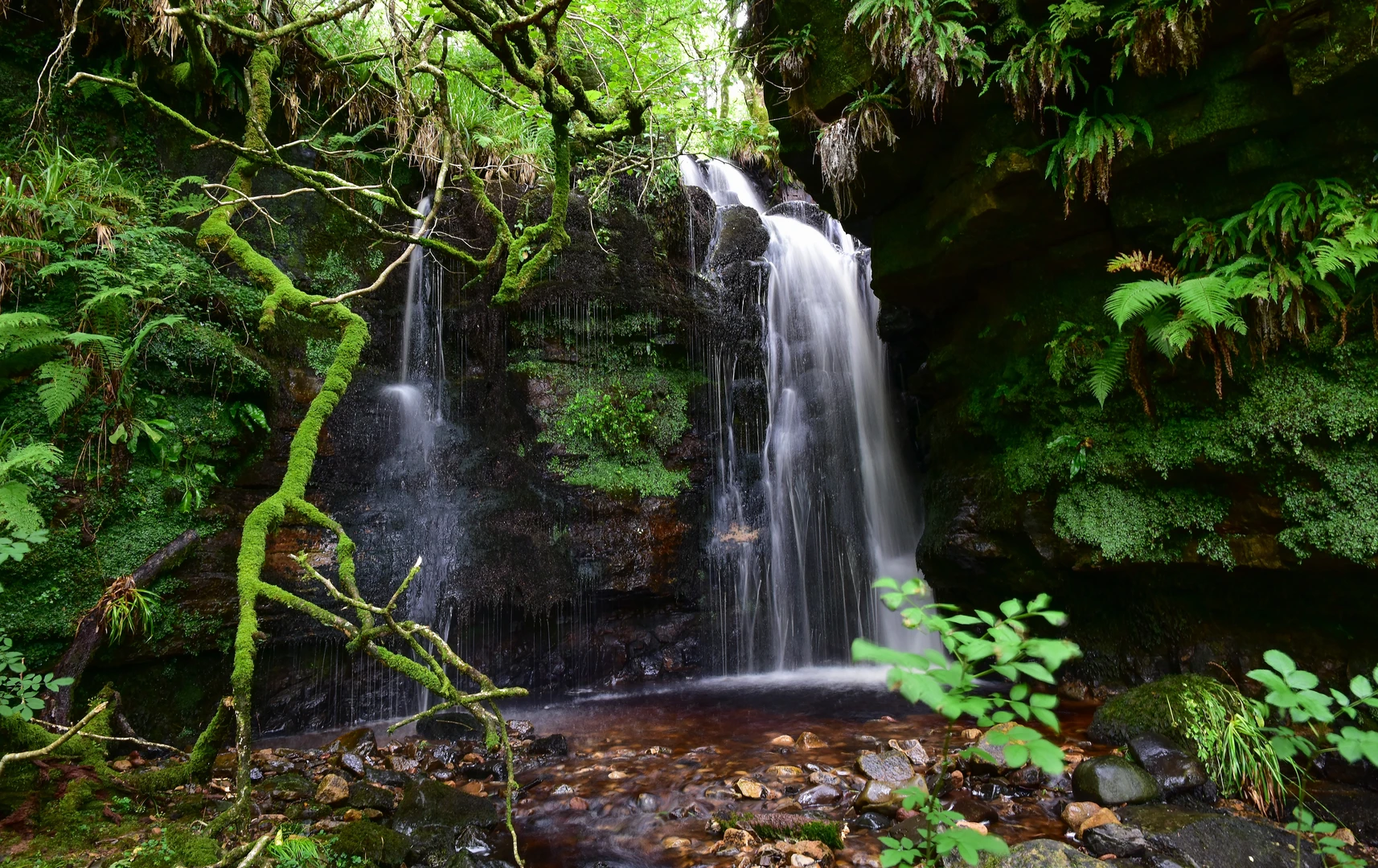
One of the main highlights is Glenashdale Falls, a dramatic double cascade on Glenashdale Burn, often described as one of the finest waterfalls on Arran. The path leads to viewing areas where the burn drops through a rocky cleft, and after wet weather the falls are especially impressive. Around the viewpoints, expect spray, slick stone, and muddy patches, so boots with decent grip are a better choice than flat-soled trainers. (walkhighlands.co.uk)
Beyond the falls, the loop continues through forest and open sections toward the Giant’s Graves, where the character of the walk changes from enclosed glen to broader coastal outlooks. This part often includes the steeper climbing of the day, especially on the zigzagging approach. The reward is a fine elevated view over Whiting Bay and across to Holy Island, making this one of those short walks that feels much bigger than its mileage suggests. (alltrails.com)
The Giant’s Graves themselves are not just scenic waypoints but important prehistoric monuments. They are the remains of two Neolithic chambered tombs, set on a wooded hillside above Whiting Bay. That means this walk links natural features with archaeology in a very direct way: waterfall, glen, ancient burial cairns, and coastal panorama all on one circuit. (en.wikipedia.org)
Some route descriptions also note a return section associated with an Iron Age fort, adding another layer of historical interest to the loop. Even when the earthworks are subtle on the ground, it is worth knowing that this hillside and glen have been used and valued for thousands of years, from Neolithic burial practices to later defended settlement. (forestryandland.gov.scot)
Terrain, hazards, and pacing
Although the route is short, allow around 1.5 to 2.5 hours depending on stops, ground conditions, and how long you spend at the falls and cairns. The path can be wet year-round, and after heavy rain the woodland sections may be muddy while rock near the burn becomes

Surfaces
Unknown
Paved
Asphalt
Ground
Comments and Reviews
User comments, reviews and discussions about the Glenashdale Falls and Giant Graves and Ashdale Bridge Loop, Scotland.
average rating out of 5
0 rating(s)