Glen Catacol, Beinn Tarsuinn, Beinn Bhreac, Bheinn Bniorach and Meall Mor Loop
Download
Preview
Add to list
More
16.2 km
~4 hrs 39 min
852 m
Loop
“A rugged Arran circuit rising from quiet Catacol into sweeping ridges, big skies, and reflective history.”
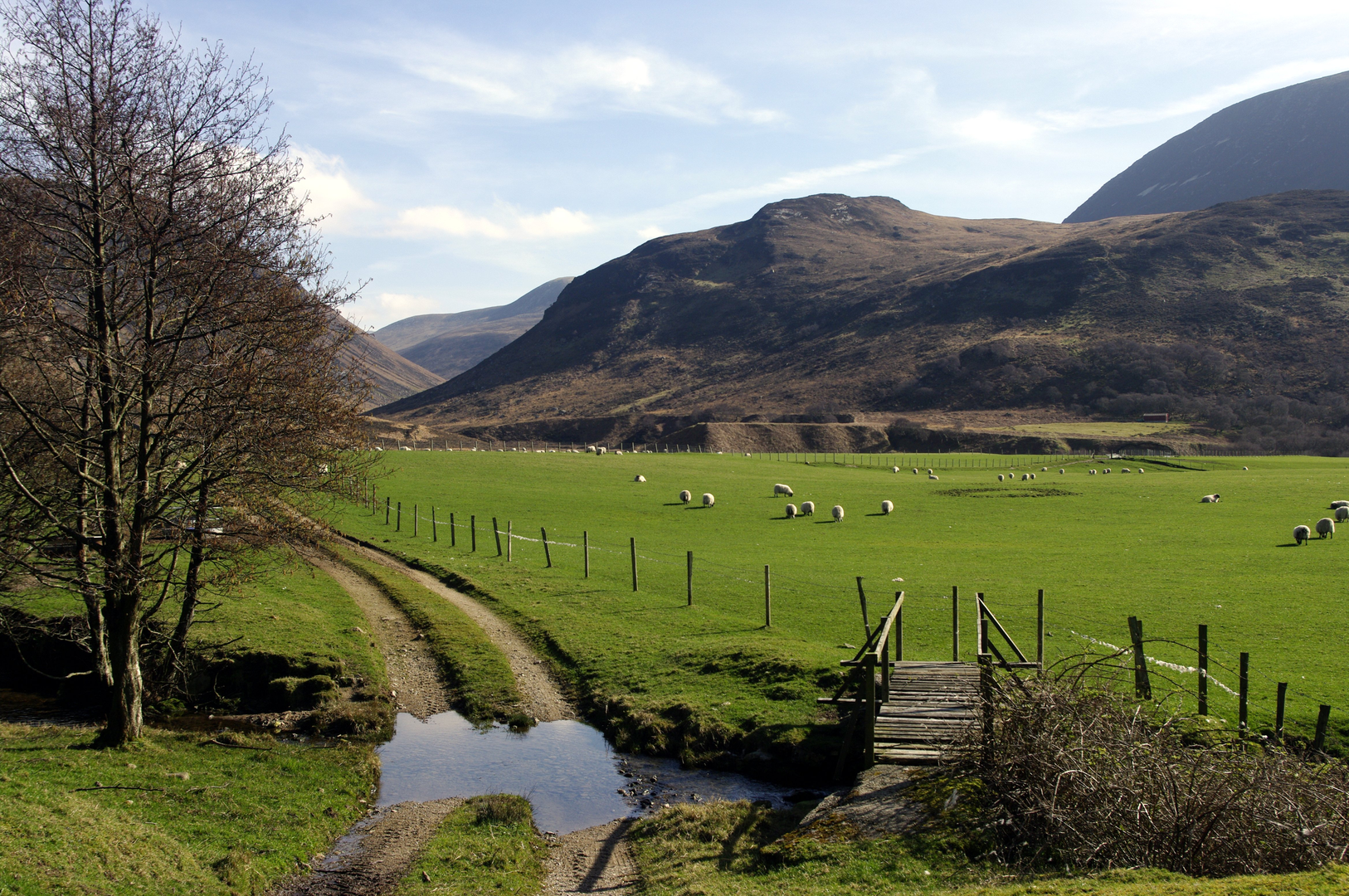
This 16 km / 10 mile hill circuit on the Isle of Arran is a serious medium-grade outing that feels bigger than the numbers suggest. With around 900 metres / 2,950 feet of ascent, it combines a long pull out of Glen Catacol with rough upland ground, broad ridges, and a sequence of rounded summits that give wide views over Arran’s northern hills and the Firth of Clyde. The start is best understood as being near Catacol Bridge, Catacol, Isle of Arran, North Ayrshire, Scotland, close to Catacol Bay and the well-known row of cottages called the Twelve Apostles. (walkhighlands.co.uk)
The terrain is varied rather than technical for most of the day: lower glen tracks and grassy lines give way to wetter moorland, steeper hill slopes, and sections where paths can be faint or intermittent. Even though the difficulty is only estimated as medium, this is not a casual walk. Good hill fitness, confident movement on uneven ground, and careful route-finding are important, especially if mist drops over the tops. For navigation, carrying the route on HiiKER is the most sensible way to keep track of the line between the summits and on the descent where trods can fade into heather and bog. The outing is most rewarding in clear weather, when the ridge positions and surrounding landmarks are easier to read. (walkhighlands.co.uk)
The opening section usually follows Glen Catacol inland from near the bridge, with the glen sides rising steeply around you. This part of Arran has a notably rugged geological character, with granite and basalt shaping the valley and its broken slopes. The lower ground can be lush and damp, with burns cutting down from the hills and wetter patches underfoot after rain. Catacol itself is one of the quieter corners of Arran, and the sense of remoteness builds quickly once you leave the road behind. (en.wikipedia.org)
Climbing into the hills
The ascent toward Beinn Tarsuinn and the neighboring tops is where the day begins to feel more committing. Expect a sustained climb, with much of the elevation gained over the first half of the route. On a loop of this length and ascent, many walkers will have covered roughly 5 to 7 km / 3 to 4.5 miles by the time they reach the higher ridge system, with around 600 to 750 metres / 1,970 to 2,460 feet of climbing already done, depending on the exact line taken. Ground conditions can be tiring: heathery slopes, peatier sections, and occasional rough, stony stretches all slow progress compared with the distance on paper. (walkhighlands.co.uk)
Beinn Tarsuinn is one of Arran’s better-known Corbetts and forms part of the island’s dramatic northern mountain architecture. Its name is commonly translated as the “transverse mountain,” and from its higher ground the views open toward the more jagged Arran skyline, including the famous granite peaks farther south and east. Nearby ridges and corries create a much more mountainous atmosphere than many medium-rated walks elsewhere in Britain. (en.wikipedia.org)
From there, the loop continues across Beinn Bhreac, Bheinn Bniorach, and Meall Mor. On these tops, expect a more rolling rhythm than a single sharp summit push: short descents into shallow bealachs, then renewed climbs onto broad domes and ridges. The cumulative effort matters here. Even where the gradients ease, the ground can remain energy-sapping. In poor visibility, these rounded uplands can feel deceptively featureless, so this is one of the key sections where accurate navigation on HiiKER becomes especially useful. (penninewalker.net)
Landmarks, views, and what to notice
One of the most distinctive cultural landmarks near the start is the Twelve Apostles at Catacol, a row of almost identical cottages built in the 1860s. They are closely tied to the history of the Highland Clearances, having been built to rehouse people displaced from Glen Catacol. That gives the opening miles a deeper historical layer: what now feels like a peaceful approach through a quiet coastal settlement sits within a landscape shaped by forced social change and estate reorganization in the 19th century. (walkhighlands.co.uk)
Higher up, the character becomes more elemental. The

Surfaces
Unknown
Unpaved
Asphalt
Comments and Reviews
User comments, reviews and discussions about the Glen Catacol, Beinn Tarsuinn, Beinn Bhreac, Bheinn Bniorach and Meall Mor Loop, Scotland.
average rating out of 5
0 rating(s)