Download
Preview
Add to list
More
11.0 km
~2 hrs 41 min
287 m
Loop
“A varied Arran loop with bay views, heathered ridge drama, and boggy stretches demanding careful footing.”
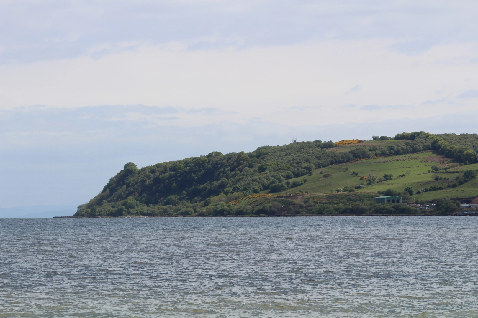
This 11 km (6.8 mile) loop from Brodick Ferry Terminal, Brodick, Isle of Arran KA27 8AY climbs into the low ridge of the Clauchland Hills before circling back toward Brodick, combining shoreline views, quiet lanes, rough hill paths, woodland, and open moorland. Expect around 300 m (about 985 ft) of ascent spread across the route, with the main climbing coming in stages rather than one sustained pull. The overall difficulty sits well in the medium range: the distance is manageable for regular walkers, but sections can be boggy, uneven, and easy to miss if visibility is poor, so this is a route that rewards steady pacing and careful navigation with HiiKER. The usual start point used for this circuit is Brodick Ferry Terminal, right by the seafront and the island’s main transport hub. (walkhighlands.co.uk)
The route begins near sea level in Brodick and heads south from the ferry area on local roads before climbing through fields and stiles above the bay. Early on, the walking is straightforward, but the gradient soon starts to build as the route gains height over the eastern side of Arran. Looking back, there are increasingly wide views across Brodick Bay, with Goat Fell dominating the skyline to the north. This first section is a good reminder that although the Clauchland Hills are much lower than Arran’s mountain core, they still feel exposed in wind and wet weather. Walkhighlands describes the terrain here as a mix of tarmac roads, grassy fields, paths and clear tracks, boggy in places, which is a fair expectation for most conditions. (walkhighlands.co.uk)
What the route feels like on the ground
After the initial field paths, the loop works through the scattered settlement of North and South Corriegills and reaches Corriegills Bridge, where the surfaced road gives way to rougher track. From here the character changes noticeably. The route traverses the hillside, crosses a small burn, and enters mixed woodland before emerging onto rougher, more open ground with bracken and heather. One of the key navigational moments comes just before the last building on the track, where a smaller signposted path branches right; this turning is known for being easy to miss, especially if chatting, moving quickly, or walking in poor light. Using HiiKER here is particularly helpful. (walkhighlands.co.uk)
The climb onto the ridge is the most energetic part of the day. The path steepens in places and can be soft underfoot, especially after rain. Once on higher ground, the reward is a broad panorama over both sides of the island’s east coast. To one side are Brodick Bay and the northern Arran peaks; to the other are Lamlash Bay and Holy Isle. A bench and cairn on the ridge are often treated as the visual high point of the walk, and the ridge itself gives the outing a much bigger feel than the modest elevation figures suggest. (walkhighlands.co.uk)
The descent section can feel sharper than expected. The path drops through heathery slopes toward forest track, and in wet weather this part can be slippery. Because the route mixes open hillside with forestry edges and old tracks, it is worth preparing for changing surfaces throughout the day: road shoes are not ideal, while waterproof boots or trail shoes with solid grip are a much better match. Gaiters can be useful if the ground is saturated or the bracken is high. (walkhighlands.co.uk)
Landmarks, geology, and local character
A notable feature on the route is Dun Fionn, a hilltop landmark in the Clauchland Hills area that helps define the skyline on this side of Arran. The ridge and surrounding slopes are also geologically interesting. The Scottish Geology Trust notes exposures of pitchstone in the wider Clauchland Hills and Lag a’ Bheith area, part of Arr

Surfaces
Unknown
Asphalt
Grass
Paved
Comments and Reviews
User comments, reviews and discussions about the Brodick Bay, Corriegills Bridge, Clauchland Hills and Lag a' Bheith Loop, Scotland.
average rating out of 5
0 rating(s)