
Download
3D Flyover
Add to list
More
12.1 km
~2 hrs 34 min
97 m
Point to Point
“A windswept shoreline ramble from Blackwaterfoot to Lagg, blending broad bays, rugged headlands, and sea-bright horizons.”
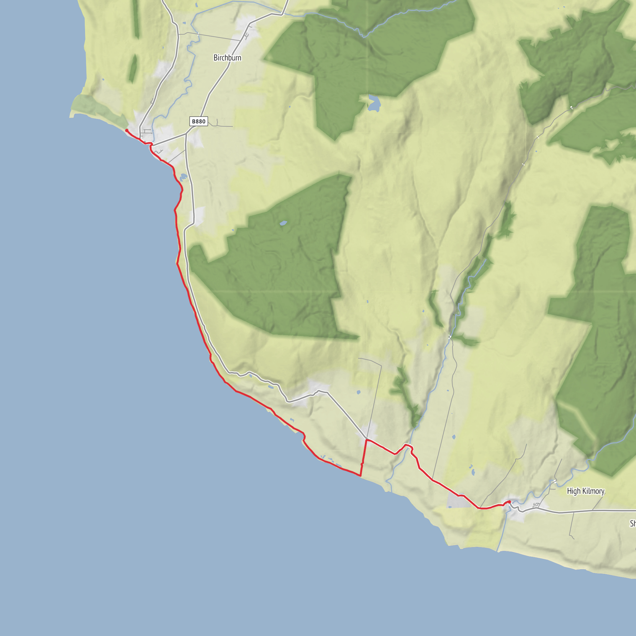
This easy coastal walk links Blackwaterfoot and Lagg on Arran’s southwest side, following a varied shoreline of sand, rock, low headlands and open sea views for roughly 12 km / 7.5 miles with only about 100 m / 330 ft of ascent overall. The route is not a big-climbing day, but it is a classic coastal outing where the main challenges come from underfoot conditions, exposure to wind, and the need to pay attention around rougher shoreline sections rather than from steep elevation gain. Around Drumadoon in particular, the coast becomes more rugged, and some sections of the Arran Coastal Way are known for rocky ground and careful foot placement. (walkhighlands.co.uk)
The walk begins near Blackwaterfoot village car park, Shore Road, Blackwaterfoot, Isle of Arran KA27 8HA, the most practical landmark and parking point for the start. Blackwaterfoot sits at the mouth of the Clauchan Water on Drumadoon Bay, and the village is the usual access point for the coastal path southward. Nearby Drumadoon is officially associated with Shore Road, Blackwaterfoot, Isle of Arran KA27 8HA, which is the clearest significant address for the northern end of this hike. (visitarran.com)
For hikers arriving without a car, the usual approach is to take the CalMac ferry to Brodick and then continue by bus across Arran. CalMac operates the main Arran crossing between Ardrossan and Brodick, with timetable details published on its official route page, and Stagecoach’s Arran network serves both Blackwaterfoot and Lagg. Stagecoach lists route 322 for Brodick–Shiskine–Blackwaterfoot and route 323/323A serving the south side including Lagg and Blackwaterfoot, which makes this a practical linear walk if you plan the return in advance. (calmac.co.uk)
By car, most visitors reach Arran via the ferry to Brodick and then drive the island roads to Blackwaterfoot. Parking is commonly used in Blackwaterfoot village car park, and because this is a linear route, many walkers either use the bus to return or leave a second vehicle near Lagg Hotel / Kilmory Primary School area in Lagg, both of which are recognized bus stops on the south Arran route. (ayrshireandarran.com)
What the route feels like
From Blackwaterfoot, the first stretch is shaped by the broad sweep of Drumadoon Bay, with open views across the Kilbrannan Sound toward the Mull of Kintyre. This opening section is one of the gentler parts of the day, and in good conditions it feels spacious and open, with beach and shore scenery rather than enclosed inland walking. Blackwaterfoot is especially noted for these west-facing coastal views, and the bay itself gives the route an expansive start before the terrain becomes more broken around the headlands. (britainexpress.com)
After roughly 2 to 3 km / 1.2 to 1.9 miles, the route reaches the more dramatic ground around Drumadoon Point and Brown Head. Here the coastline becomes more rugged, with basalt cliffs, boulder-strewn sections and a more engineered line through rougher terrain on the coastal way. This is the part of the walk where “easy” should be read as low in ascent rather than completely effortless underfoot. Expect slower progress, especially if the rocks are wet, if there has been recent rain, or if sea spray is blowing in. Using HiiKER for route tracking is especially helpful through these more intricate coastal sections. (walkhighlands.co.uk)
Beyond the rougher headland terrain, the route gradually settles again into a more flowing coastal line toward Port na Feannaiche and then onward to Lagg. The final few kilometres, about **4 to 5 km / 2.5 to 3.
Surfaces
Unknown
Asphalt
Comments and Reviews
User comments, reviews and discussions about the Blackwaterfoot to Lagg via Drumadoon Bay, Brown Head and Port na Feannaiche, Scotland.
average rating out of 5
0 rating(s)


