Download
3D Flyover
Add to list
More
14.5 km
~4 hrs 28 min
941 m
Loop
“A wild Arran circuit of bog, sandstone and airy ridges, best for confident mountain hikers.”
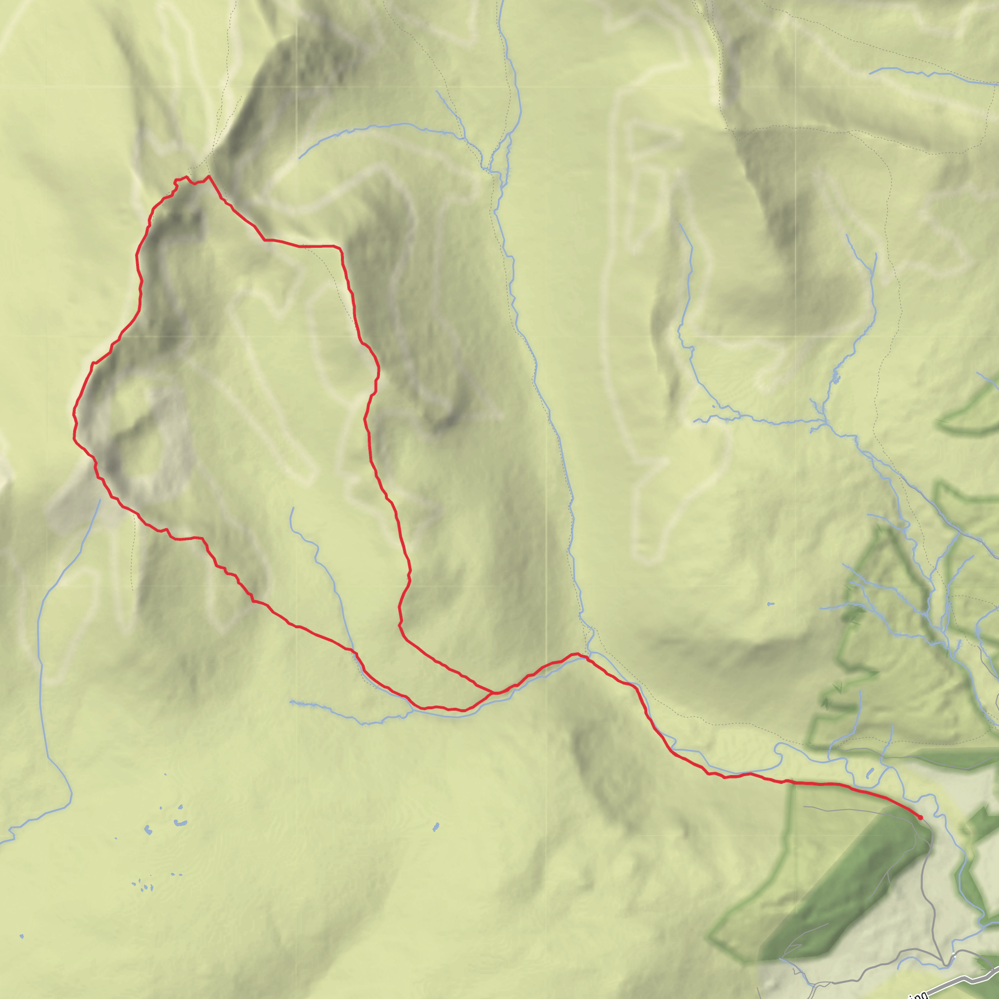
This is one of Arran’s classic hard mountain circuits: a compact 14 km / 8.7 mile loop with roughly 900–950 metres / 2,950–3,115 feet of ascent, starting near Glen Rosa Campsite, Glen Rosa, Brodick, Isle of Arran KA27 8DF. The usual trailhead is at the small parking area at the end of the public road up Glen Rosa, just beyond Brodick, with the route heading into Glen Rosa before climbing the western side of the glen toward Beinn Nuis, Beinn Tarsuinn, and the return ridge over Cnoc Breac. (walkhighlands.co.uk)
The outing is rightly considered difficult. Although the mileage is moderate, the challenge comes from the steep ascent, rough sandstone terrain, boggy sections, intermittent path definition, and a demanding descent from Beinn Tarsuinn. Walkhighlands describes the ground as rough and bouldery, with very boggy terrain in Coire a’ Bhradain until higher ground is reached, and notes that the descent from Beinn Tarsuinn involves rocky steps, slabs, and some scrambling. This is a route for hikers comfortable on steep, exposed-feeling mountain ground and able to navigate confidently if mist drops over the ridge. Using HiiKER for mapping and route tracking is a sensible precaution here. (walkhighlands.co.uk)
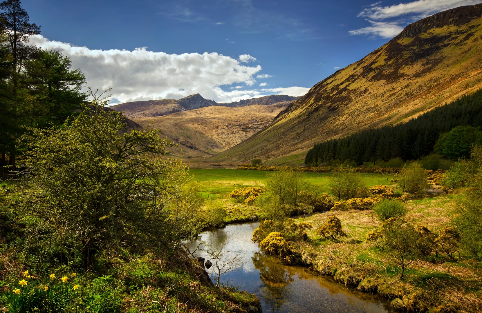
The first part is comparatively gentle. From the Glen Rosa road end, the route follows the good track west into the glen for a little over 2 km / 1.25 miles, giving a chance to settle in before the climbing begins. This opening stretch is one of the pleasures of the day: broad glen scenery, the sound of the river, and increasingly dramatic views toward the Arran peaks, especially Goatfell and the jagged skyline around Cìr Mhòr. After crossing the footbridge over the Garbh Allt, the character changes quickly as the route turns uphill beside the burn. (walkhighlands.co.uk)
Climb to Beinn Nuis
The ascent toward Beinn Nuis is the first major test. Over roughly the next 3 km / 1.9 miles, most of the day’s height gain begins to stack up, and the terrain becomes a mix of steep path, wet moorland, eroded sections, and rocky ground. Lower down, the route can be very boggy, especially after rain, and the path may feel more like a line of least resistance than a built trail. Higher up, the ridge narrows in character and the footing becomes more secure but rockier, with slabs and boulders replacing the wet tussocks below. (walkhighlands.co.uk)
Beinn Nuis itself rises to about 792 metres / 2,598 feet and is often overshadowed by its higher neighbour, but it is a striking summit in its own right, forming a sharp western edge to this part of the range. From here, the views open across Glen Rosa, over Brodick Bay, and toward the granite peaks farther north. Arran is often called “Scotland in miniature” because of the variety packed into one island—mountains, coast, moor, woodland, and a long human history—and this ridge gives a particularly good sense of that contrast. (arranwildwalks.com)
Ridge to Beinn Tarsuinn and the return over Cnoc Breac
The traverse from Beinn Nuis to Beinn Tarsuinn is often the most enjoyable section under good conditions. The ridge is rocky and undulating rather than technically difficult throughout, with occasional hands-on moments and short bypasses around rougher outcrops. Just before the final rise to Beinn Tarsuinn, one of the route’s best-known features appears: the Old Man of Tarsuinn, a natural rock outcrop said to resemble a human profile looking out toward the sea. �
Comments and Reviews
User comments, reviews and discussions about the Beinn Nuis, Beinn Tarsuinn and Cnoc Breac Loop, Scotland.
average rating out of 5
0 rating(s)
