
Download
3D Flyover
Add to list
More
17.8 km
~4 hrs 53 min
797 m
Loop
“A wild Arran circuit of bog, lochs and broad ridges feels gloriously remote and demanding.”
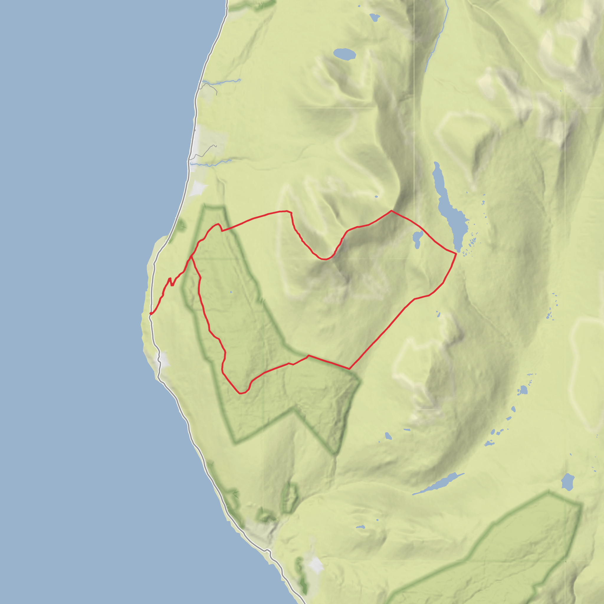
This 18 km / 11.2 mile circuit in the north-west of the Isle of Arran links the broad uplands of Beinn Bharrain and Mullach Buidhe with a quieter chain of lochs and rounded tops, giving a day that feels much more remote than the mileage suggests. Expect roughly 800 metres / 2,625 feet of ascent overall, with long stretches of pathless or faintly trodden ground, wet moor, and some steep hill sections that can feel harder than a typical “medium” walk when the ground is saturated or visibility drops. Beinn Bharrain is the name of the whole hill mass, while Mullach Buidhe is its highest summit at 721 metres / 2,365 feet. (en.wikipedia.org)
The route is associated with the Pirnmill hills above the villages of Pirnmill and Catacol on Arran’s west and north-west side, so the nearest practical start point is the village of Pirnmill, Isle of Arran, KA27, using the parking area opposite the village shop and café or nearby village parking. A commonly used mapped start is around grid reference NR872441, which places the trailhead by the signed footpath rising inland from Pirnmill rather than at an isolated roadside lay-by. (walkhighlands.co.uk)
Getting there is straightforward by Arran standards. By car, most walkers reach Arran via the main ferry to Brodick, then drive the island road north and west through Lochranza or across the island depending on arrival direction; Pirnmill lies on the west coast road between Catacol and Imachar. There is also a second ferry terminal at Lochranza, useful for some mainland approaches. By public transport, buses serve Pirnmill, making it one of the more accessible hill starts on this side of Arran, though services should always be checked carefully before committing to a long day in the hills. (walkhighlands.co.uk)
What the route feels like on the ground
The opening section usually climbs away from Pirnmill through lanes, birch woodland and rougher hillside path, with early views of burns and waterfalls. The lower ground can be muddy, and once above the trees the route enters open moorland where drainage is poor and the line of travel becomes less obvious in places. Walkers should be prepared for bog, heather, and soft ground from quite early on, especially after rain. (walkhighlands.co.uk)
As height is gained, the route steepens toward the ridges above Coire Roinn. On the more direct line toward Mullach Buidhe there are rocky steps and short scrambling difficulties; these are avoidable if a bypass line is taken on easier ground to the right, but the terrain still demands care, especially in wind or when rock is greasy. This is one of the key points where the walk can feel more serious than the distance alone suggests. (walkhighlands.co.uk)
Once on the upper ridge, the character changes. The ground broadens into a high, grassy and stony crest with wide views over Loch Tanna, Dubh Loch, the Kilbrannan Sound, and the more dramatic Arran mountains to the east. The summit area around Mullach Buidhe is marked by an eroded trig point and cairn, and from here the route can be extended into a fuller circuit over neighbouring tops and down toward the loch basin. Older route accounts and hill records describe this ridge as one of the best vantage points in the north-west hills, particularly for looking across to Kintyre and, in clear weather, as far as Jura. (walkhighlands.co.uk)
Landmarks, lochs and terrain to watch for
Beinn Bharrain / Mullach Buidhe is the main high point and the visual anchor of the day. Although not as jagged as Goatfell or the northern Arran corries, it stands apart as the highest summit of the Pirnmill hills and gives a broad, open mountain panorama. (en.wikipedia.org)
Loch Tanna is one of the most distinctive landmarks on this side of Arran, lying east of Beinn Bh
AI Planner
Days planned around your pace, with somewhere to stay each night.
Surfaces
Unknown
Ground
Comments and Reviews
User comments, reviews and discussions about the Beinn Bharrain, Mullach Buidhe, Dubh Loch, Loch Tanna and Cnoc Leana Fheior, Scotland.
average rating out of 5
0 rating(s)



