Download
3D Flyover
Add to list
More
5.4 km
~1 hrs 7 min
20 m
Out and Back
“Shell-sand beaches, flower-rich machair, and a ruined chapel make this Harris stroll quietly magical.”
This easy coastal walk on the Isle of Harris links the machair and dunes of Northton with a string of bright, shell-sand beaches and the ruined chapel at Rubh’ an Teampaill, also known in English as Northton Temple. Expect roughly 5 to 5.5 km / 3.1 to 3.5 miles there and back, with only about 0 to 21 m / 0 to 69 ft of ascent, so it is one of the gentler outings in Harris and a good choice when you want scenery without a demanding climb. The usual start is at the road end in Taobh Tuath/Northton, near the gate onto the machair, close to Northton, Isle of Harris, HS3 3JA. (walkhighlands.co.uk)
From the start, the route heads out on a grassy and sandy track across open grazing land. Underfoot it is generally dry and fairly level by Hebridean standards, though short sections can feel soft where the path reaches dunes or beach edges. Because the terrain is broad and open rather than tightly waymarked, it is worth checking the route in HiiKER before setting out, especially if sea mist rolls in or if you plan to wander between the beaches. (walkhighlands.co.uk)
What the walk is like
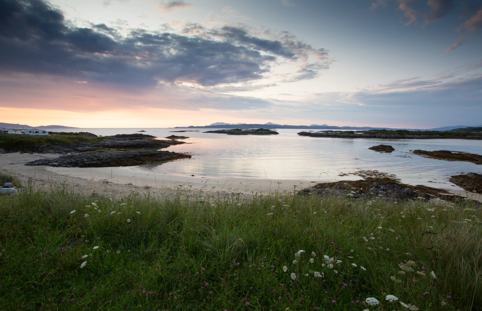
The first part of the walk crosses machair, one of the Hebrides’ most distinctive landscapes. This is fertile, flower-rich grassland formed where shell sand blows inland over peat, creating a rare coastal habitat. In early summer it can be especially colorful, while throughout the season the open ground supports abundant birdlife. Ahead and to the side, there are wide views over the coast, with Ceapabhal rising inland and the sea stretching toward the offshore islands. (walkhighlands.co.uk)
Soon the track reaches the dunes behind Tràigh na Cleabhaig, a south-facing beach known for pale sand and clear water. This section is the visual highlight for many walkers: low dunes, open surf, and long coastal views give the route a spacious, almost remote feel despite its short length. On clear days you may also see Pabbay and other islands out to sea. (andrewswalks.co.uk)
Beyond Tràigh na Cleabhaig, the path continues past more small beaches and curves around the headland toward Rubh’ an Teampaill. The chapel ruin stands in a striking position above the shore, and the final approach is almost flat, making this a very manageable walk for families, casual walkers, and anyone looking for a shorter outing in good weather. (andrewswalks.co.uk)
Landmarks, wildlife, and things to watch for
The main landmark is the ruined medieval chapel itself. Walkhighlands describes the present ruin as dating from the fifteenth century, while other local historical material notes that the visible chapel is often dated to the 15th or 16th century. More important than the exact century is the depth of occupation here: the site has seen successive phases of use, including a Viking predecessor and an earlier Iron Age broch, and archaeological work indicates human presence in the area stretching back thousands of years, even to Mesolithic times. Cup-marked stones nearby are older still, with some estimates placing them around 5,000 years old. (walkhighlands.co.uk)
That long history gives the walk unusual depth for such a short route. You are not just walking to a scenic ruin, but to a headland that has attracted settlement, worship, and defensive use over many centuries. The wider Northton area is one of the archaeologically important parts of Harris, and the chapel’s position on a coastal promontory helps explain why people kept returning to it. (hebridespeople.com)
Wildlife is another strong point. The machair is especially good for birds, and walkers on this route have noted species such as lapwing, oystercatcher, and snow bunting. In warmer months, the grassland can also be rich in wildflowers. If livestock are grazing, give them space and pass calmly through gates and pasture. Highland cattle are sometimes present near the route, particularly around the grazing land near Northton. (andrewswalks.co.uk)
The main things to look out for are exposure and changing coastal conditions rather than steep ground. There is very little shelter, so strong wind can make the walk feel more serious than the distance suggests. Waterproof layers are sensible even on

Surfaces
Grass
Unknown
Comments and Reviews
User comments, reviews and discussions about the Traigh na Cleabhaig and Rubh an Teampaill, Scotland.
average rating out of 5
0 rating(s)