
Tolstadh to Port Nis heritage walk via Bun Abhainn na Cloich and Loch Bacabhat Ard
Download
3D Flyover
Add to list
More
18.0 km
~3 hrs 55 min
201 m
Point to Point
“A windswept Hebridean crossing of moor, cliffs and shielings, rich in history and quiet drama.”
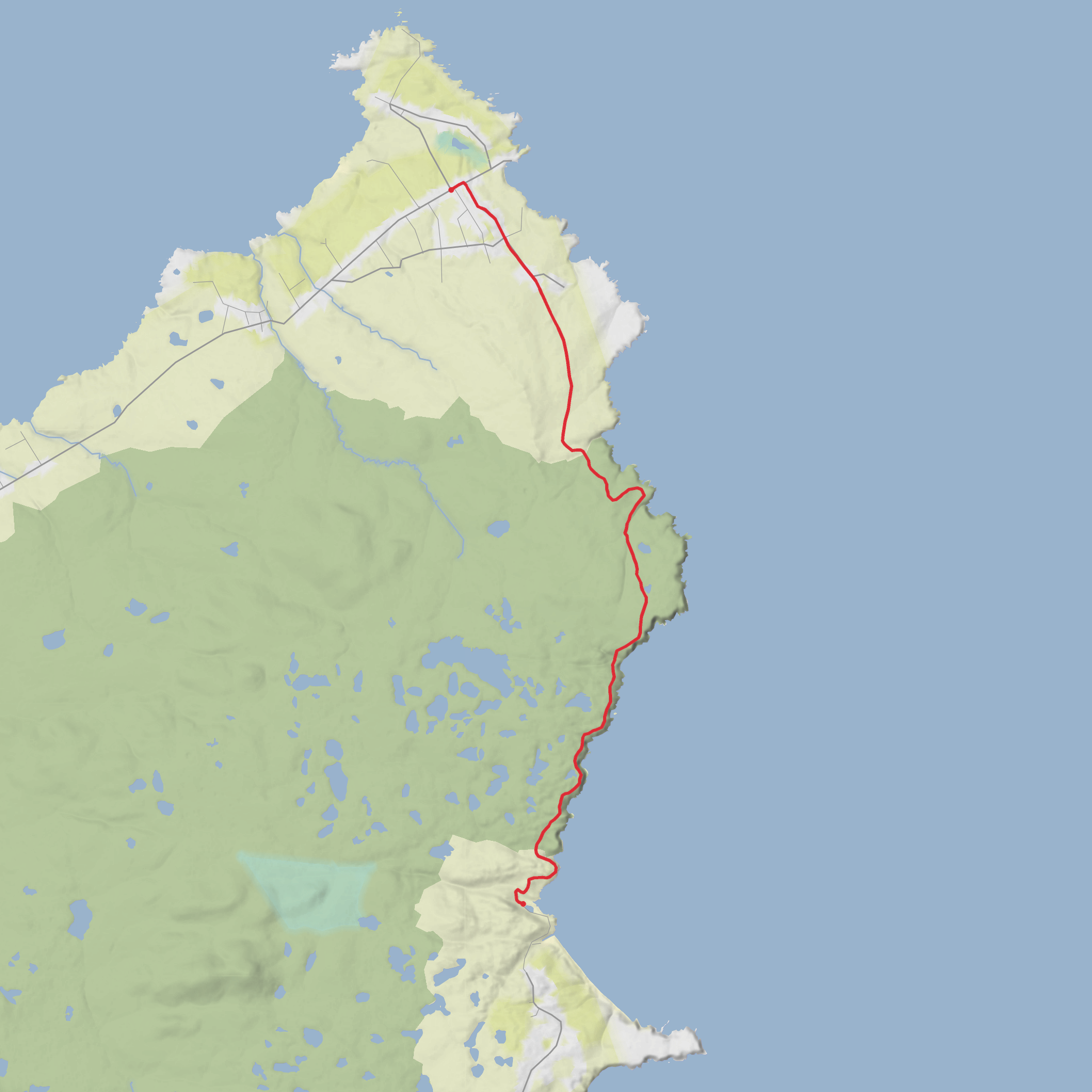
This long coastal heritage walk links North Tolsta with the Port of Ness/Skigersta side of north Lewis across open moor, cliff-top ground, old shieling country and a remarkably rich stretch of Hebridean history. Although your details list it as easy, it is better planned as a long, exposed moorland walk of around 18–19 km / 11–12 miles with roughly 200 m / 656 ft of ascent, where the challenge comes less from steep climbing and more from distance, uneven ground, wet sections, burn crossings and exposure to wind. Official local descriptions give 19 km / 12 miles and a typical walking time of 7–9 hours. (visitnorthlewis.com)
The route is generally walked between Garry Beach car park, North Tolsta, at the north end of the B895, and the Skigersta road end / High Street parking area near Ness, which is the practical trailhead on the Port of Ness side. Local route notes describe parking at Garry Beach car park if starting from Tolsta, and at the small parking area at the end of High Street, Skigersta if starting from the Ness side. (visitnorthlewis.com)
From the Tolsta end, the walk begins on a gravel road for about 300 m / 0.2 miles before reaching Garry Bridge (Drochaid Ghearadha), often called the “Bridge to Nowhere.” This is one of the best-known landmarks on the route: a relic of Lord Leverhulme’s early-20th-century plan to drive a road through to Port Nis, a scheme that was never completed. The opening stretch is one of the gentler parts of the day, with broad views over Traigh Mhòr, the huge sweep of Tolsta’s beach, and out across The Minch toward the Scottish mainland on a clear day. (visitouterhebrides.co.uk)
What the route feels like underfoot
After the bridge, the character changes quickly. The trail narrows and begins to weave between burns, low rises and rough coastal turf before passing Dùn Othail, a dramatic rock-stack stronghold. Local route information describes it as a natural fortress about 200 ft / 61 m high, separated from the mainland by a steep ravine known as Nicolson’s Leap. This is one of the most memorable points on the walk, and it gives a strong sense of how defensive and isolated this coastline once was. (visitouterhebrides.co.uk)
Beyond Dùn Othail, the route trends slightly inland across moor and loch-studded ground. This is where the walk becomes more committing. Expect peat, soft patches, rough grass, intermittent path definition and waymarked sections rather than a continuously built trail. The local route description specifically notes that the ground around the Bacabhat lochs and out toward Rubha an t-Seileir / Cellar Head is very undulating and tiring, so even though the total ascent is modest, the repeated ups and downs can make the day feel longer than the numbers suggest. (visitouterhebrides.co.uk)
There are also several burn crossings. In dry weather these may be straightforward step-overs or easy fords, but after rain they deserve more caution. The route notes mention crossings near the confluence below Lower Dìobadal, around Cellar Head, and again before the approach to Filiscleitir. Waterproof footwear, spare socks and careful pacing are sensible here. (visitnorthlewis.com)
If you are using digital navigation, rely on HiiKER alongside the on-ground marker posts. That is especially useful across the inland moor sections, where the line of travel matters more than any obvious trodden path.
Landmarks, heritage and old settlement traces
This walk stands out because the landscape is full of human history rather than empty wilderness. The route passes or approaches the remains of shielings at Aird Dhiobadail, Lower Dìobadal, and Cuidhsiadar. These seasonal dwellings were used when people moved with livestock to summer grazing, and they are a direct link to older crofting life in Lewis. Some of the local information notes that people still use the moor in summer in ways that echo those older traditions. (visitouterhebrides.co.uk
AI Planner
Days planned around your pace, with somewhere to stay each night.
Surfaces
Unknown
Asphalt
Comments and Reviews
User comments, reviews and discussions about the Tolstadh to Port Nis heritage walk via Bun Abhainn na Cloich and Loch Bacabhat Ard, Scotland.
average rating out of 5
0 rating(s)


