Download
3D Flyover
Add to list
More
2.9 km
~37 min
20 m
Out and Back
“A gentle lochside wander through South Uist’s wild east, with ruined crofts and shifting Hebridean skies.”
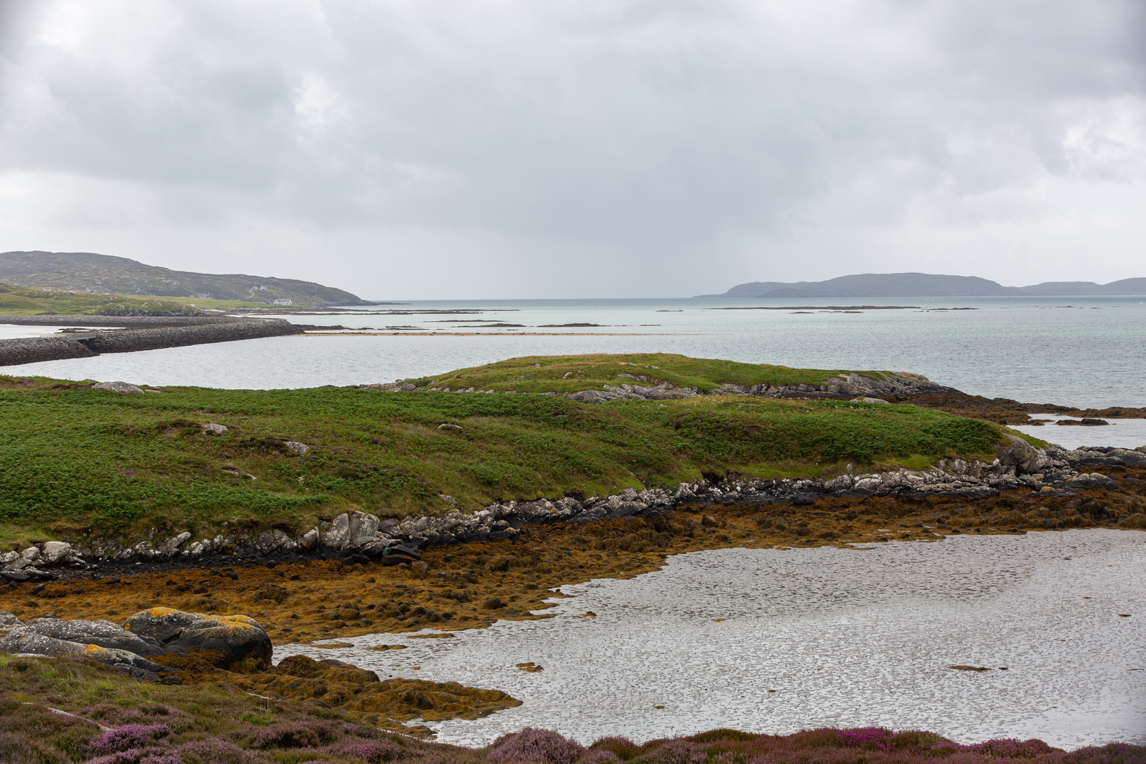
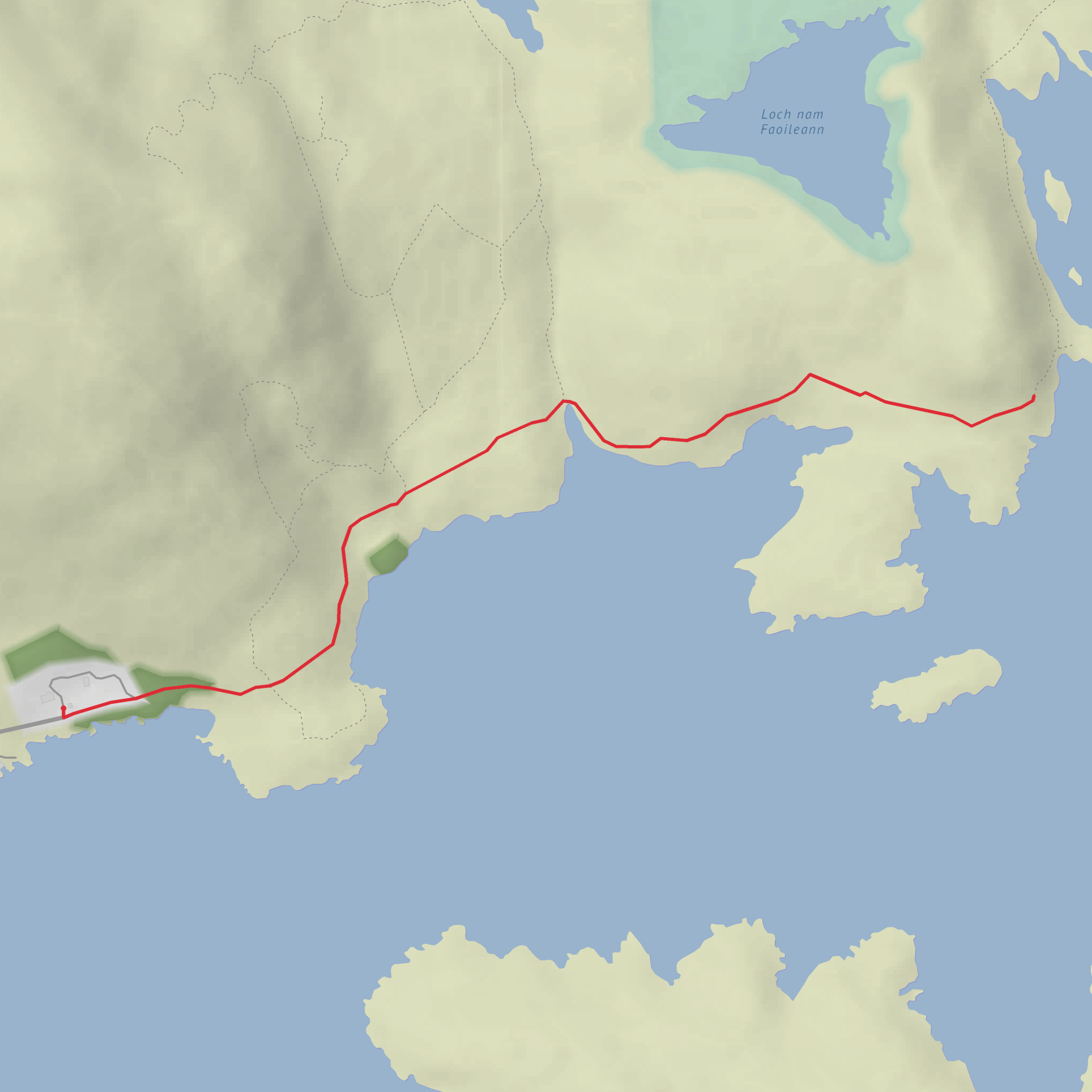
This easy out-and-back walk follows the north side of Loch Aineort at North Locheynort on South Uist, giving you a gentle coastal outing of about 3 km / 1.9 miles with virtually no climbing. The terrain is generally straightforward, and the route suits walkers looking for a short, low-level excursion rather than a strenuous hike. Expect a simple path and track experience beside the sea loch, with open views across the water toward the rugged eastern hills of South Uist. A historic photo record of the route notes the path running along the north side of Loch Aineort with a ruined croft visible ahead, which gives a good sense of the landscape character you can still expect here. (geograph.org.uk)
The start is best described as being near North Locheynort / Taobh a Tuath Loch Aineort, South Uist, Na h-Eileanan Siar, HS8 5SB, close to the Locheynort Road End area. That is the nearest clear landmark and access point identifiable from available transport and place information. (busmaps.com)
Because the elevation gain is around 0 m / 0 ft, the main things to prepare for are not steepness or exposure but wet ground, wind, and changeable Hebridean weather. Even on a short walk, waterproof layers, sturdy shoes with grip, and an extra warm layer are sensible. The path can feel more remote than the mileage suggests, especially if low cloud, rain, or strong coastal wind moves in from the Minch. If you want mapping and route tracking, use HiiKER.
What the walk feels like
From North Locheynort, the route heads out beside the loch on a quiet shoreline path. The walking is easy-going, with the sea loch on one side and the more rugged, sparsely settled eastern side of South Uist rising beyond. This part of the island is very different from the famous west-coast machair and beaches: it is wilder in mood, with moorland, rocky slopes, scattered croft remains, and long inlets cutting into the land. NatureScot describes this eastern side of South Uist as a landscape of high rugged hills, knolls, and peatland bordering the sea, while local visitor information highlights Locheynort as a starting point for coastal walking and wildlife watching. (nature.scot)
On a walk of roughly 3 km / 1.9 miles, most hikers should allow around 45 minutes to 1.5 hours, depending on how often they stop for views, wildlife spotting, or photos. Since the route is short and nearly flat, it works well as a relaxed standalone outing or as part of a broader day exploring South Uist’s east side.
Landmarks, nature, and wildlife
The most memorable feature is Loch Aineort itself, a sea loch on the east coast of South Uist with a quiet, indented shoreline and a distinctly remote feel. The path’s waterside position means the scenery changes with tide, light, and weather, and even a short distance can offer broad views across the loch and back toward the settlement. (scapetrust.org)
A notable visual landmark along the route is the presence of ruined croft buildings, including the ruined croft mentioned in the Geograph record. These remains help anchor the walk in the human history of the Uists, where small crofting communities were shaped by isolation, land use, and the demands of coastal living. (geograph.org.uk)
Wildlife is one of the strongest reasons to slow your pace here. Visitor information for South Uist specifically recommends leaving from Locheynort to follow the coastal path for chances to spot otters and sea eagles. You may also see common coastal and moorland birdlife such as waders, gulls, and waterfowl depending on season and tide. As always in sensitive island habitats, keep dogs under close control and give wildlife plenty of space. (visitouterhebrides.co.uk)
Historical significance of the area
North Locheynort sits within a part of South Uist where landscape and history are tightly linked. South Uist has a deep archaeological
Comments and Reviews
User comments, reviews and discussions about the Taobh a Tuath Loch Aineort, Scotland.
average rating out of 5
0 rating(s)
