Download
3D Flyover
Add to list
More
768 m
~10 min
12 m
Out and Back
“A gentle wander through mossy mill ruins and whispering water, rich in rural memory.”
This is a short, easy outing of about 1 km (0.6 miles) with virtually no elevation gain—roughly 0 m / 0 ft—so it suits walkers looking for a gentle historical wander rather than a strenuous hike. Expect a mostly level route with a relaxed pace, and allow extra time if you like stopping to look at old stonework, water features, or interpretive details along the way. Because the distance is so short, it also works well for families, casual walkers, and anyone wanting a quick heritage-focused walk.
The route centers on the remains of a mill and kiln site, so the main appeal is usually the combination of local industrial history and a quiet rural setting. On a walk like this, the landscape often feels shaped as much by people as by nature: watercourses redirected or harnessed for milling, stone ruins softened by moss and lichen, and open ground that hints at former agricultural use. Even on an easy trail, surfaces can vary—short grass, compacted earth, gravel, or damp patches near water—so sturdy walking shoes are still a good idea, especially after rain.
What to expect on the route
With only around 1 km (0.6 miles) to cover, the walk is likely to unfold in a few simple stages. The opening section is usually the easiest, often beginning from a roadside pull-in, small parking area, or access point near the heritage feature itself. Since the elevation change is negligible, there should be no sustained climbing, but uneven ground, exposed roots, or slick stones can still require care.
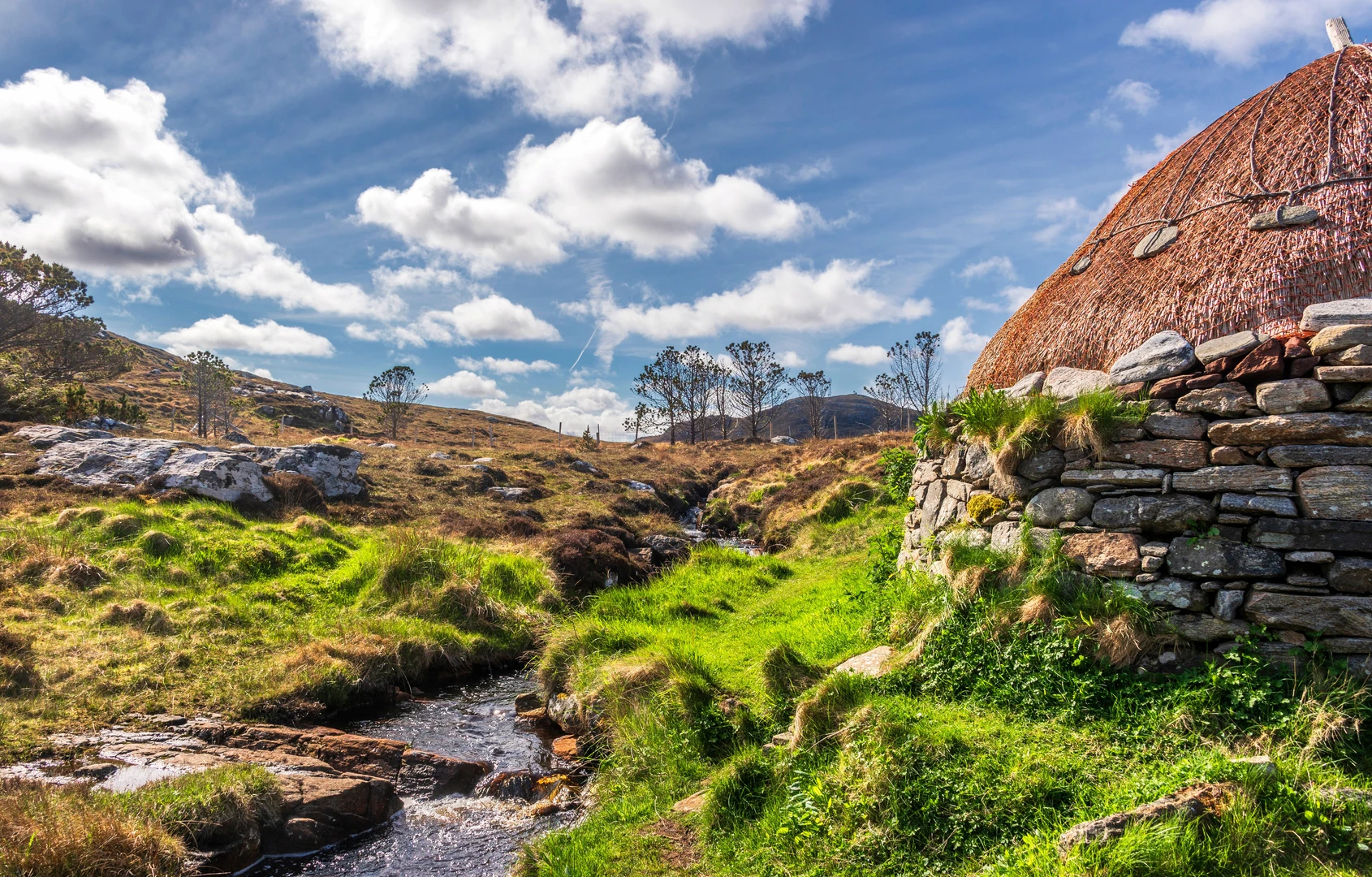
The most significant landmark is the old mill and kiln remains. These kinds of sites are often tied to earlier farming communities, where grain processing and drying were essential parts of daily life. A mill would have been central to local food production, while a kiln—depending on the site’s history—may have been used for drying grain before milling, or for lime burning in support of agriculture and building. If masonry survives, look for thick stone walls, partial foundations, channels for water management, and any surviving circular or arched forms that might indicate kiln construction.
Because the route is short and flat, many walkers treat it as a slow exploration rather than a point-to-point objective. It is worth scanning the surrounding terrain for clues to how the site once functioned: nearby stream alignments, embankments, old trackways, and changes in vegetation that may mark former human activity. If you are planning the walk in advance, HiiKER is the best tool to use for checking the route line, access points, and nearby features.
Nature and wildlife
Although the historical remains are the main draw, short heritage walks like this often pass through attractive pockets of habitat. Depending on the exact setting, expect a mix of rough grassland, hedgerow, scrub, and damp ground near water. In these areas, common birdlife may include robins, wrens, blackbirds, wagtails, and crows, with swallows or martins possible in open country during warmer months. If there is a stream or wet margin, listen for the sound of moving water and watch for insects such as dragonflies in summer.
Plant life around old ruins can be especially interesting. Stone structures often support mosses, lichens, ferns, and small wildflowers, while surrounding banks may hold nettles, grasses, brambles, and seasonal blooms. In wetter weather, the area can feel greener and more atmospheric, but also more slippery underfoot. If livestock graze nearby, keep dogs under close control and move calmly through fields.
Historical significance
The strongest character of this walk comes from its connection to the region’s working past. Mills and kilns were once essential rural infrastructure, supporting farming communities by processing grain or producing materials needed for cultivation and construction. Even a modest ruin can reveal a great deal about how local people lived and worked before mechanized transport and modern industry changed the countryside.
A mill site usually points to the importance of water power or local grain production, while a kiln suggests a specialized process that served the surrounding settlement or farmland. In many regions, these structures date from periods when communities depended heavily on local resources and seasonal labor. Their remains are often among the clearest surviving traces of everyday rural industry. When visiting, avoid climbing on fragile masonry or disturbing loose stones, as these sites can be both historically important and structurally delicate.
Access, parking, and planning
Because the hike details do not include a precise trailhead location, the start point should be treated as the nearest signed access to the Norse Mill and Kiln site. If you have coordinates available, they should be converted to the nearest road address or notable landmark before setting out, and then checked against HiiKER for the most practical approach.
By car, the easiest option is usually to drive to the nearest minor road, heritage pull-off, or informal parking area serving the site. On very short walks like this, parking can be limited, so be prepared for roadside parking only where it is clearly safe and legal, without blocking gates or farm access.
By public transport, access will depend entirely on the nearest village or local road network. In rural areas, the usual approach is to take a bus or train to the closest settlement and then continue on foot or by taxi to the trail start. If using public transport, it is wise to check return times carefully before leaving, since services near small heritage sites can be infrequent.
Even though this is an easy route, bring the basics: waterproof layers in unsettled weather, drinking water, and footwear with decent grip. A short walk can still feel exposed if conditions turn wet or windy, and old mill areas near water can become muddy or slick. If visiting with children, the main things

Comments and Reviews
User comments, reviews and discussions about the Norse Mill and Kiln, Scotland.
average rating out of 5
0 rating(s)