Download
3D Flyover
Add to list
More
1.2 km
~14 min
0 m
Out and Back
“A gentle Atlantic stroll through Mayo’s bogland and open skies, rich in remoteness and weather-worn charm.”
This easy walk of around 1 km / 0.6 miles is best approached as a short, low-level outing suited to a relaxed pace, with little to no climbing—roughly 0 m / 0 ft of elevation gain. With such a short distance, the route is more about the setting than physical challenge, so it works well for families, casual walkers, or anyone looking for a brief leg-stretch rather than a full day hike. Expect straightforward terrain overall, though even easy coastal or rural Irish paths can include damp patches, uneven ground, short grassy sections, or loose gravel after rain.
What to expect on the route
Because the walk is so short and nearly flat, most hikers will complete it comfortably in well under an hour, even with stops. The main things to prepare for are exposure to weather and underfoot conditions rather than steepness or endurance. In this part of County Mayo, paths can feel very open to Atlantic wind, and a dry day can make the route feel gentle and accessible while wet weather may leave sections soft or slippery. Mayo’s walking routes are often set through a mix of minor roads, grassy tracks, bog-edge ground, and coastal or open countryside landscapes, so sturdy footwear is still worthwhile even on an easy outing. (mayo.ie)
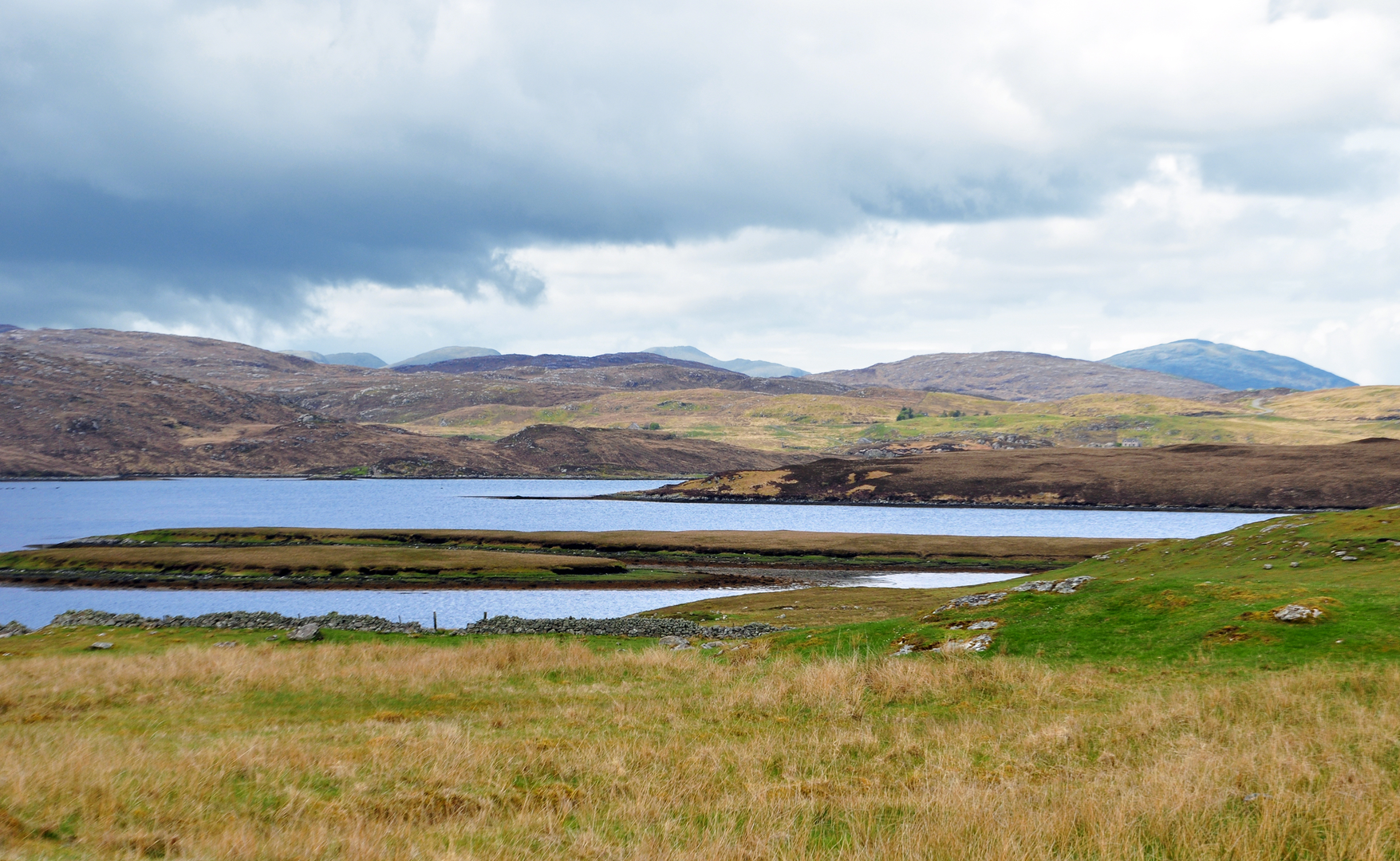
If Mihinish is the small local walk associated with the wider Erris / north Mayo walking area, hikers should expect broad views, open skies, and a landscape shaped by peatlands, stone walls, and the Atlantic edge rather than dense woodland or major ascent. North Mayo is especially known for its wild, sparsely populated scenery and a strong sense of remoteness, even on short walks. (mayo.ie)
Landscape, nature and wildlife
The surrounding region is one of blanket bog, rough grassland, coastal exposure, and wetland habitat. These landscapes are ecologically important and support birdlife that can include seabirds along the coast and waders or other wetland species in boggier ground, depending on season and exact location. Mayo’s wetlands and bog systems are among the county’s defining natural features, and even a short walk can pass through terrain that feels distinctly Atlantic and deeply tied to the local ecology. (mayo.ie)
Plant life is typically hardy and low-growing in exposed areas, with grasses, heather, mosses, and bog vegetation more likely than tall forest cover. After rain, the ground can hold water, so hikers should watch for saturated edges beside the main walking line. If visibility drops in mist or showers, using HiiKER for route awareness is sensible, especially where short local trails connect with lanes or less distinct ground.
Landmarks and regional character
North Mayo’s walking country is rich in coastal viewpoints, old field systems, and traces of long settlement in a harsh but beautiful environment. Even where a specific short trail has few built landmarks, the wider area carries strong cultural character through Irish-speaking communities, scattered townlands, and a long relationship with fishing, small-scale farming, and life on the Atlantic fringe. The nearby Erris region is widely recognized for dramatic scenery and for loop walks that showcase some of the county’s most isolated and striking coastal terrain. (mayo.ie)
Historically, this part of Mayo reflects the broader story of western Ireland: rural settlement patterns, peat cutting, subsistence agriculture, and maritime life all shaped the land. Stone boundaries, bogland, and open commonage are not just scenic features; they are part of a long-lived working landscape. In Gaeltacht parts of north Mayo, Irish language and local place-names remain an important part of the region’s identity. (trips.ie)
Getting to the start
The exact trailhead is unclear from the details provided, but Mihinish appears to be in the wider north Mayo / Erris area of County Mayo, Ireland. Based on that, the nearest practical access point is likely via the Belmullet or Carrowteige area rather than a major town. Belmullet is the main service hub for the Erris Peninsula and is the most useful place to aim for by car before continuing on local roads to the walk start. Car access is usually the simplest option in this part of Mayo because many short rural trailheads are reached by narrow local roads with limited public transport coverage. (mayo.ie)
By public transport, the usual approach would be to travel first to Belmullet by regional bus and then use a local taxi for the final stretch if the trailhead is outside town. If you are planning the walk in detail, it is worth checking HiiKER alongside current local transport options before setting out, as services in remote parts of Mayo can be infrequent.
Practical planning notes
For a 1 km / 0.6 mile easy walk, most hikers only need light day gear:

Surfaces
Dirt
Unknown
Comments and Reviews
User comments, reviews and discussions about the Mihinish, Scotland.
average rating out of 5
0 rating(s)