Download
3D Flyover
Add to list
More
7.5 km
~2 hrs
308 m
Loop
“Barra’s west-side loop weaves machair, lochs, ruins and Atlantic beaches into a richly layered adventure.”
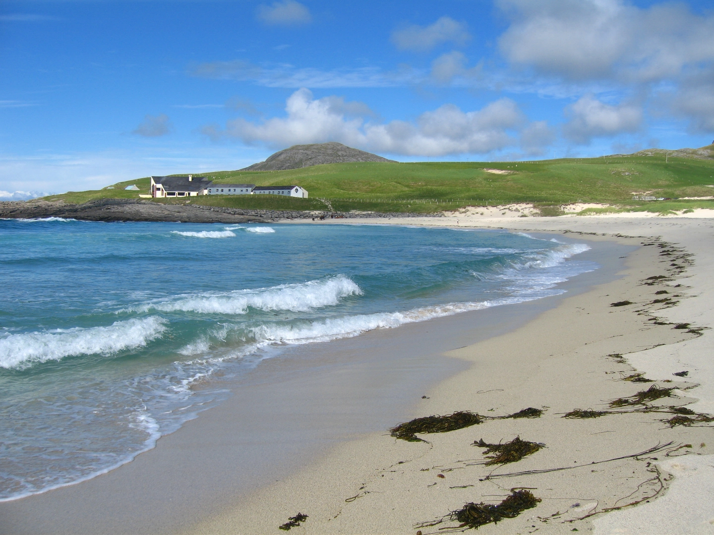
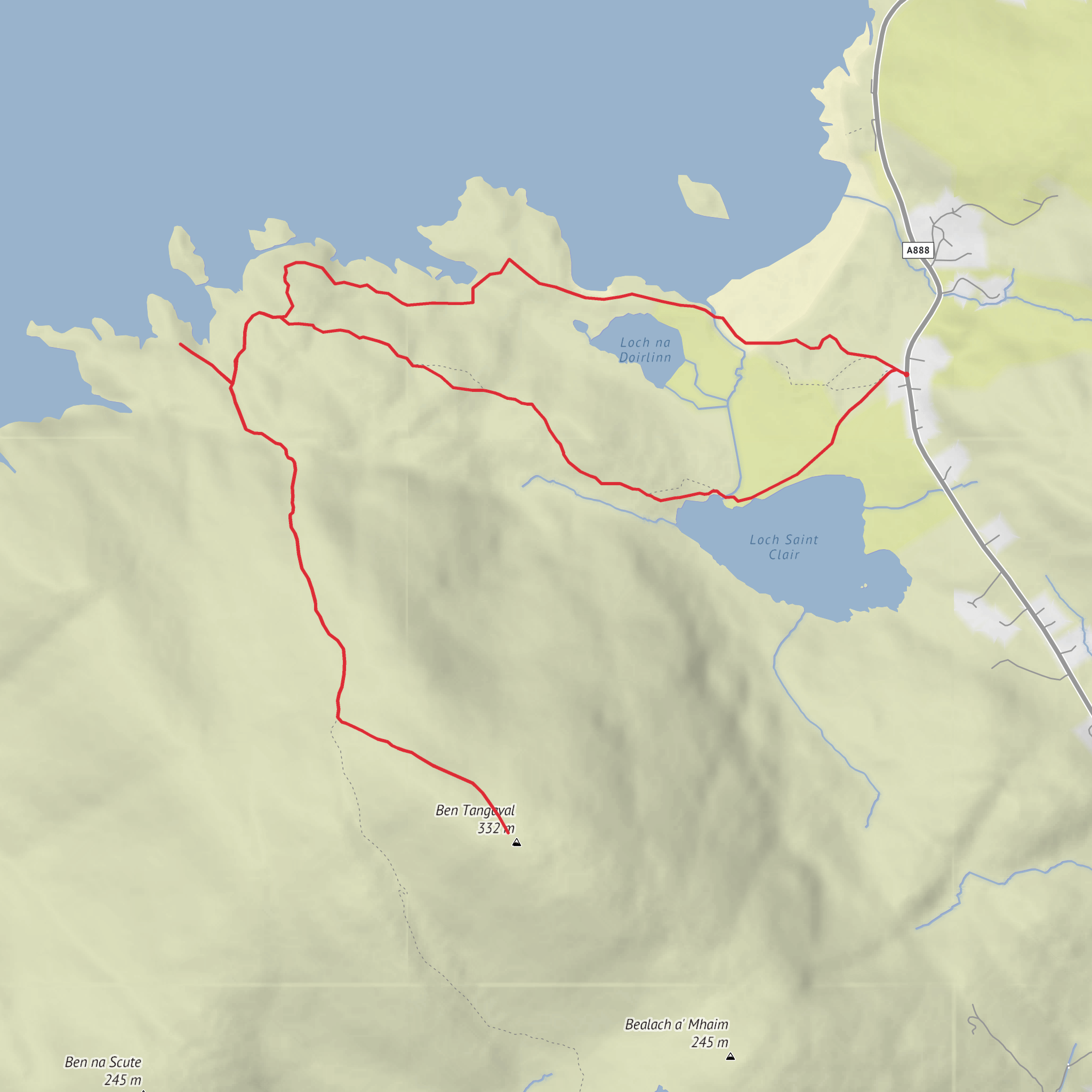
This medium-rated loop on Barra’s west side packs a lot into roughly 7 km / 4.3 miles, with about 300 m / 985 ft of ascent. It combines machair, lochside walking, a short hill climb, archaeological sites, and a beach return, all with wide Atlantic views and a strong sense of the island’s layered history. The route is associated with Tangasdale, west of Castlebay, and the start is best described as the signed walking access opposite the old telephone kiosk near Tangasdale, close to the Isle of Barra Beach Hotel area on the west coast of Barra. Local walking information places the start about 2.5 miles / 4 km west of Castlebay, with informal parking by the fence line near the access point. (isleofbarra.com)
Expect a varied outing rather than a single sustained climb. The early part of the walk crosses open machair and grazed ground on generally easy terrain before reaching Loch St Clair, also known locally as Loch Tangasdale or Loch Sinclair. From there, the route builds interest quickly: loch views, old settlement remains, a climb toward Ben Tangaval, a detour or out-and-back to Dun Ban, and a return past Loch na Doirlinn and the beach. Although the distance is modest, the mix of uneven ground, short steeper sections, wet patches, and coastal exposure is what pushes it into the medium category rather than easy. Stout footwear is specifically recommended in local route notes. (isleofbarra.com)
The first landmark most hikers notice is Loch St Clair itself, with Ben Tangaval rising steeply above it. On the loch sits MacLeod’s Tower, a small tower house built in the early 15th century on top of what is thought to be an earlier Iron Age crannog. That pairing of medieval masonry over much older foundations is typical of Barra, where prominent defensive sites were reused across centuries. The lochside section is one of the most photogenic parts of the walk, and it is also where the route begins to feel more rugged and remote despite being relatively close to the road. (isleofbarra.com)
Terrain and what to expect
The ground underfoot changes often. Across the machair, the walking is usually straightforward, though it can be soft after rain. Around the lochs and on the hillier sections, expect rougher grass, faint paths, boggier patches, and some uneven footing. If you include the rise onto or toward Ben Tangaval, the ascent becomes more noticeable, with steeper gradients than the coastal sections. Ben Tangaval stands about 333 m / 1,093 ft high, so even a partial ascent gives a broad payoff in views over Barra, the Atlantic, and neighboring islands. (isleofbarra.com)
Navigation should not be underestimated, especially in mist or low cloud. Parts of the route are waymarked in local walking literature, but coastal and hill paths can still feel indistinct. Checking the route carefully on HiiKER before setting out is sensible, particularly if you plan to link the loch, summit, fort, and beach sections into one continuous loop. On windy days, the exposed ground near the coast and higher slopes can feel much more serious than the mileage suggests.
The beach return is attractive but comes with a few practical cautions. Local guidance notes a small stream crossing near the beach, and this can widen after heavy rain. There is also an area of softer sand south of the main line back, so it is worth keeping to firmer ground rather than drifting too far onto the softer beach margins. (isleofbarra.com)
Landmarks, archaeology, and natural interest
Dun Ban is one of the standout historical features. It is identified as a prehistoric promontory fort, possibly incorporating a broch, and local interpretation describes it as around 2,000 years old. Its position on a rocky headland explains its defensive value immediately: steep coastal edges, a commanding outlook, and a naturally strong site reinforced by human construction. Trove Scotland classifies it as a promontory fort and possible Iron Age broch, while local route information emphasizes the surviving walling and dramatic setting. (trove.scot)
There are other traces of past settlement scattered through the route. Near Loch St Clair, remains of structures are linked in local tradition to Roderick the Dove, a MacNeil of Barra who is said to have lived there after leaving Kisimul Castle in 1748. Elsewhere on the route are the remains of blackhouses
Surfaces
Unknown
Grass
Asphalt
Comments and Reviews
User comments, reviews and discussions about the Loch Saint Clair, Dun Ban, Ben Tangaval and Loch na Doirlinn Loop, Scotland.
average rating out of 5
0 rating(s)
