Download
3D Flyover
Add to list
More
13.9 km
~3 hrs 53 min
671 m
Loop
“A wild Hebridean circuit of white sands, dark lochs and wind-scoured heights rewards prepared walkers.”
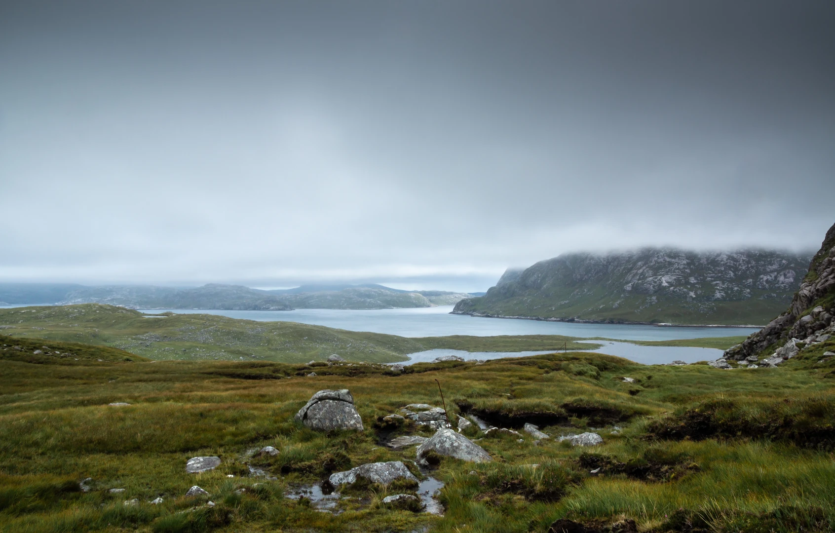
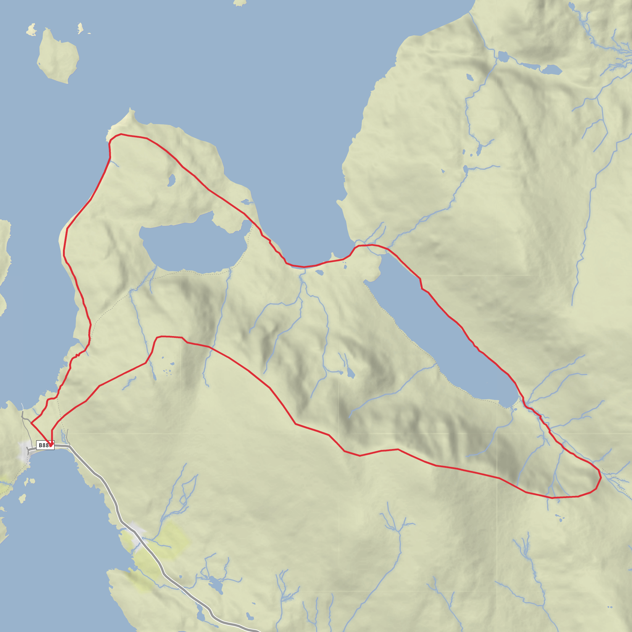
This 14 km / 8.7 mile loop in west Harris is a wild, committing circuit through one of the most dramatic corners of the Outer Hebrides, linking the sea loch of Loch Crabhadail with the inland waters of Loch na Cleabhaig and Loch a’ Ghlinne before climbing onto the broad heights around Huiseabhal Mòr. With roughly 700 m / 2,300 ft of ascent, it sits comfortably in the medium bracket on paper, but the terrain can make it feel harder: expect rough path, boggy ground, steep coastal sections, and exposed upland stretches where wind and visibility can change the day completely. The route is best thought of as a remote hill-and-coast loop rather than a straightforward waymarked walk. The usual start is at the Hùisinis car park and visitor facilities at the road end near Hushinish, west of Tarbert on the Isle of Harris, which is the nearest clear landmark and practical trailhead for this area. (walkhighlands.co.uk)
By car, the approach is via the single-track road from Tarbert to Hùisinis/Hushinish at the far western end of Harris. Walkhighlands notes parking and toilets at the start, and the Hùisinis Gateway area is also known for basic visitor amenities. If using public transport, Hushinish is the terminus of an infrequent bus service from Tarbert, so timings need to be checked carefully in advance with Comhairle nan Eilean Siar’s bus service information before committing to the hike. Because services are limited, many walkers will find a car the more practical option, especially for an early start or if weather delays progress. (walkhighlands.co.uk)
The opening section is gentler than the middle of the day suggests. From Hùisinis, the route begins near the coast on a clear path and old track line, with immediate views over the Sound of Taransay and toward Scarp. This first stretch gives a good sense of the landscape: machair-like grass, rocky shore, white sand, and a constant Atlantic presence. The path toward Crabhadail and Tràigh Mheilein follows an old route that has seen repair work, but it is still uneven and in places runs above steep drops, so it deserves attention even early on. Approximate distance to the point where the route turns inland is around 3 to 4 km / 1.9 to 2.5 miles, with only modest ascent at first. (walkhighlands.co.uk)
Terrain and route character
After the coastal approach, the route becomes more serious as it turns inland beneath the steep ground of Huiseabhal Beag and works toward Loch na Cleabhaig. This is where the hike starts to earn its elevation gain. The path can be rocky, damp, and broken, and there are sections where old fence lines or faint trods help more than any engineered trail. Around Loch na Cleabhaig, the ground can become rougher and wetter, with peat, heather, and uneven shoreline travel slowing the pace. If conditions have been wet, this part can feel much longer than the map suggests. HiiKER is the best tool to have loaded before setting out, especially if low cloud drops over the higher ground or if you need to confirm the line between lochs and bealachs. (walkhighlands.co.uk)
From Loch na Cleabhaig the route trends toward Loch Crabhadail and Loch a’ Ghlinne, two of the defining landmarks of the circuit. Loch a’ Ghlinne sits inland behind the sea loch, and the connection between the two creates one of the most memorable landscape compositions on the walk: dark freshwater, sea inlets, rock ribs, and open Atlantic beyond. Older route accounts describe the descent toward Loch a’ Ghlinne as steep and at times eroded, with rough going around the loch margins and signs of former crofting nearby. That means strong boots, gaiters in wet weather, and realistic timing matter more here than the medium rating alone might suggest. (robert-fugate.pixels.com)
The climb onto or around Huiseabhal Mòr is the physical high point of the day. The broad ridge gives huge views when clear, including offshore islands and, on a very good day, distant St Kilda from the wider Hùisinis ridge area. The ascent is not especially technical, but it is exposed and can be punishing in wind. The final descent back toward the coast can also require care, particularly if legs are tiring or the rock is slick. Allow extra time for route-finding and for pauses
Surfaces
Unknown
Ground
Asphalt
Comments and Reviews
User comments, reviews and discussions about the Loch na Cleabhaig, Loch Crabhadail, Loch a' Ghlinne and Huiseabhal Mor Loop, Scotland.
average rating out of 5
0 rating(s)
