
Loch Leosaid, Loch Chliostair, Loch Aiseabhat, Oireabhal and Cleiseabhal Loop
Download
3D Flyover
Add to list
More
15.4 km
~4 hrs 13 min
693 m
Loop
“A wild Lewis circuit threads lonely lochs, boggy moor, and airy ridges with sweeping island views.”
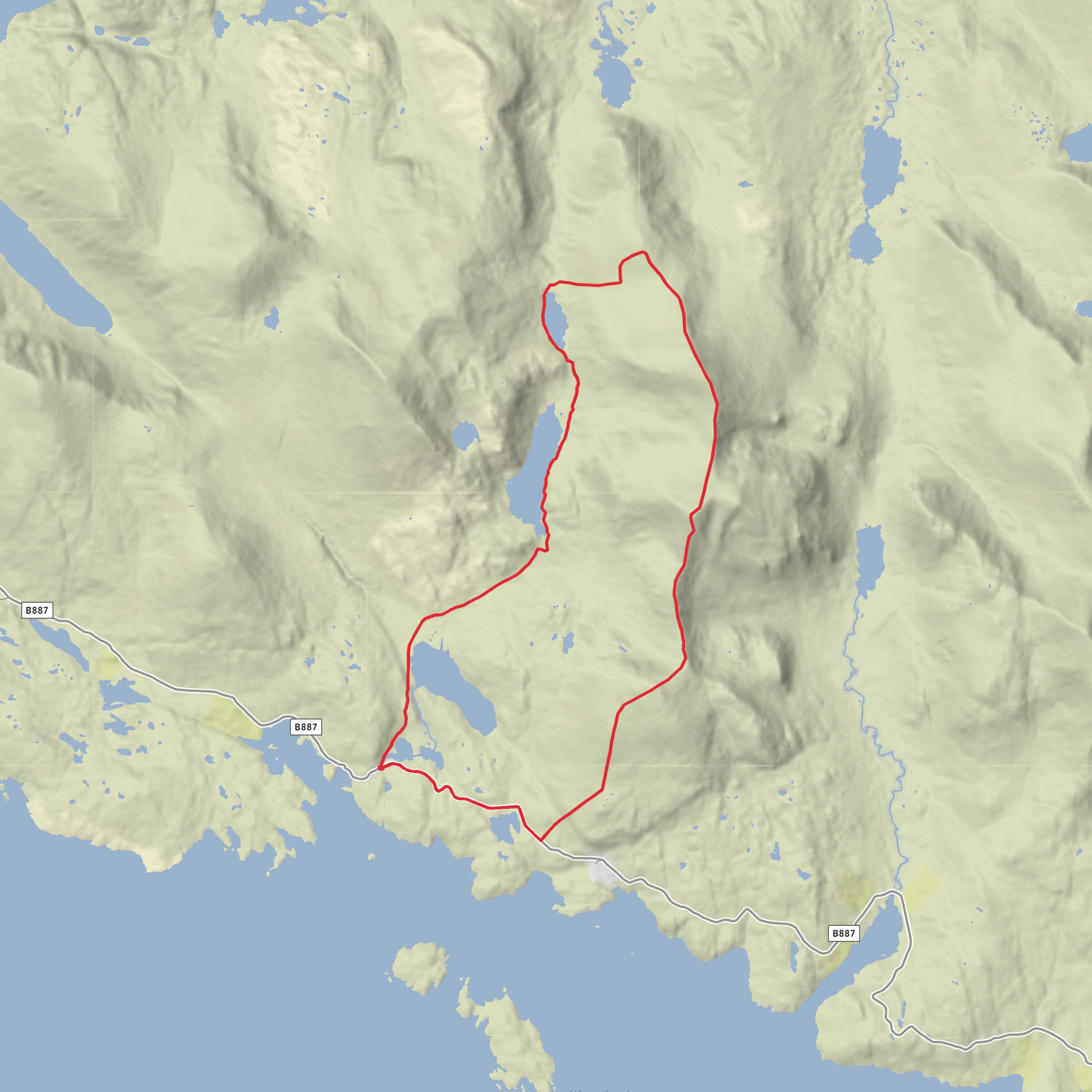
This 15 km / 9.3 mile loop in the hills of Lewis is a moorland-and-ridge outing with roughly 700 m / 2,300 ft of ascent, linking a chain of inland lochs with the higher ground of Oireabhal and Cleiseabhal. It is generally best thought of as a medium-grade hillwalk for experienced walkers in good conditions, but the seriousness rises quickly in poor visibility because sections of the route leave the clearer path network and cross boggy, pathless ground before joining a broad, rocky ridge. The start is by the power station road in Gleann Chliostair, off the B887 on the Isle of Lewis, near the Chliostair Hydro-Electric Scheme and the small roadside parking spots by the cattle grid. There is no formal trailhead car park. (walkhighlands.co.uk)
The opening section is comparatively straightforward. From the road, the route follows the power station access road and then a rougher track that drops toward the west side of Loch Leosaid. This first stretch gives a good sense of the landscape you will be in for the rest of the day: open moor, engineered watercourses, and long views toward the surrounding hills. The track passes the small power station and climbs toward the dam, so the first few kilometres are useful for settling into a rhythm before the more remote hill section begins. (walkhighlands.co.uk)
Route character and terrain
Beyond the dam, the route improves briefly again on a stalkers’ path running along the east side of Loch Chliostair. This is one of the most attractive middle sections of the walk, with the loch stretching ahead and the hills beginning to close in. After a bridge crossing, the path climbs to Loch Aiseabhat, where stepping stones cross the outflow and the route continues beside the water. Up to this point, navigation is relatively uncomplicated in clear weather, but the ground can still be wet and peaty, and after rain the stepping stones and lochside sections need care. (walkhighlands.co.uk)
At the far end of Loch Aiseabhat, the walk changes character. The route leaves the clearer path and heads onto easy but boggy ground, first toward a bealach and then onto higher slopes. This is where strong navigation becomes important, especially if low cloud sits on the tops. HiiKER is the tool to have prepared in advance, but it should be backed up by map, compass skills, and an understanding that the line on the ground may be faint or absent. Expect wet feet if conditions have been unsettled, and allow extra time for slower travel across peat and rough grass. (walkhighlands.co.uk)
The ridge itself is the reward for the effort. The climb steepens toward Ulabhal, then continues south with rocky outcrops, broad summit ground, and increasingly expansive views. Oireabhal is one of the standout high points, with wide panoramas toward South Harris and the surrounding island-studded coast, while Cleiseabhal, marked by a trig point, gives another excellent viewpoint over the lochs and sea inlets below. The ridge is not described as technically difficult in dry, calm weather, but it is exposed to wind and weather, and the descent from Cleiseabhal is noted for being boggy and steep in places. Care is needed to avoid craggier ground on the west flank. (walkhighlands.co.uk)
Landmarks, scenery, and what to watch for
The three lochs named in the route give the walk much of its identity. Loch Leosaid sits lower down and is tied directly to the hydro scheme, while Loch Chliostair and Loch Aiseabhat feel progressively wilder as the route climbs inland. The hydro infrastructure is part of the landscape here rather than a distraction from it: dams, water control features, and the pipeline reflect the mid-20th-century development of hydro-electric power in the Highlands and Islands. The Chliostair scheme uses the drop from Loch Chliostair via Abhainn Eabhal to Loch Leosaid to generate power, and that engineered descent is one of the defining features of the glen. (en.wikipedia.org)
Geologically and visually, this is classic Lewis terrain: open mo
Surfaces
Unknown
Asphalt
Gravel
Concrete
Comments and Reviews
User comments, reviews and discussions about the Loch Leosaid, Loch Chliostair, Loch Aiseabhat, Oireabhal and Cleiseabhal Loop, Scotland.
average rating out of 5
0 rating(s)



