
Download
3D Flyover
Add to list
More
5.3 km
~1 hrs 5 min
19 m
Out and Back
“A gentle North Uist circuit where loch, moor, and tide-washed shore blur beautifully together.”
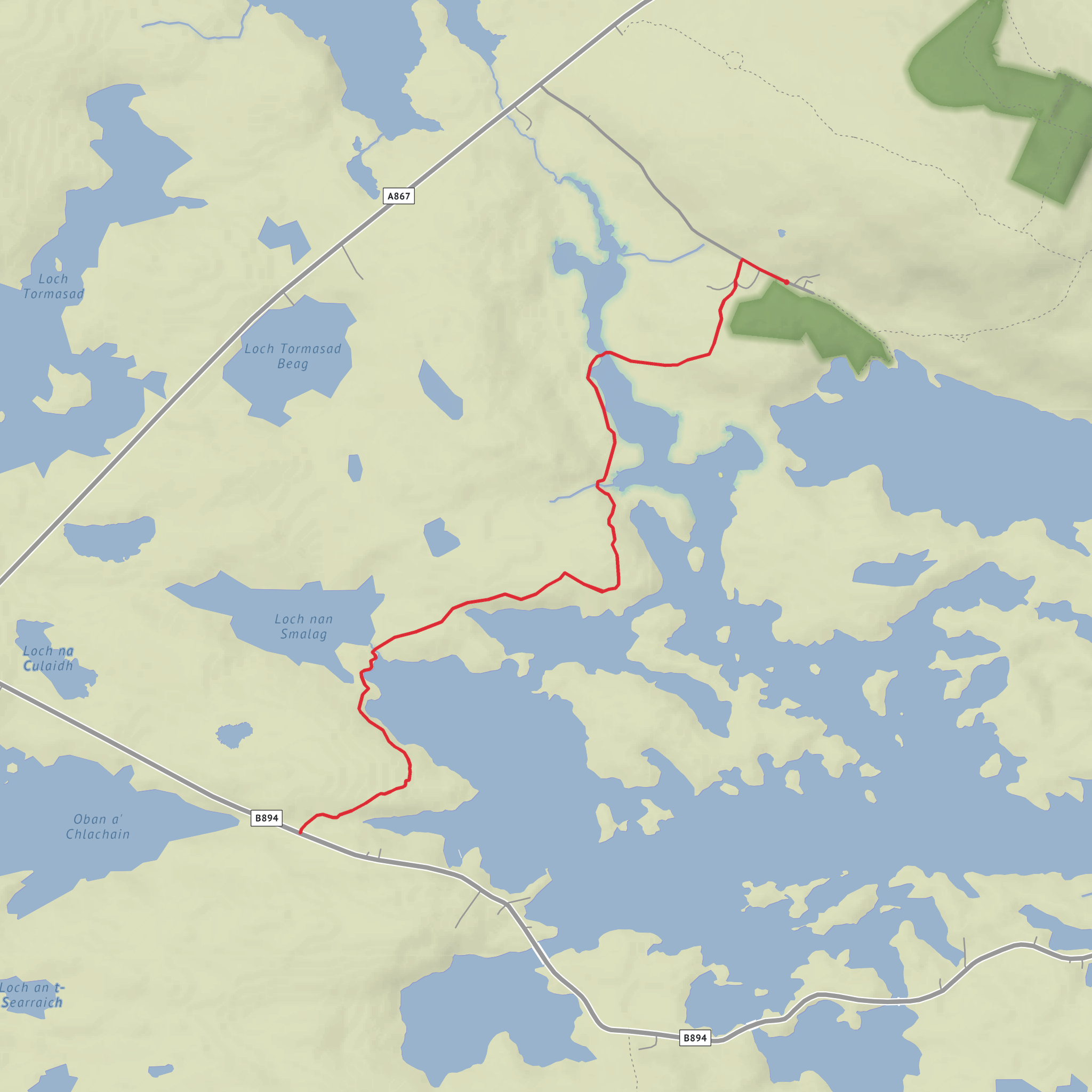
This easy coastal-and-lochside circuit near Langass Lodge, Langass, Isle of North Uist, HS6 5HA, explores a quiet corner of North Uist where inland freshwater, peatland, and sea edge sit almost side by side. The route is around 5 km / 3.1 miles with very little ascent—about 0 m / 0 ft overall, so it is best thought of as a gentle outing rather than a strenuous hike. What makes it memorable is not climbing, but the shifting Hebridean scenery: low moor, open water, tidal inlets, and broad views that can feel much bigger than the mileage suggests. Langass itself lies on the A867, about 6 miles / 9.7 km south of Lochmaddy, and the nearby car park used for local trails is directly beside that road. (visitouterhebrides.co.uk)
Expect a route where the walking is generally straightforward, but where conditions underfoot can still change quickly with weather. In this part of North Uist, even easy trails can include damp ground, short boggy patches, rough grass, and sections where the path is less obvious than the map suggests. On nearby established routes through the same Langass and Loch nan Smalag area, walkers are specifically warned to expect boggy moorland in places, gates, footbridges, and stretches where careful attention to waymarking is useful. That means waterproof footwear is still a sensible choice even for a short walk, especially after rain. For navigation, it is worth checking the route carefully on HiiKER before setting out. (walkhighlands.co.uk)
What the route feels like
The character of this walk is low-level and open. Rather than a single dramatic objective, it links a series of small Hebridean landscape features: Langais, Loch nan Smalag, Barra Mhail, and Bagh na Tarruing. The lochside sections are likely to feel sheltered compared with the more exposed coastal edges, while the shoreline portions open out to wider sea views and a stronger sense of space. Because the terrain is so flat, even slight rises or firmer ground can create surprisingly broad outlooks across lochs, moor, and sea.
Loch nan Smalag is part of a particularly attractive section of North Uist where the route passes between the sea and the loch, with open views toward the surrounding hills and moorland. On longer waymarked walks in the same corridor, this stretch is noted for its footbridges and scenic waterside walking, which gives a good indication of what hikers can expect here as well: easy gradients, wet ground in places, and a strong sense of walking through a landscape shaped by water. (walkhighlands.co.uk)
Barra Mhail and Bagh na Tarruing add a more coastal feel to the outing. In North Uist, these shorelines are typically a mix of rocky margins, salt-tolerant grasses, and tidal textures rather than steep cliff scenery. On a calm day the coast can feel peaceful and expansive; in wind, it becomes much more elemental. Even on an easy route, that exposure matters. Strong Atlantic winds can make a short walk feel significantly cooler and more committing than the distance suggests, so an extra warm layer and waterproof shell are worth carrying year-round.
Landmarks, wildlife, and what to look out for
This is a rewarding area for birdlife. The Langass area is part of a recognized birdwatching zone where short-eared owls may be seen hunting low over open ground in daylight, and in summer red-throated divers can often be heard or seen moving between inland breeding lochs and the sea. The wider Langass area is also associated with moorland and loch habitats that support a good range of Hebridean birds, so hikers should keep an eye on open water, fence posts, and rough grassland edges. (visitouterhebrides.co.uk)
The surrounding landscape also supports red deer, which are specifically noted near Barpa Langais, only a short distance from the Lang
Comments and Reviews
User comments, reviews and discussions about the Langais, Loch nan Smalag, Barra Mhail and Bagh na Tarruing, Scotland.
average rating out of 5
0 rating(s)


