
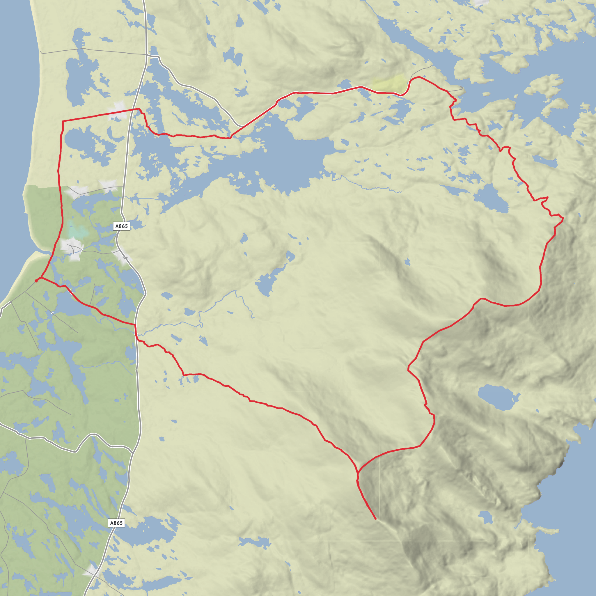
Howmore to Head of Gleann Uisinis via Loch Druidibeag, Heacla and Beinn Mhor
Download
3D Flyover
Add to list
More
31.7 km
~2 days
1111 m
Point to Point
“A wild South Uist traverse through lochs, bog, and airy ridges to its highest summit.”
This is a long, committing hill day across the wild interior of South Uist in the Outer Hebrides, linking the moorland around Howmore, the loch country of Loch Druidibeag, the broad ridge of Heacla, and Beinn Mhòr, the island’s highest summit at about 620 m / 2,034 ft. Expect roughly 32 km / 19.9 miles with around 1,100 m / 3,610 ft of ascent, which makes it a solid medium-to-hard outing in practice: the numbers are manageable for strong walkers, but the remoteness, bog, rough ground, and changeable Atlantic weather can make it feel much bigger. (en.wikipedia.org)
The start is best understood as being near Howmore (Tobha Mòr), Isle of South Uist, close to the Howmore church and road end on the A865, which is the most recognizable landmark for access and parking in the area. Howmore lies southwest of Loch Druidibeag and is one of the small settlements on the west side of South Uist. (en.wikipedia.org)
Getting there is part of the planning. By car, most visitors reach South Uist via the Lochboisdale ferry port, the island’s main ferry gateway, then drive north on the A865 toward Howmore. By public transport, the practical option is the W17 bus running through the Uists; current timetable information shows stops including Howmore R.E. and links with Lochboisdale, Benbecula Airport, and other settlements along the island chain. Services are limited, so timings need to be checked carefully before committing to a full-day mountain route. (en.wikipedia.org)
The opening section is gentler than the mountain skyline suggests. From the Howmore side, the route trends inland across low-lying ground toward Loch Druidibeag, where the landscape shifts from crofting land and machair-edge terrain into open moor. This area is known for a mix of habitats, including freshwater loch, acidic moorland, and nearby machair systems, so underfoot conditions can vary from grassy track to wet peat and soft, uneven ground. Even before the climbing begins, this can slow progress more than the map suggests, especially after rain. (nature.scot)
Through the loch and moorland country
Loch Druidibeag is one of the defining landmarks of the day. It sits in a broad, open basin with a striking backdrop of South Uist’s main hills, and the contrast between water, moor, and steep rock gives this route much of its character. The loch and surrounding ground are important for breeding birds and wetland habitats, with a notably rich bird assemblage recorded in the protected area. Depending on season, hikers may encounter waders, waterfowl, raptors, and smaller moorland birds; dogs should be kept under close control here because the reserve is managed for breeding birds. (nature.scot)
Navigation through this section deserves respect. Paths can be faint or intermittent, and in poor visibility the transition from lochside moorland to the mountain approaches can be confusing. A route like this is much easier to manage with careful advance planning on HiiKER, especially for identifying escape lines, likely wet sections, and the points where the terrain steepens onto the ridge.
Once beyond the loch, the route begins to feel more mountainous. The climb toward Heacla is where the day starts to demand sustained effort, with long uphill stretches over rough, often pathless ground. Heacla forms part of the trio of major South Uist hills often linked on longer outings with Beinn Choradail and Beinn Mhòr, and the ridge walking here is one of the finest upland experiences in the southern Outer Hebrides. (stevenfallon.co.uk)
The ridge over Heacla and Beinn Mhòr
As height is gained, the views widen dramatically. To the west are the machair, beaches, and Atlantic edge of South Uist; to the east, the island narrows toward sea lochs and a more broken coastline. On a clear day, this ridge gives a strong sense of just how slender and water-shaped the Uists are. The terrain, however, is not simply a pleasant grassy crest. There are rocky
Surfaces
Unknown
Dirt
Gravel
Comments and Reviews
User comments, reviews and discussions about the Howmore to Head of Gleann Uisinis via Loch Druidibeag, Heacla and Beinn Mhor, Scotland.
average rating out of 5
0 rating(s)



