
Download
3D Flyover
Add to list
More
12.5 km
~3 hrs 25 min
556 m
Loop
“A wild Harris loop climbs lonely ridges, then unwinds beside luminous Luskentyre sands.”
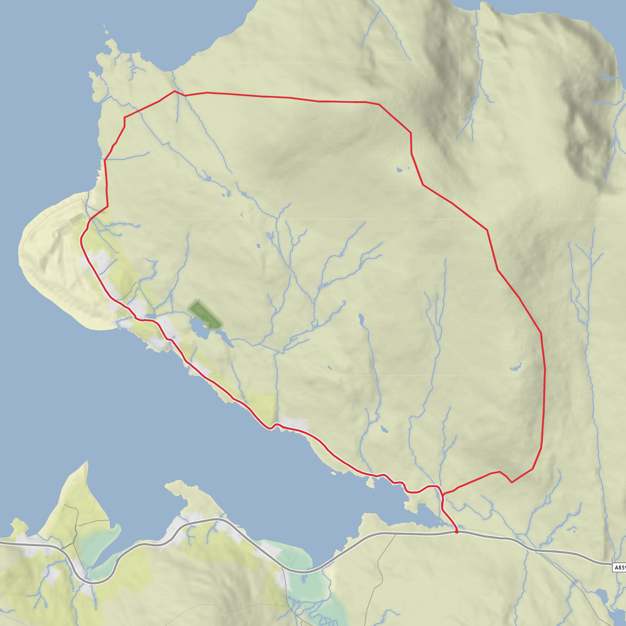
This 12 km (7.5 mile) loop on the west side of Harris combines a steady hill walk with one of the most striking beach returns in the Outer Hebrides. Expect around 600 metres (about 1,970 feet) of ascent, a mix of pathless moorland and ridge walking, and long stretches where the landscape feels open, exposed, and wonderfully remote. Although the overall difficulty is best described as medium, it can feel harder in poor weather because much of the route is off-path, the descent can be rough underfoot, and visibility matters on the broad upper ground. Sources describing closely matching versions of the route give distances of roughly 11.7 to 13 km and ascent around 500 to 570 metres, which fits well with your estimate. (outdooractive.com)
The walk begins near the Losgaintir/Luskentyre area on Harris, with the most practical trailhead being the small parking area at the end of the minor road by Traigh Rosamol and Losgaintir Cemetery, just off the A859 west of Tarbert. One mapped start point for this circuit is around 57.871039, -6.905364, which corresponds to the Losgaintir beach and cemetery parking area near Traigh Rosamol; another commonly used start is the car park on the same minor road about 1 mile southeast of Luskentyre. (outdooractive.com)
From the start, the route usually heads inland and uphill first, climbing onto the ridge by way of Sròn Godamuil before continuing over Mullach Buidhe to Beinn Losgaintir and then Beinn Dhubh. Walkhighlands notes that the ridge gives easy walking in places once gained, with expansive views over West Loch Tarbert and the Luskentyre sands, while other route descriptions emphasize that there is little or no constructed path for much of the day. (walkhighlands.co.uk)
Terrain and what to expect
The first half of the day is the more physical part. The climb is sustained rather than technical, but the ground can vary from short grass and rock slabs to boggier patches and rough heather. The ascent to the ridge is where most of the effort is concentrated, and it is worth pacing it carefully, especially if the ground is wet or there is a strong Atlantic wind. One route description specifically warns of steep ascent and descent, with pathless terrain throughout apart from the road section. (sobt.co.uk)
Once on the higher ground, the walking becomes more spacious and panoramic. Beinn Losgaintir is the first major high point, marked by a cairn, and the ridge onward to Beinn Dhubh is broad and obvious in clear conditions. Beinn Dhubh itself has a trig point set into a large cairn or windshelter, and this is the best point for the full sweep of west Harris: Luskentyre and Traigh Rosamol below, Taransay offshore, and the mountains of North Harris beyond. (walkhighlands.co.uk)
The descent is often the section hikers underestimate. Rather than a neat engineered trail, it is more of a long drop through heather, rock, and occasional boggy ground toward the coast. Outdooractive’s route description notes that the descent is pathless and can be a tiring tramp before the ground eases near the shore. That means good footwear, dry socks packed in reserve, and careful line choice matter more here than the raw distance suggests. (outdooractive.com)
Landmarks, scenery, and wildlife
The defining landmark of the route is the contrast between dark, rounded hills and the luminous coast below. Traigh Losgaintir, better known in English as Luskentyre Beach, is one of the signature landscapes of the Outer Hebrides, and the return by Traigh Rosamol gives a lower-level perspective after the hill section. The beach and bay are known for broad sands, dunes, shifting sandbars at low tide, and views across the Sound of Taransay. (visitscotland.com)
On the hill section, look for wide
Surfaces
Unknown
Asphalt
Comments and Reviews
User comments, reviews and discussions about the Frith Losgaintir, Beinn Dhubh and Traigh Losgaintir Loop, Scotland.
average rating out of 5
0 rating(s)


