Download
3D Flyover
Add to list
More
8.4 km
~2 hrs 6 min
252 m
Out and Back
“A vivid climb from flower-speckled machair to sweeping island views, with a surprisingly rugged feel.”
This is a short but memorable hill walk on South Harris, climbing Ceapabhal above the machair near Northton for wide views over beaches, tidal flats, and the island-studded Sound of Harris. Although the round trip is only about 8 km / 5 miles, the ascent of roughly 300 m / 985 ft gives it a much bigger feel than the distance suggests. The route is generally considered medium, but that rating depends heavily on weather and footing: the lower ground can be wet and uneven across the machair, while the upper slopes are steep enough to feel strenuous on the way up and awkward on the descent. (outdooractive.com)
The walk begins near the road end at Taobh Tuath, Northton, on the Isle of Harris, with the nearest practical landmark being the road end and parking area by the gate onto the machair, close to Northton beach and the former MacGillivray Centre building. A useful nearby reference point for drivers is Northton, Isle of Harris, HS3 3JA, which is commonly used for the beach and access area. Parking is limited and roadside rather than a formal large trailhead, so it is best to arrive early in busy periods and avoid blocking passing places or gates. (walkhighlands.co.uk)
By car, most visitors reach the start from Leverburgh via the A859, then turn toward Northton and continue to Taobh Tuath at the road end. If arriving from farther afield, Harris is typically reached by ferry to Tarbert or Leverburgh depending on your wider itinerary, then continued by road. Public transport on Harris is possible but requires planning: island bus services connect settlements across the Outer Hebrides, and Tarbert is the main transport hub on Harris, but service frequency can be limited, so check current island bus timetables before setting out and be prepared for a road walk or taxi for the final approach if no direct service matches your schedule. (visitscotland.com)
What the route is like
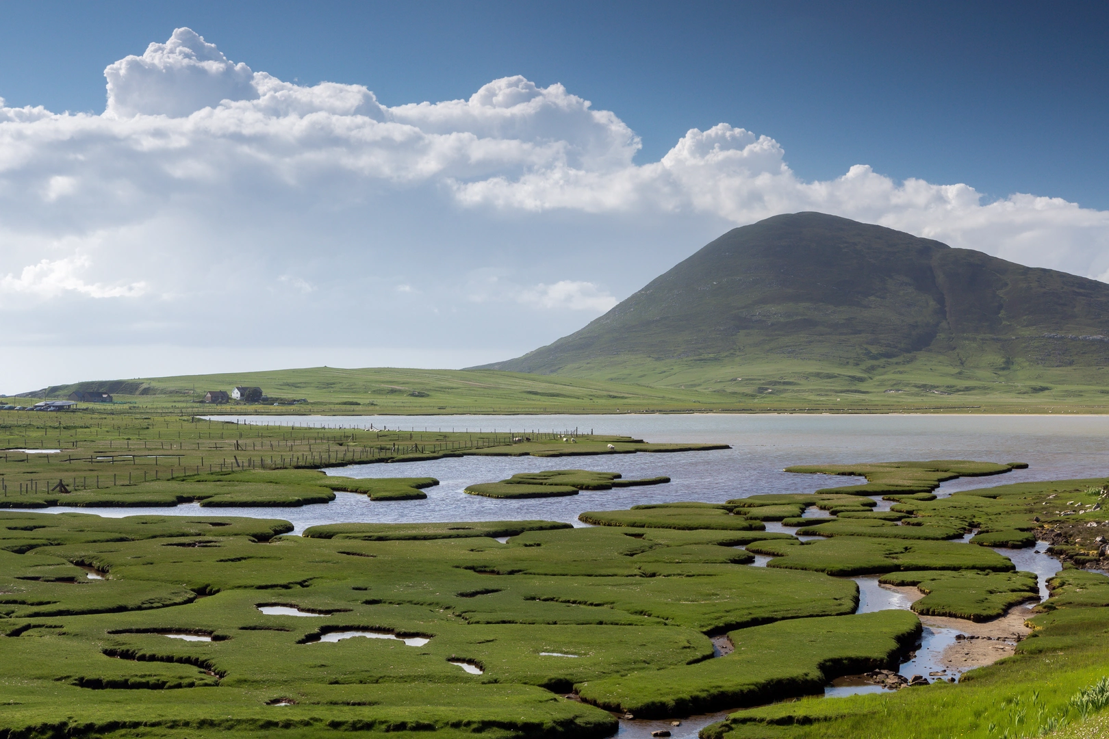
From the road end, the first section crosses open machair rather than immediately attacking the hill. This gives the walk an unusual character: instead of starting in woodland or on a built mountain path, you begin on low, coastal grassland shaped by shell sand, wind, grazing, and centuries of crofting. In dry weather this opening stretch feels easy and airy; after rain it can be soft underfoot, with damp patches and rough ground slowing progress. The gradient is gentle at first, and for roughly the first 1.5 to 2 km / 1 to 1.25 miles you are gaining only a little height while moving toward the base of the hill. (outdooractive.com)
The climb steepens decisively once you leave the flatter ground and begin ascending Ceapabhal itself. This is the part that earns the route its medium rating. The hill rises abruptly from the surrounding machair, and NatureScot describes Ceapabhal’s bare, steep sides dropping to the flat coastal plain below. Expect a sustained uphill pull over grassy and rocky terrain, with the steepest section concentrated into a relatively short distance. Trekking poles can help on both ascent and descent, especially if the grass is slick. (nature.scot)
As height is gained, the views open quickly. Looking outward, the reward is far larger than the modest summit height suggests: Scarista and Northton’s beaches, the tidal inlets and sands below, and the scattered islands of the Sound of Harris become the dominant features. On a clear day, this is very much a viewpoint walk, and that is the main reason many hikers choose it. If cloud is low, however, the route can feel more serious because the visual payoff disappears and the upper hill can become a navigation exercise. For route-finding, HiiKER is the best tool to have ready before setting out. (walkhighlands.co.uk)
The return is by the same line. Because it is an out-and-back, the descent deserves as much attention as the climb. The steep upper section can be slippery, and tired legs often make the final drop back across the machair feel longer than expected. Allow extra time if walking with children, in wet conditions, or if you plan to stop often for photography and wildlife watching.
Landmarks, scenery, and natural interest
One of the most distinctive features of this walk is the contrast between landforms. The route links a low-lying machair landscape with a sharply rising hill, creating a strong sense of moving from coast to summit in a short space. The machair itself is one of the defining habitats of the Outer Hebrides

Surfaces
Grass
Unknown
Comments and Reviews
User comments, reviews and discussions about the Cepabhal Out and Back, Scotland.
average rating out of 5
0 rating(s)