
Bhalasaigh, Poll Ila, Tob Bhalasaigh, Stiogha Chnap and Caolas Bearnaraigh Beag Loop
Download
3D Flyover
Add to list
More
22.5 km
~4 hrs 58 min
279 m
Out and Back
“A wind-brushed Bernera circuit weaves lagoons, moorland and wild coast into a quietly demanding island day.”
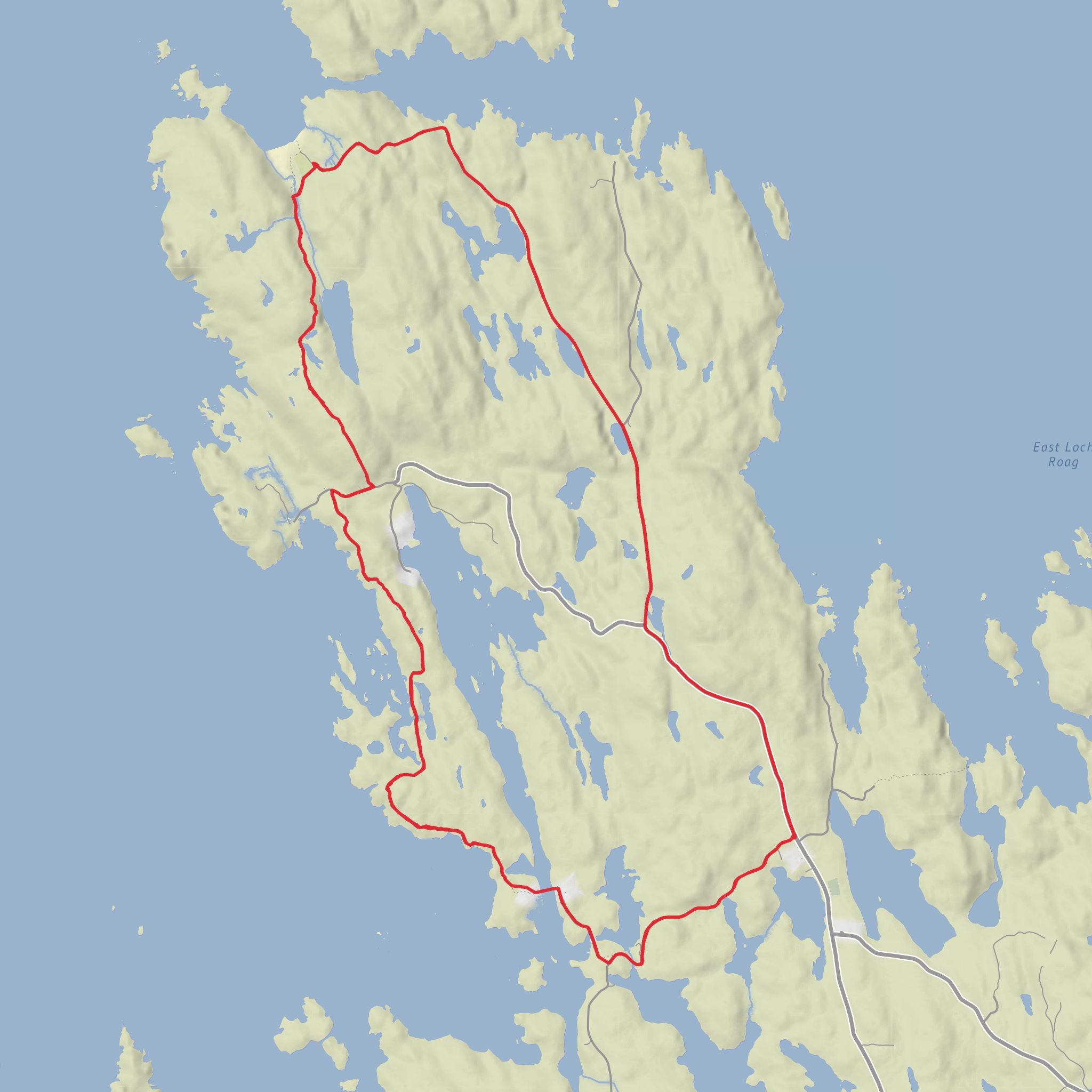
This 22 km / 13.7 mile circuit on Great Bernera in the Outer Hebrides is a long but relatively gentle coastal-and-moorland outing, with around 300 m / 985 ft of ascent spread gradually through the day. Despite the modest elevation, it is not a quick walk: the combination of rough coastal ground, gates, wet sections, and exposed island terrain means it feels more committing than the “easy” label might suggest, especially in wind or rain. The route explores the Bhalasaigh side of the island, passes the lagoon at Tòb Bhalasaigh, then continues through open ground toward Tobson, Bostadh, and the road back toward Breacleit. (visitouterhebrides.co.uk)
The nearest practical start point is Breacleit Community Centre, Great Bernera, Isle of Lewis, HS2 9LT, which serves as the usual trailhead area for walks on this side of the island. Great Bernera is linked to Lewis by Bernera Bridge, so the walk begins near a real settlement rather than a remote roadside lay-by. The official walking leaflet describes the route from the community centre, following the Tacleit road for about 1.25 km / 0.75 mile before turning toward Bhalasaigh. (visitouterhebrides.co.uk)
By car, the approach is straightforward once you are on Lewis: drive west from Stornoway toward Great Bernera, cross Bernera Bridge, and continue to Breacleit. Parking is typically associated with the community-centre area and nearby village roads, but because this is a small island community, it is best to park considerately and avoid blocking access for residents, croft traffic, or service vehicles. Great Bernera’s visitor information notes that having your own transport makes getting around much easier. (greatbernera.org)
Public transport is possible, though it requires more planning. Outer Hebrides visitor guidance notes that bus travel can connect onward from ferry and air arrivals, and the local Great Bernera guidance says there is no internal bus service on the island, so once you arrive you should expect to walk or arrange onward transport. The official walking leaflet also notes that a local bus can call at Bostadh twice daily on request in summer months, which can be useful for shortening the day if needed; bus details should be checked in advance with Stornoway Bus Station or current Comhairle nan Eilean Siar timetables. (visitouterhebrides.co.uk)
Terrain and what the day feels like
The opening section is easy to follow on minor road and then over the footbridge at Tòb Bhalasaigh, but once beyond the cottages the walk becomes more varied. The official route description sends walkers through gates and onto the west coast of the island, following waymarkers over rougher ground before rejoining an old track toward Tobson. Expect a mix of tarmac, grassy trods, uneven coastal turf, boggier patches, and occasional stony sections rather than a continuously engineered path. (visitouterhebrides.co.uk)
Because the island is low-lying and open, weather is often the main difficulty. Even with only about 300 m / 985 ft of climbing, strong Atlantic winds can make progress slower and more tiring than the numbers suggest. Waterproof layers, spare insulation, and footwear that can cope with wet ground are sensible year-round. If you are using a navigation app, plan the route in HiiKER before setting out, as waymarking helps but should not be your only means of navigation in mist, heavy rain, or fading light.
The coastal sections deserve particular care. The official leaflet specifically warns walkers to avoid the geos and sea caves on the west coast because they are inaccessible from land. In practical terms, that means keeping well back from cliff edges, undercut ground, and steep breaks in the coastline, especially in wet or windy conditions. (visitouterhebrides.co.uk)
Landmarks, scenery, and wildlife
One of the standout natural features is **Tòb B
AI Planner
Days planned around your pace, with somewhere to stay each night.
Surfaces
Unknown
Asphalt
Grass
Ground
Wood
Comments and Reviews
User comments, reviews and discussions about the Bhalasaigh, Poll Ila, Tob Bhalasaigh, Stiogha Chnap and Caolas Bearnaraigh Beag Loop, Scotland.
average rating out of 5
0 rating(s)



