
Download
3D Flyover
Add to list
More
9.8 km
~2 hrs 40 min
425 m
Loop
“A breezy Pentlands loop of rolling tops, moorland colour, and city-to-wild contrasts.”
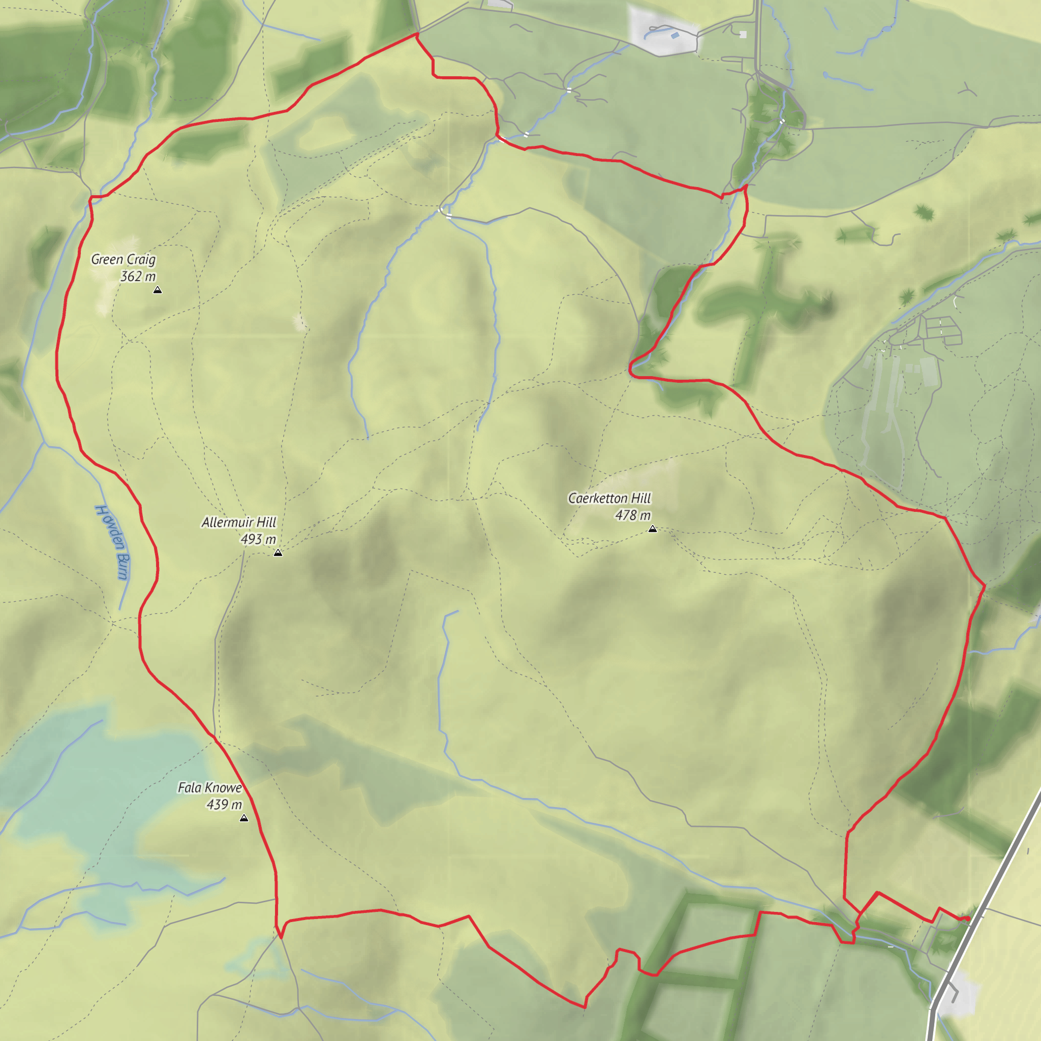
This 10 km (6.2 mile) loop in the Pentland Hills packs a lot into a relatively compact outing: open hill ground, broad views over the southern edge of Edinburgh, a mix of grassy tracks and rougher upland paths, and a sequence of rounded summits that make the route feel more adventurous than the mileage suggests. With around 400 m (about 1,312 ft) of ascent and an estimated medium difficulty, it suits walkers who are comfortable with steady climbing, occasional exposed ground, and changeable hill weather. The route sits in the eastern Pentlands around Woodhouselee Hill, Fala Knowe, Hillend Hill and Boghall, close to the Hillend and Boghall access points on the edge of the regional park. (pentlandhills.org)
The most practical starting point is near Boghall car park, EH10 7DX, or the nearby Hillend Upper car park, EH10 7DU, both on the southeastern side of the Pentland Hills Regional Park near the Hillend ski slope area south of Edinburgh. These are the nearest clearly identified access points for this part of the hills and are the best-known landmarks for locating the start. If arriving by public transport, the regional park advises using Houstons 101 or 102 for Hillend, or Lothian buses 4 or 15 for Hillend access; these services make this side of the Pentlands one of the easier hill access points to reach from Edinburgh without a car. By car, both Boghall and Hillend Upper are official access points, though parking can be busy in good weather. (pentlandhills.org)
The walking begins gently enough on estate tracks and hill paths, but the route soon starts to earn its elevation. Expect the first climbs to come in short, definite pulls rather than one long continuous ascent. Woodhouselee Hill and the ground around Fala Knowe introduce the character of the day: open, grassy upland terrain with occasional wetter patches underfoot, especially after rain. Even on a moderate route, the Pentlands can feel quite exposed because the hills are broad-backed and treeless in many places, so wind can be a bigger factor than the map suggests. The paths are generally clear in the main access corridors, but junctions and trods across open ground can be less obvious in mist, so carrying the route in HiiKER is a sensible way to stay on line.
Terrain and route character
The loop’s 400 m (1,312 ft) of ascent is spread across several hills rather than concentrated in a single summit push, which gives the walk a rolling rhythm. Fala Knowe and Hillend Hill are not dramatic mountain tops, but they offer the kind of elevated shoulders and ridgelines that make the eastern Pentlands rewarding: wide views, a sense of space, and a constant awareness of the city giving way to moorland. On clearer days, the northern outlook opens toward Edinburgh, while the interior of the Pentlands shows off a patchwork of reservoirs, burns, plantations, and rounded summits. The regional park map places Boghall Burn, Woodhouselee Hill, Hillend, and nearby high ground all within this compact eastern sector. (pentlandhills.org)
Underfoot, hikers should be ready for a mixture of firm land-rover track, grassy hill path, and potentially muddy or peaty sections. This matters most on connecting stretches between the better-used access paths and the more open hillside. Good waterproof footwear is usually the safer choice here year-round. In poor visibility, the broadness of the terrain can make direction feel less intuitive than on a narrow ridge, so this is a route where navigation matters even though the distance is only around 10 km (6.2 miles).
Landmarks, views, and what to notice
One of the most distinctive nearby landmarks is Hillend Ski Centre, marked on the Pentland Hills visitor map as “Hillend Ski Lift,” a reminder that this edge of the range has long been a gateway between city and hills. The route also passes through or near Boghall and Boghall Plantation, where the contrast between open moor and enclosed woodland gives the walk some variety. Plantation sections can offer shelter from wind, while the open tops provide the best panoramas. (pentlandhills.org)
The eastern Pentlands are especially good for noticing how quickly the landscape changes over short distances. Burns cut through the lower ground, rough grazing land gives way to managed woodland, and the skyline alternates between rounded summits and shallow saddles. This is not a route of crags and scrambling; its appeal is in the sweep of the land and the layered views. In spring and summer, expect moorland grasses, heather patches, and gorse in places, while autumn often brings richer colour around the plantation edges and lower slopes.
Wildlife is typical of Pentland upland and fringe habitats. Walkers may see or hear skylarks
Surfaces
Unknown
Gravel
Grass
Unpaved
Dirt
Comments and Reviews
User comments, reviews and discussions about the Woodhouselee Hill, Fala Knowe, Hillend Hill and Boghall Plantation Loop, Scotland.
average rating out of 5
0 rating(s)

