
Download
3D Flyover
Add to list
More
5.0 km
~1 hrs 28 min
280 m
Loop
“A punchy Pentlands loop trading muddy lower slopes for wind-whipped ridges, ancient traces, and city-wide views.”
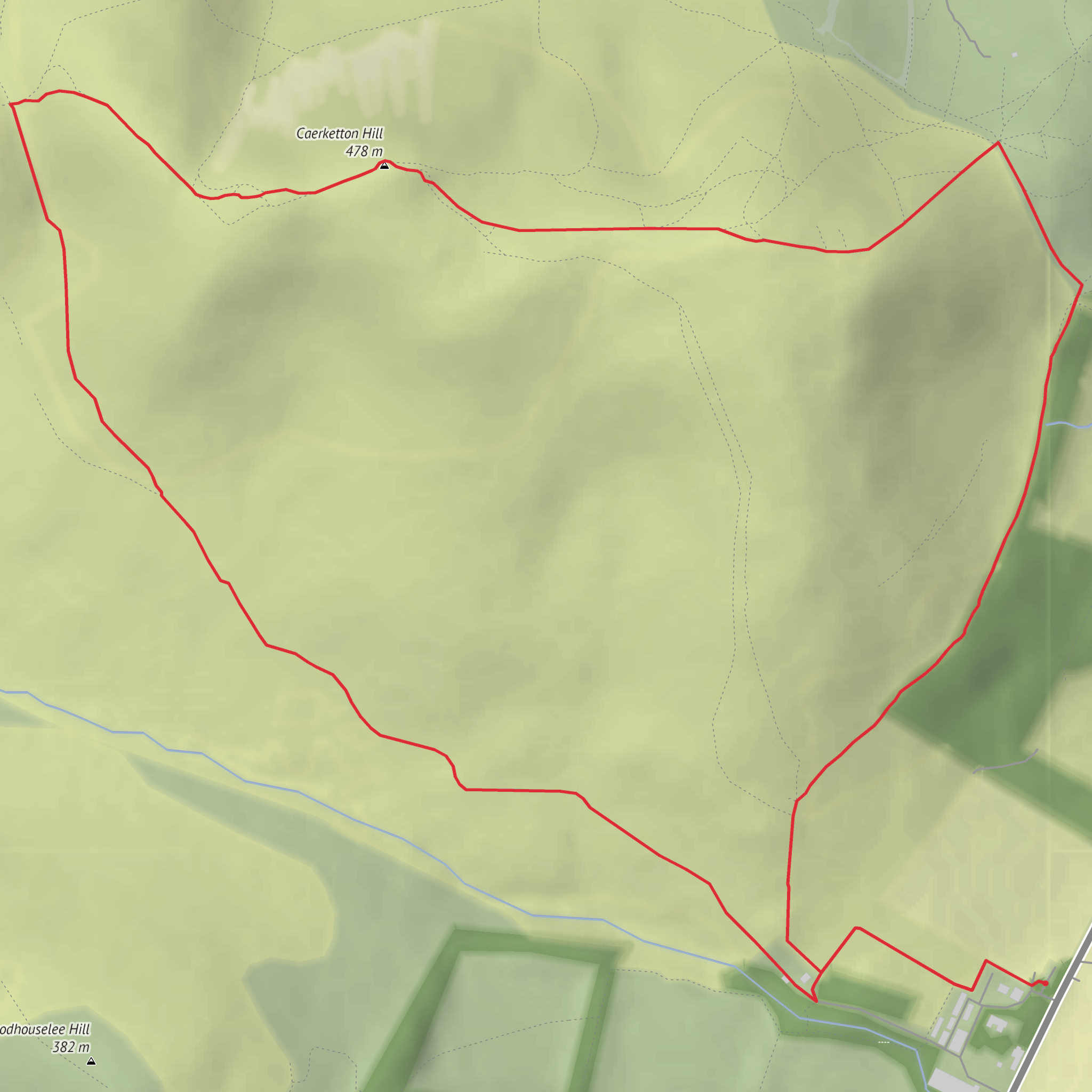
This medium-grade loop in the northeastern Pentland Hills packs a lot into roughly 5 km / 3.1 miles, with about 300 m / 985 ft of ascent. Expect a short but fairly energetic outing: the climbing is concentrated, the ground can be wet and slippery in places, and the exposed ridge around Windy Door Nick can feel much harsher than the distance suggests. The route is best thought of as a compact hill walk with a mix of plantation edge, open hillside, and broad summit views rather than a gentle woodland circuit. Caerketton Hill itself rises to about 478 m / 1,568 ft and sits at the northeastern end of the Pentland chain, just beyond Edinburgh’s southern edge. (en.wikipedia.org)
The usual access point for this loop is near Boghall car park, Boghall Farm House, EH10 7DX, a well-known Pentland Hills access point on the south side of the range. If you are arriving by car, this is the most practical landmark to use for navigation. If coming by public transport, Pentland Hills guidance lists Hillend as a bus-served access area, with services including the 101, 102, Lothian 4, and 15, after which you connect on foot toward the hill paths. Because local access arrangements and bus timetables can change, it is worth checking current services before setting out. (pentlandhills.org)
The walk begins on lower ground near Boghall, where the landscape feels greener and more enclosed before the route starts to climb. Early sections can be muddy, especially after rain, and the paths may be softened by runoff from the surrounding slopes. As height is gained, the route trends toward Windy Door Nick, the gap on the ridge between Caerketton Hill and neighboring high ground. This is one of the key character points of the walk: a natural saddle where the terrain opens abruptly and the wind often funnels through with real force. Even on a calm day in Edinburgh, this notch can feel exposed, so an extra layer is often useful. A path from Boghall Glen is known to rise directly toward this ridge gap. (geograph.org.uk)
What the climb feels like
For a route of only around 5 km / 3.1 miles, the ascent is noticeable. The climb to the ridge is the main effort, and hikers should expect some steep walking on grassy, sometimes slick ground. In poor weather, the combination of wet turf, mud, and wind can make the route feel more demanding than its “medium” rating suggests. Good grip matters more here than technical skill. If visibility drops, the open hillside can also feel less obvious underfoot, so carrying and checking the route on HiiKER is sensible.
Once on or near the ridge, the reward is immediate. Caerketton Hill is one of the Pentlands’ most accessible viewpoints, with wide outlooks over Edinburgh, the Firth of Forth, and, in clearer conditions, hills farther north. The hill stands close enough to the city that the contrast is part of the appeal: within a short time, the route shifts from suburban fringe to open upland scenery. (scotland.org.uk)
Landmarks, nature, and terrain
Caerketton Hill is notable not just for views but for its physical setting. The Pentland Hills are described by the British Geological Survey as an ancient volcanic landscape later shaped by glacial action, and that helps explain the rounded yet rugged feel of the ground. The soils and exposure support typical upland vegetation, with rough grasses, heath, and patches of more acidic ground across the wider hills. Around the plantation and burn lines, conditions are often damper and more sheltered, while the upper slopes are more open and wind-scoured. (bgs.ac.uk)
Boghall Plantation adds a different texture to the loop, giving a brief sense of enclosure and contrast against the open hill. Depending on season, hikers may see common upland birdlife such as skylarks, meadow pipits, and raptors using the rising air over the slopes; quieter sections near woodland edges and burns can also hold smaller songbirds. As with many Pentland routes, sheep may be present, and dogs should be managed carefully around livestock.
The route also passes through a landscape shaped by water. The northern slopes of Caerketton feed burns that ultimately drain toward the Firth of Forth, while the southern slopes feed the Boghall Burn system. After prolonged rain, this can translate into soggy path sections and soft ground lower down. (en.wikipedia.org)
Historical significance
This is a small walk in a landscape with a long human story. On the crest of Caerketton Hill are the remains of a cairn, now reduced but still recognized as a protected monument. On the eastern flank, there are also remains of a hill fort in a naturally defensive position, likewise scheduled as an ancient
Surfaces
Unknown
Grass
Ground
Unpaved
Comments and Reviews
User comments, reviews and discussions about the Windy Door Nick, Caerketton Hill and Boghall Plantation Loop, Scotland.
average rating out of 5
0 rating(s)


