
Glencorse Reservoir, Loganlea Reservoir, Redford Bridge, Threipmuir Reservoir and Harlaw Reservoir Loop
Download
3D Flyover
Add to list
More
18.7 km
~4 hrs 7 min
228 m
Loop
“A gentle Pentlands circuit threads shimmering reservoirs, marshy margins and open moorland in a long, quietly rewarding day.”
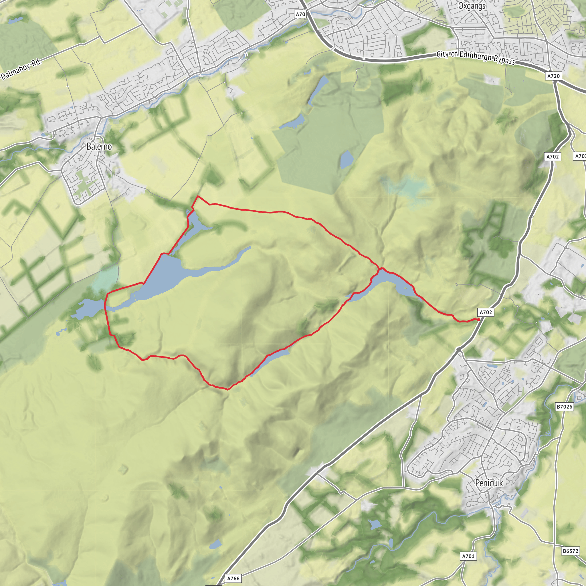
This easy-going reservoir circuit explores one of the most accessible parts of the Pentland Hills Regional Park, linking Glencorse, Loganlea, Threipmuir and Harlaw with Redford Bridge and broad views across open moorland, marsh and managed water. At around 19 km / 11.8 miles with roughly 200 m / 656 ft of ascent, it is a longer outing rather than a strenuous one, best suited to walkers who are comfortable being on the move for much of the day. The gradients are generally gentle, with most of the elevation gain coming in small rises and undulations rather than any sustained climb. The route is usually classed as easy because the terrain is mostly estate tracks, reservoir-side paths, tarmac access roads and well-used hill paths, though sections can feel more exposed in wind and rain. Information on the route line and junctions is best checked in HiiKER before setting out. (pentlandhills.org)
The walk is in the Pentland Hills, southwest of Edinburgh, and the most practical trailhead for this loop is the Threipmuir Reservoir car park, EH14 7JT, a signed access point within the regional park. That is the clearest nearby address or landmark for the start area. Harlaw Reservoir is another well-known access point nearby, but Threipmuir car park is specifically listed by the park as an access location and works well for a loop linking all five named features. (pentlandhills.org)
By car, approach via Balerno/Currie on the western side of Edinburgh and follow signs for Harlaw or Threipmuir in the Pentland Hills Regional Park. Parking demand can be high on fine weekends and holidays, so an early start is wise. The park also notes ongoing capacity issues and encourages visitors to consider public transport, cycling or walking where possible. (pentlandhills.org)
By public transport, the usual approach is to travel to Balerno or Currie by bus from Edinburgh, then continue on foot to the reservoir access roads. From Balerno, walkers can reach Harlaw Road and continue for about 1 mile / 1.6 km to the Harlaw side of the park before linking to Threipmuir. This adds a little distance compared with driving, but it is a workable option for a car-free day. (visitwestlothian.co.uk)
What the route feels like
From the Threipmuir side, the opening stretch is usually calm and straightforward, with wide paths and water close at hand. Threipmuir Reservoir sits on the northwestern side of the regional park, and the route around here feels open rather than rugged, with low hills rising beyond the shoreline. Harlaw lies nearby at a slightly lower level, connected hydrologically to Threipmuir, and the paths between the two are among the most approachable in the Pentlands. (pentlandhills.org)
As the loop continues south and east toward Loganlea and Glencorse, the landscape becomes a little wilder in character. Loganlea sits farther up the glen beyond Glencorse, and the road and track through this section follow the line of the burn and reservoir margins. This part of the walk often feels more enclosed by the surrounding slopes, with a stronger sense of being in the hills even though the route remains relatively undemanding underfoot. (pentlandhills.org)
Redford Bridge is one of the route’s notable waypoints, sitting between Bavelaw Marsh to the west and Threipmuir Reservoir to the east. It acts as a natural transition point between the marshy interior of the park and the more open reservoir tracks. In wet weather, the ground around marsh and burn-fed sections can be softer, so waterproof footwear is useful even on an easy-rated day. (komoot.com)
Landmarks, wildlife and seasonal interest
The reservoirs are the defining landmarks, but the variety between them is what makes the loop interesting. Harlaw and Threipmuir have a gentler, lower-level feel, while Loganlea and Glencorse sit deeper into the folds of the Pentlands. Expect long waterside stretches, embankments, feeder burns, marshy edges and repeated views to rounded hills beyond. On clearer days, the contrast between still water and broad grassy slopes is one of the main rewards of the route. (en.wikipedia.org)
Wildlife is typical of reservoir and moorland-edge habitat. Waterfowl are common
AI Planner
Days planned around your pace, with somewhere to stay each night.
Surfaces
Asphalt
Unknown
Unpaved
Gravel
Dirt
Grass
Wood
Comments and Reviews
User comments, reviews and discussions about the Glencorse Reservoir, Loganlea Reservoir, Redford Bridge, Threipmuir Reservoir and Harlaw Reservoir Loop, Scotland.
5.0
average rating out of 5
1 rating(s)



