
Download
3D Flyover
Add to list
More
8.9 km
~2 hrs 16 min
299 m
Loop
“Reservoir calm gives way to breezy heights and ancient echoes on this richly varied Pentland loop.”
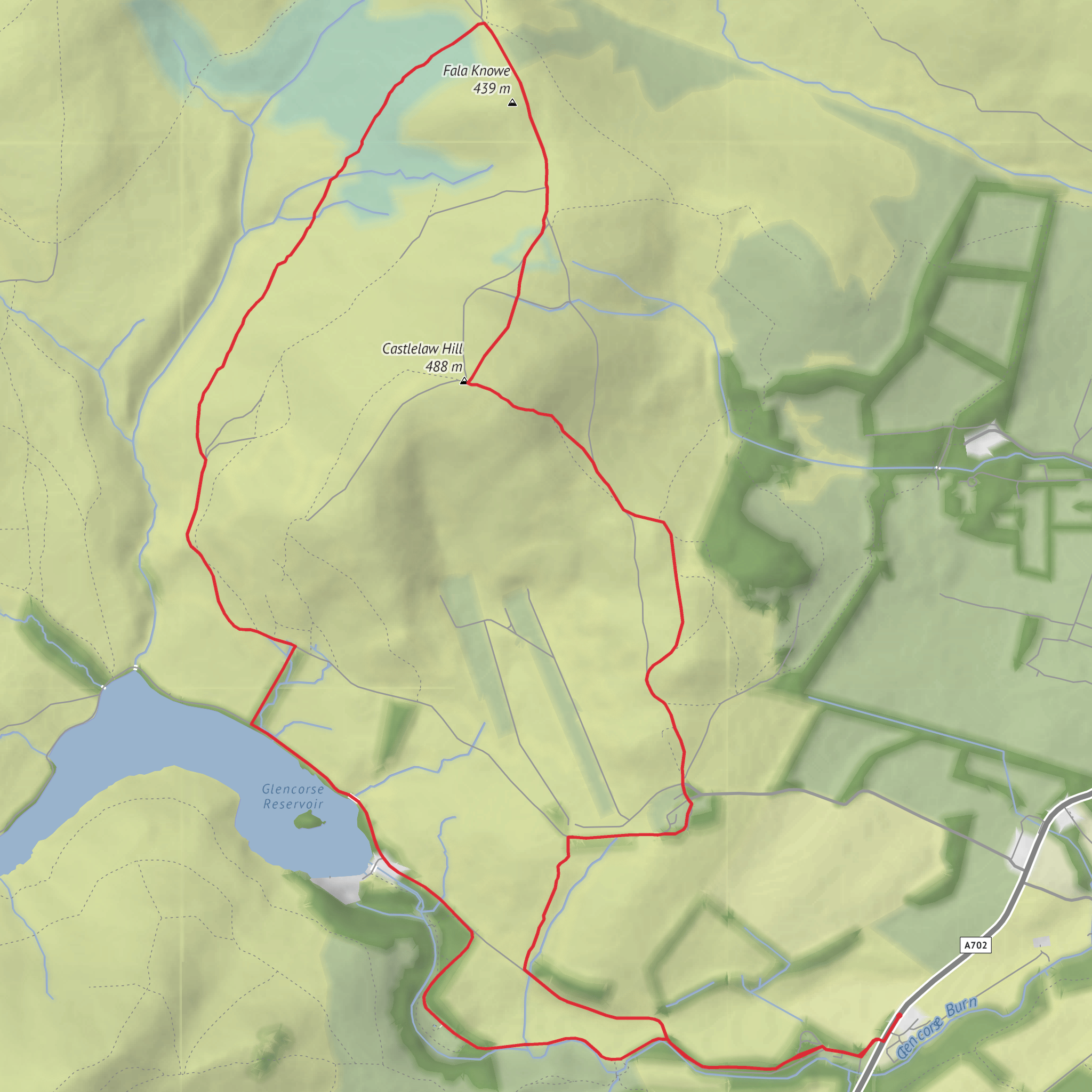
This medium-difficulty loop in the Pentland Hills packs a lot into roughly 9 km / 5.6 miles, with about 300 m / 985 ft of ascent. It combines easy reservoir-side walking, a steady hill climb, broad upland views, and one of the area’s most interesting historic sites near Castlelaw Hill. The route is generally well suited to hikers who are comfortable with uneven hill paths and a few steeper sections, but it is still short enough to fit into a half day if weather and visibility are on your side. The usual access point is around Flotterstone Information Centre / Flotterstone car park, near Flotterstone Inn, Penicuik, Midlothian, on the southern side of Edinburgh in the Pentland Hills Regional Park. (pentlandhills.org)
Getting there is straightforward by both car and public transport. By car, Flotterstone car park is one of the main signed access points for the Pentland Hills Regional Park, though the park notes that capacity can be limited at busy times. If you are aiming closer to the historic site, Castlelaw Hill Fort car park on Castle Knowe is another recognized access point, with the fort about 0.2 miles / 0.3 km away. By public transport, the 101 bus between Edinburgh and Biggar has been noted as stopping at Flotterstone Inn, which gives practical access to this part of the hills; for current journey planning, the official visitor information points hikers to Traveline Scotland. (pentlandhills.org)
The opening section is usually the gentlest part of the day. From Flotterstone, the route heads through lower woodland and along the burn toward Glencorse Reservoir, following one of the established Pentland Hills waymarked walking corridors. This first stretch is a good warm-up, with compact paths, water nearby, and a gradual sense of the landscape opening out. Expect around 2 to 3 km / 1.2 to 1.9 miles of easier walking before the route begins to feel more exposed and hill-like. Around the reservoir, the terrain shifts from sheltered edges and estate-style tracks to more open moorland margins, with the long line of the water and surrounding slopes becoming the dominant feature. (pentlandhills.org)
Terrain and route character
Once beyond the reservoir-side section, the loop turns toward Fala Knowe and the higher ground around Castlelaw Hill, where the ascent becomes more noticeable. This is where most of the 300 m / 985 ft of climbing is earned. The paths here can be grassy, stony, or muddy depending on recent weather, and wind exposure often increases quickly once you leave the lower tracks. The climb is not especially long, but it is enough to raise the effort level into a solid medium outing, especially if the ground is wet or if low cloud sits on the tops.
Fala Knowe gives the walk a more upland feel than the reservoir start suggests. The surrounding Pentland ridges are rounded rather than jagged, but they can still feel wild in poor weather. Good waterproof layers and extra insulation are worth carrying even on a relatively short route, because conditions can change quickly on these open hills. Visibility matters here too: in clear weather, the route rewards you with wide views across the Pentlands and back toward Edinburgh; in mist, the same open ground can feel much less obvious, so having the route loaded in HiiKER is a sensible planning step. (cdn.ramblers.org.uk)
The descent and return leg usually pass near Castlelaw, where the landscape mixes natural hill scenery with traces of long human use. From here, the route trends back toward the start on easier gradients. Even though the final kilometres are less demanding than the climb, tired legs can still notice the uneven ground, especially after rain when grassy descents become slick.
Landmarks, wildlife, and what to look for
Glencorse Reservoir is the visual anchor early in the walk. The water, embankments, and surrounding slopes create one of the classic Pentland scenes, and the reservoir edge often attracts birdlife. Depending on season and conditions, hikers may spot common upland and waterside species such as gulls, ducks, geese, and small songbirds in the lower scrub and woodland margins. The Pentland Hills are also known for open moorland habitat, so keep an eye out for raptors overhead and for the usual mix of heather, rough grassland, and gorse on drier slopes. The lower sections can feel surprisingly green and sheltered, while the upper ground is more exposed and pastoral. (pentlandhills.org)
The standout historic landmark is Castlelaw Hill Fort, an Iron Age defensive site in the Pentlands just outside Edinburgh. Historic Environment Scotland highlights it as an impressive defended hilltop site, and the area is also known for its souterrain or earth house, an underground structure associated with later prehistoric settlement. These remains are a major
Surfaces
Unknown
Gravel
Asphalt
Ground
Grass
Dirt
Comments and Reviews
User comments, reviews and discussions about the Glencorse Reservoir, Fala Knowe and Castlelaw Hill Loop, Scotland.
average rating out of 5
0 rating(s)


