
Stob Dearg, Stob na Doire, Stob Coire Altruim and Stob na Broige Loop
Download
3D Flyover
Add to list
More
14.2 km
~4 hrs 38 min
1072 m
Loop
“A grand, punishing sweep over Buachaille Etive Mòr’s four tops, with glorious views and serious commitment.”
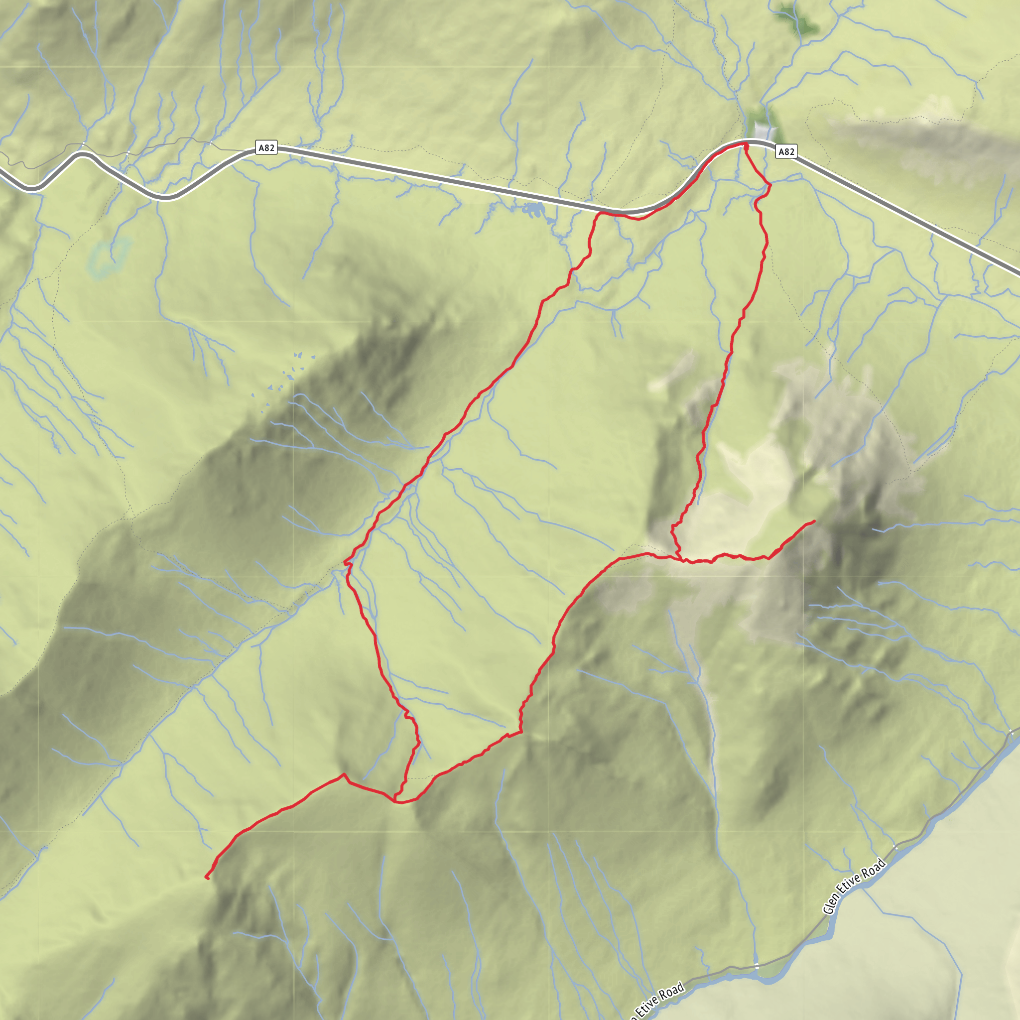
This is a big, serious round on Buachaille Etive Mòr in Glen Coe, taking in Stob Dearg, Stob na Doire, Stob Coire Altruim, and Stob na Bròige. Expect roughly 14 km / 8.7 miles with about 1,100 m / 3,610 ft of ascent, and a day that feels every bit as demanding as those numbers suggest. The usual start is the large layby at Altnafeadh on the A82 near Kingshouse, Ballachulish PH49 4HY, which is the recognised access point for the ridge. Walkhighlands gives the classic Buachaille Etive Mòr ridge outing from Altnafeadh as 13 km / 8 miles with 1,110 m of ascent, and this four-top variation fits that same scale. (walkhighlands.co.uk)
The route begins by crossing the footbridge over the River Coupall and heading into Coire na Tulaich, the broad corrie that splits the mountain’s famous front face. The first few kilometres are straightforward in navigation but not in effort: the path steepens quickly and climbs relentlessly on loose, eroded ground. In wet weather this section can be greasy, and in descent it is often more awkward than many expect. The climb to the bealach below Stob Dearg accounts for a large share of the day’s elevation gain, with around 900 m / 2,950 ft of climbing coming before the first summit is reached. (walkhighlands.co.uk)
From the bealach, the out-and-back to Stob Dearg is one of the visual highlights of the day. At 1,021.4 m / 3,351 ft, it is the highest point on Buachaille Etive Mòr and the summit most people associate with the mountain’s iconic pyramid seen from the A82. The ground here is rocky and often bouldery rather than technical in dry summer conditions, but mist changes the character of the ridge immediately, and strong winds can make progress feel exposed. Views, when clear, stretch over Rannoch Moor, the Black Mount, Glen Etive, and across to the dramatic peaks of Glen Coe. (en.wikipedia.org)
Along the ridge
After returning to the bealach, the route continues southwest over Stob na Doire at about 1,011 m / 3,317 ft. This top is often underestimated because it sits between the two Munros, but it is a substantial climb in its own right and can feel like a second mountain after the pull onto Stob Dearg. Walkhighlands notes that care is needed here in poor visibility, as some walkers are drawn onto the wrong line of descent to the southeast instead of following the ridge onward. (walkhighlands.co.uk)
Beyond that, the ridge narrows in character rather than becoming a true scramble. Stob Coire Altruim, around 941 m / 3,087 ft, is reached after another dip and rise, with steep crags dropping away on one side and a more broken, stony crest underfoot. The final summit, Stob na Bròige, stands at 956 m / 3,136 ft and looks directly down Glen Etive. It became a separate Munro in 1997, which is why modern ridge traverses usually include the full chain of tops rather than stopping earlier. (walkhighlands.co.uk)
This middle section is where the route earns its difficult rating. The ridge is long, undulating, and tiring, with repeated re-ascent that adds to the sense of effort beyond the headline distance. In dry, settled weather it is a magnificent mountain walk; in rain, clag, or high wind it becomes a committing outing where accurate line choice matters. For navigation, checking the route in HiiKER before setting out is worthwhile, especially for the descent line from near the bealach before Stob na Doire.
Surfaces
Unknown
Unpaved
Ground
Wood
Asphalt
Comments and Reviews
User comments, reviews and discussions about the Stob Dearg, Stob na Doire, Stob Coire Altruim and Stob na Broige Loop, Scotland.
5.0
average rating out of 5
1 rating(s)

