
Download
3D Flyover
Add to list
More
8.1 km
~2 hrs 52 min
760 m
Loop
“A fierce little ridge circuit above Loch Cluanie, where short mileage hides a big mountain feel.”
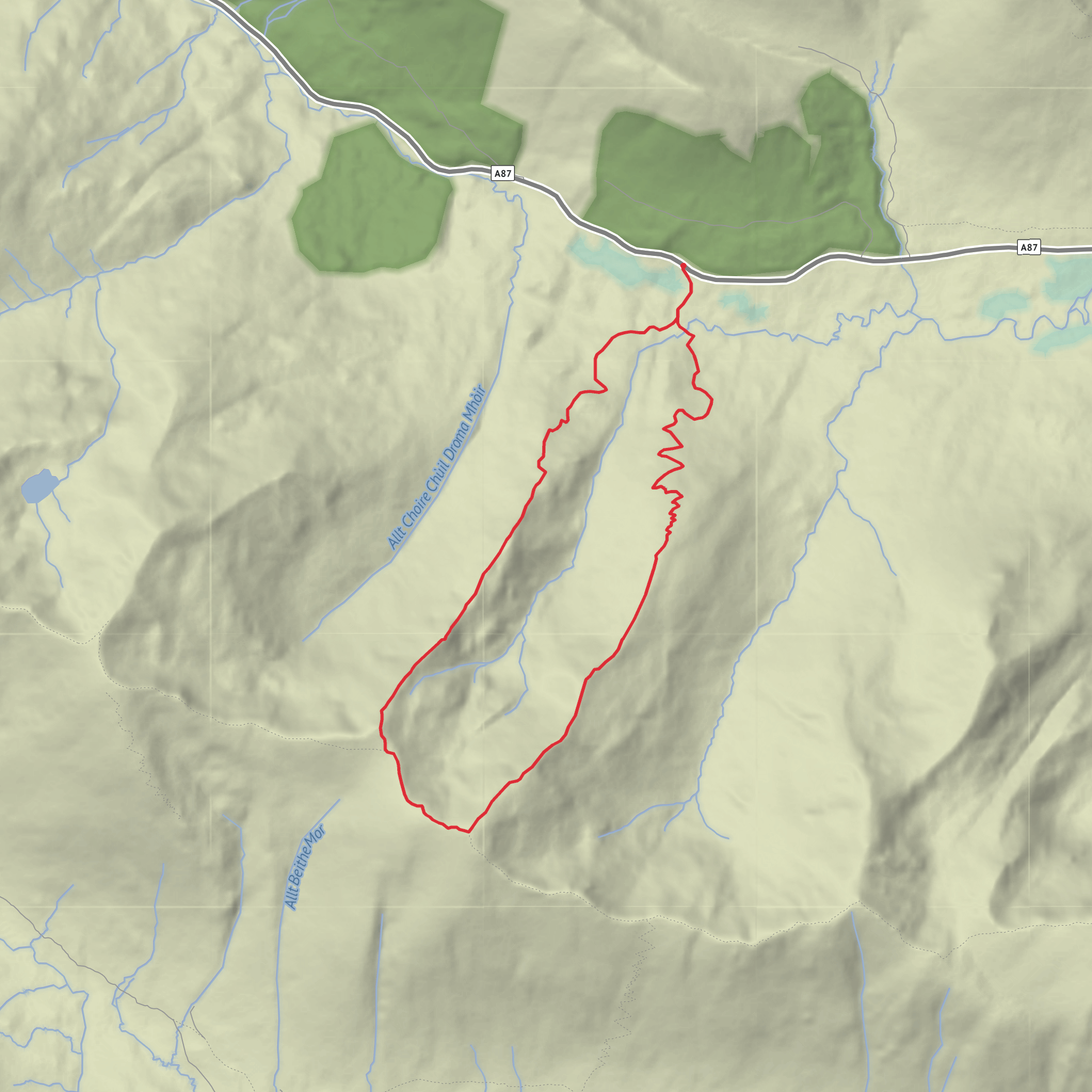
This is a short but serious mountain loop on the South Glen Shiel ridge, linking Sgùrr Coire na Feinne with Maol Chinn-dearg above the A87 near Cluanie. Although the distance is only about 8 km / 5 miles, the climb is steep and sustained, with roughly 800 m / 2,625 ft of ascent packed into a compact outing, so it feels much bigger than the mileage suggests. The usual line is to climb one ridge directly from the roadside, cross the high ground between the two tops, and descend the parallel ridge back to the glen, creating a neat circuit above Loch Cluanie and Glen Shiel. Maol Chinn-dearg stands at 981 m / 3,219 ft and Sgùrr Coire na Feinne is the adjoining top on the same ridge system. Walkhighlands notes that Maol Chinn-dearg can be climbed quickly from the A87 via the Druim Coire nan Eirecheanach ridge, with Druim Thollaidh providing a natural descent from Sgùrr Coire na Feinne. (walkhighlands.co.uk)
The start is best described as a roadside lay-by on the A87 near Cluanie Inn, Glenmoriston, IV63 7YW, which is the nearest widely recognised address and landmark for this route. The exact parking spot used for these ridge variations is typically one of the lay-bys on the A87 opposite the lower ends of the two ridges, rather than a formal signed trailhead. Expect limited roadside parking only, and take care crossing the road because traffic can be fast on this stretch. The Cluanie Inn sits on the A87 at the head of Loch Cluanie and is the clearest navigation reference for planning the approach. (booking.com)
If travelling by public transport, the most useful option is the long-distance bus service along the A87. Walkhighlands states that Citilink buses from Glasgow and Inverness can stop at Cluanie Inn on request, which makes this one of the more accessible high-level Kintail outings for hikers without a car. By car, approach on the A87 from Invergarry or from the west via Shiel Bridge and Glen Shiel, then use a safe lay-by near Cluanie rather than blocking estate access or passing places. (walkhighlands.co.uk)
What the route feels like
From the road, the day begins abruptly. There is very little gentle warm-up: the route gains height almost immediately on rough, steep hillside, usually picking up a stalkers’ path higher up. If climbed clockwise via Druim Coire nan Eirecheanach, the ascent is direct and efficient, with the ridge narrowing into a broad grassy crest as views open over Loch Cluanie, the North Glen Shiel peaks, and deeper into Kintail. If done the other way, Druim Thollaidh gives a similarly steep but often very logical line to Sgùrr Coire na Feinne. Either way, this is a route where strong legs and steady pacing matter more than distance alone. (walkhighlands.co.uk)
Once on the crest, the character changes from grind to ridge walking. The ground is generally grassy and stony rather than technical, but it is still mountain terrain with steep flanks and exposure to wind, mist, and sudden weather changes. The traverse between Sgùrr Coire na Feinne and Maol Chinn-dearg is short, undulating, and very scenic. In clear weather, the outlook stretches across Loch Cluanie, toward the Five Sisters and the wider Kintail mountains, and south toward more remote country around Loch Quoich. (walkhighlands.co.uk)
For an 8 km / 5 mile outing, a rough breakdown is: - around 2.5 to 3 km / 1.5 to 1.9 miles to
Surfaces
Unknown
Grass
Comments and Reviews
User comments, reviews and discussions about the Sgurr Coire na Feinne and Maol Chinn dearg Loop, Scotland.
average rating out of 5
0 rating(s)
