Download
3D Flyover
Add to list
More
4.6 km
~57 min
26 m
Loop
“Windswept ridges, ancient fort walls, and shifting sea light make this a vividly atmospheric island ramble.”
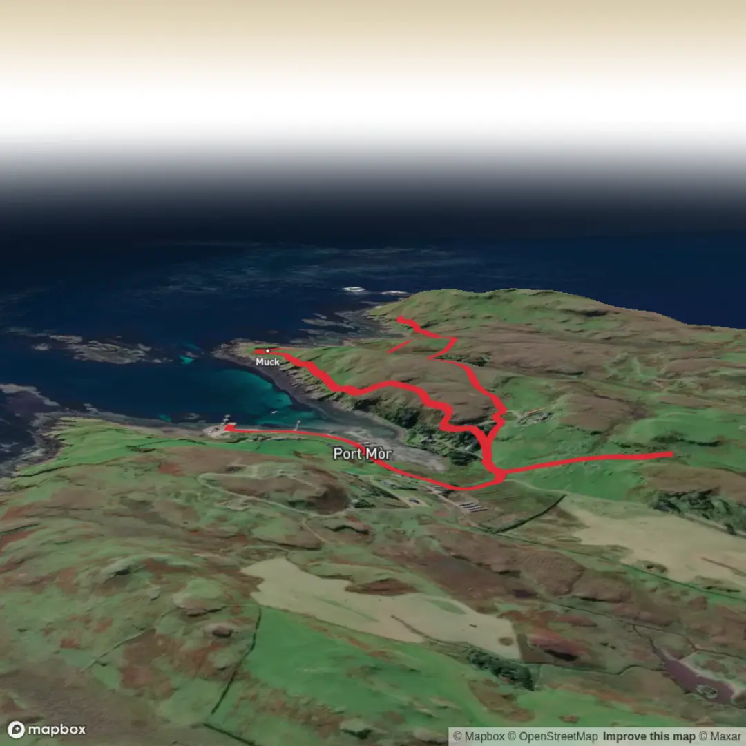
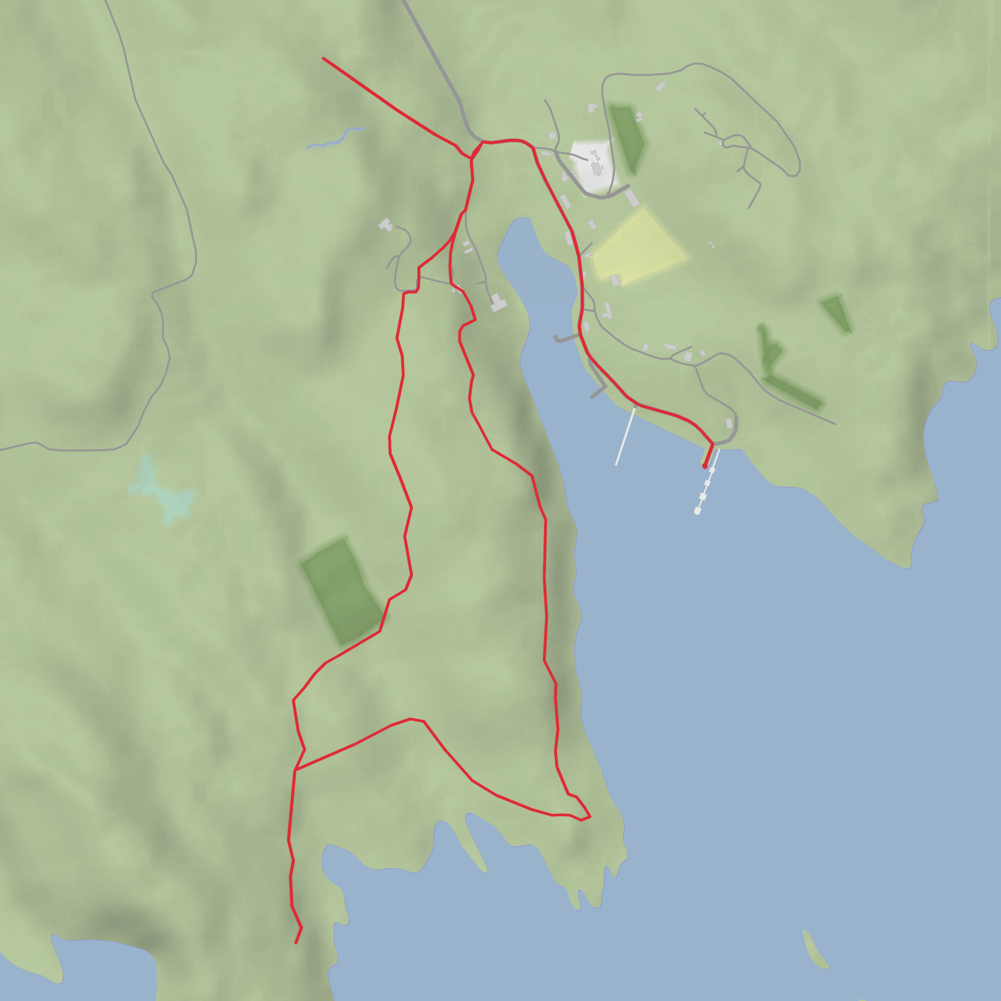
This easy coastal outing on the Isle of Muck is best understood as a short archaeological and scenery walk rather than a purely waymarked loop. The route is around 5 km / 3.1 miles overall with very little climbing—roughly 0 m / 0 ft to 34 m / 112 ft depending on the exact line you take from the ferry slip and around the headland. The walk begins at Port Mòr ferry jetty, Isle of Muck, Small Isles, Lochaber, Scotland, which is the island’s main arrival point and the nearest clear landmark for the trailhead. (walkhighlands.co.uk)
From Port Mòr, the walk heads through the island settlement on track and minor road before leaving the built area and crossing open grassy ground toward Caisteal an Duin Bhain, a fort site about 600 m south of Port Mòr. The terrain is gentle in gradient, but that does not always mean effortless: parts of the route are pathless or only lightly trodden, with uneven grass, sheep tracks, and rough coastal ground underfoot. Even on an easy-rated walk, that means sturdy footwear is a better choice than casual trainers, especially after rain. (walkhighlands.co.uk)
What to expect on the route
The first section is the simplest. Leaving the ferry slip, you follow the track past houses in Port Mòr, then continue by the old pier, local café area, and the road junction where the route turns inland briefly before climbing onto open ground. This opening stretch is useful for getting bearings before the route becomes less defined. If you are planning with a digital navigation aid, use HiiKER alongside an offline backup because the more open section beyond the settlement is where people are most likely to drift off line in poor visibility. The official walk description for the fort approach notes ridge walking above the sea with pathless going, which is the main planning point for this hike. (walkhighlands.co.uk)
Once you leave the track, the character changes quickly. The route follows an open grassy ridge with sea views and a noticeably wilder feel than the short distance from the village might suggest. Although the ascent is minimal, the ground can be lumpy and soft in places, and the coastal edge deserves respect, particularly in wind or if the grass is slick. This is the kind of short walk where weather matters more than mileage. On a calm, clear day it feels relaxed; in mist or strong Atlantic wind it can feel much more exposed. (walkhighlands.co.uk)
Fort, coastline, and historical interest
The standout landmark is Caisteal an Duin Bhain, a defensive site occupying the summit of a natural rock stack. Historic records describe a substantial enclosing wall built around the top, with the wall varying between about 2.2 m and 2.7 m thick and enclosing a roughly lozenge-shaped interior. The monument is listed as a Scheduled Monument of national importance, and the Highland Historic Environment Record classifies it broadly as a fort dating from the Early Iron Age to Pictish period, while also noting traces of later rectangular buildings within the enclosure that may be medieval or later. (her.highland.gov.uk)
That layered history is one of the most interesting parts of the walk. What hikers see is not just a single ruin, but a place reused over time: an older defended site adapted to the dramatic coastal rock, with later occupation traces inside and around it. Historic descriptions mention a natural stack rising above the surrounding ground, strengthened by a thick wall around the summit, plus additional later walls and building remains outside the main fort. For anyone interested in the long human story of the Hebrides, this is a compact but very evocative site. (her.highland.gov.uk)
The surrounding landscape adds to that sense of age. Muck is one of the Small Isles off Scotland’s west coast, and this stretch of coast feels exposed, elemental, and strategic—exactly the kind of place where a fortified lookout makes sense. Expect broad views over sea and shoreline, low grassy slopes, rocky outcrops, and a strong sense of openness rather than woodland or mountain scenery. (walkhighlands.co.uk)
Nature and wildlife
Because the route crosses open coastal grassland and shoreline habitat, hikers should watch for seabirds, grazing sheep, and changing marine light rather than forest wildlife or alpine species. The island setting means bird activity can be one of the highlights, especially around cliffs and shore. Conditions underfoot may also reflect the island environment: wet grass
Comments and Reviews
User comments, reviews and discussions about the Sean Bhaile, Casteal an Duin Bhain Fort and Dun Ban Loop, Scotland.
average rating out of 5
0 rating(s)
