
Download
3D Flyover
Add to list
More
3.4 km
~58 min
177 m
Loop
“A short, wild Highland climb above Slattadale delivers bog, breeze, and surprisingly grand Wester Ross views.”
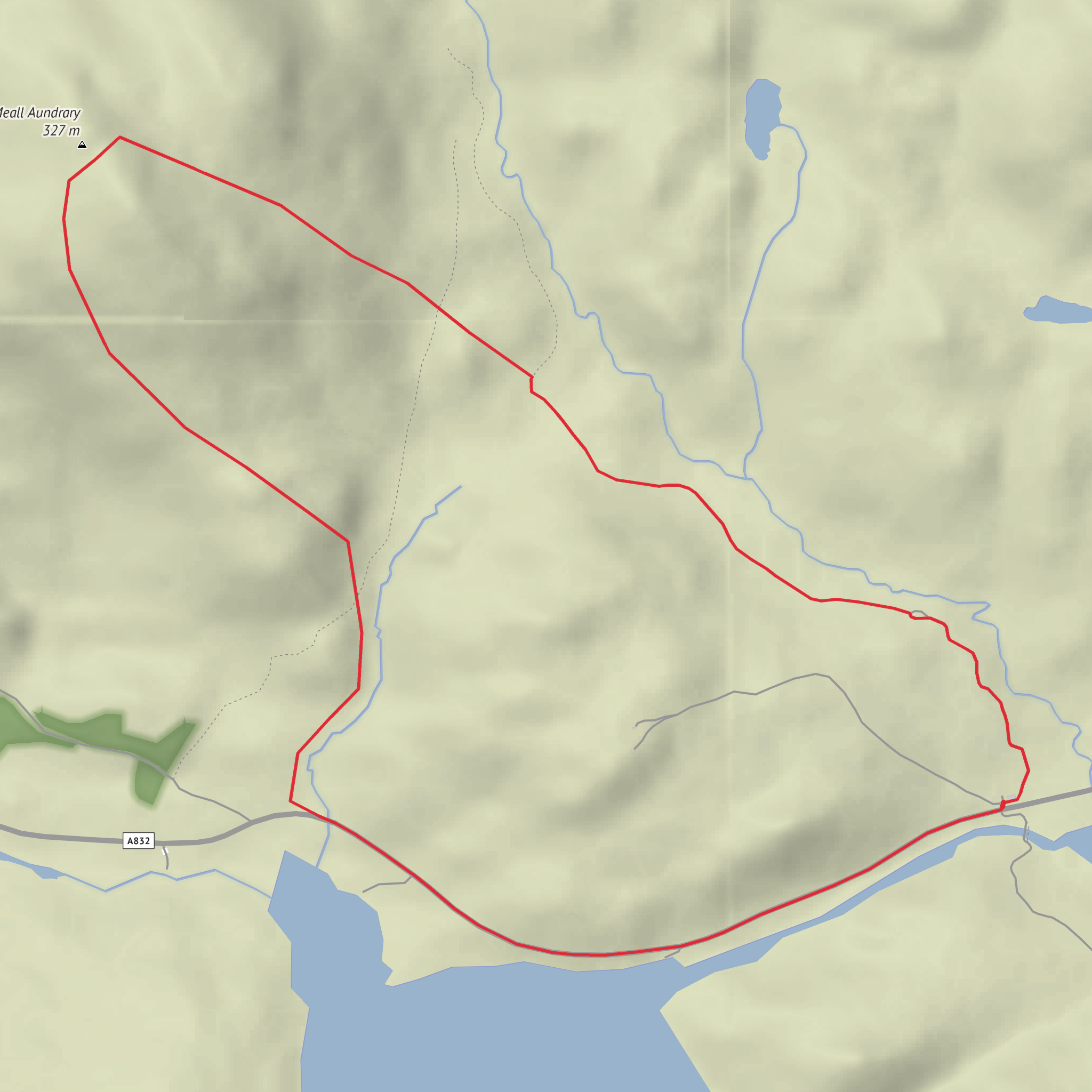
This short hill circuit explores rough Highland ground above Slattadale, on the A832 about 5 miles / 8 km south of Gairloch, with Meall Aundrary rising to about 327 metres / 1,073 feet. The hill itself sits near Loch Bad an Sgalaig and the nearest useful landmark for planning is the small parking area and shed east of Loch Bad an Sgalaig, near Slattadale, Highland, IV22 2HP. Meall Aundrary is a modest summit by Highland standards, but the loop still feels like a proper hillwalk: short, steep in places, often pathless or faint underfoot, and exposed to weather despite the relatively low height. The overall outing is around 3 km / 1.9 miles with roughly 200 metres / 656 feet of ascent, which makes the “medium” rating sensible for walkers who are comfortable on uneven terrain. (en-us.topographic-map.com)
For drivers, the simplest approach is via the A832 between Kinlochewe and Gairloch, heading for Slattadale and Loch Bad an Sgalaig. Slattadale is a recognised roadside location on this route, and recent Highland Council roadworks references place it clearly on the A832 south of Gairloch. Parking for nearby walks is commonly used at the small pull-in or car park beside the shed east of the loch, which is also the established start for other local hill routes. If arriving by public transport, the practical option is the Inverness–Gairloch bus corridor, then alighting on the A832 near Slattadale if the service and driver permit; services in this part of Wester Ross are limited, so checking current timetables before travel is essential. For navigation on the ground, carrying the route in HiiKER is a very good idea because short Highland loops like this can have indistinct trods, wet ground, and poor visibility in mist. (highland.gov.uk)
The walk begins gently enough from the roadside or parking area, but the character changes quickly. Expect a brief approach over rough moorland margins or estate ground before the climb starts in earnest. On a route of only 3 km / 1.9 miles, gaining 200 metres / 656 feet means the uphill sections feel direct rather than gradual. The terrain is likely to be a mix of grassy slopes, heather, peat, scattered rock, and occasional wet patches. In dry weather it can feel straightforward, but after rain the ground can become soft and slippery, especially where peat sits over rock or where sheep and deer tracks braid across the hillside. Because the summit is not especially high, some walkers underestimate it; the real challenge is not altitude but footing, route-finding, and exposure to Atlantic weather. (mudandroutes.com)
What to expect on the ascent
The climb onto Meall Aundrary is the main effort of the day. The hill is part of the rugged landscape between Loch Torridon and Loch Maree, and even on a short loop the views can open quickly behind you toward the surrounding moor, lochs, and larger mountains of Wester Ross. The summit itself is identified as an outcrop, with a cairn nearby but not at the exact highest point, so walkers should not assume the first pile of stones is the true top. The ascent is likely to feel steeper in its middle section, where the slope tightens and the line of least resistance may weave around rockier patches. In poor visibility, it would be easy to drift off the cleanest descent line, so keeping an eye on position in HiiKER is worthwhile. (mudandroutes.com)
Although this is a compact route, the setting has a distinctly wild feel. The nearby Bad na Sgalag area is known for rough hill paths, boggy sections, regenerating woodland, waterfalls, and broad views over Loch Bad an Sgalaig, and those same landscape traits shape the feel of Meall Aundrary. Even if your loop stays mostly on open hillside rather than entering the longer pinewood circuit, you are still moving through a
Comments and Reviews
User comments, reviews and discussions about the Meall Aundrary Loop, Scotland.
average rating out of 5
0 rating(s)
