
Download
3D Flyover
Add to list
More
16.4 km
~4 hrs 26 min
695 m
Loop
“A forest-to-ridge Cairngorms circuit unfolding into airy horizons, shifting light, and a satisfyingly rugged hill day.”
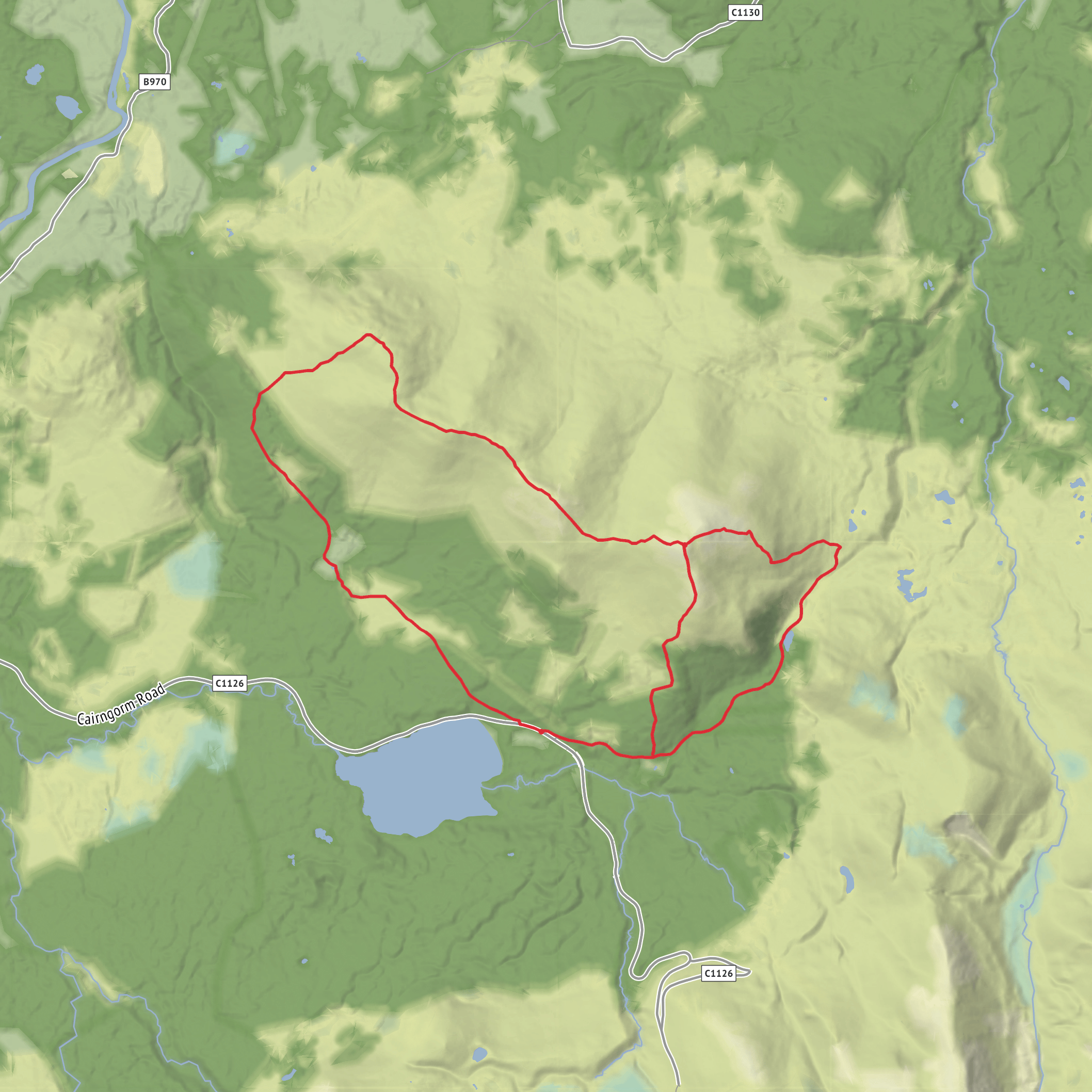
This medium-difficulty Cairngorms loop packs a lot into roughly 16 km / 10 miles, with about 700 m / 2,300 ft of ascent: forest tracks, open moor, a long airy ridge, three distinct tops, and one of the best viewpoints over Glenmore and the northern Cairngorms. The route is most commonly associated with Badaguish Outdoor Centre, Glenmore, Aviemore, or with Glenmore Visitor Centre, Glenmore, Aviemore PH22 1QU, depending on the exact line you follow. For a loop of this length and ascent, expect a full hill day of around 6 to 7 hours, longer in poor weather or if the ground is wet. (walkhighlands.co.uk)
The walking begins gently enough through woodland and estate tracks, but that easy start can be misleading. Once you leave the forest behind, the route becomes a more serious upland outing with rougher hill paths, occasional boggy sections, and steeper climbs onto the ridge. The broad ridge linking Craiggowrie, Creagan Gorm, and Meall a’ Bhuachaille gives the walk its character: long views, changing light, and a real sense of space without the technical demands of the higher Cairngorm plateau. (walkhighlands.co.uk)
What the route feels like
From the Badaguish side, the first few kilometres are usually on clear forest tracks and paths, climbing gradually through Scots pine woodland before breaking out onto open ground. After about 2 km / 1.25 miles, the route steepens and becomes more obviously a hillwalk, with some wetter patches underfoot and a more sustained pull up to the first ridge high point near Craiggowrie. This opening section is a good place to settle into a steady pace, because the ridge ahead is longer and more undulating than it can appear on a map. (walkhighlands.co.uk)
Once on the ridge, the walk becomes far more expansive. The line south and southeast over the intermediate tops is never especially technical in dry, calm conditions, but it is exposed to wind and weather. There are repeated small descents and re-ascents, so the effort feels greater than the raw distance suggests. Looking out, you can expect wide views over Glenmore, Loch Morlich, the forests around Rothiemurchus, and across to the higher Cairngorm massif. (walkhighlands.co.uk)
The climb from the bealach below Meall a’ Bhuachaille is the final main ascent. The summit itself stands at about 810 m / 2,657 ft, and it is well known as a superb viewpoint despite being lower and more accessible than many neighbouring hills. A large shelter cairn marks the top. On a clear day, this is where the scale of the northern Cairngorms really opens up. (walkhighlands.co.uk)
Navigation and terrain to watch for
Although the route is generally straightforward for experienced hillwalkers in good visibility, there are a few places where care matters. The descent from Creagan Gorm is one of the main navigation points: it is easy to drift too far left and lose the correct line. The safer approach is to descend directly from the cairn on the steeper line to the bealach before continuing toward Meall a’ Bhuachaille. In mist, the broad ridge and open moor can feel less obvious than they do in clear weather, so route-finding should not be underestimated. Use HiiKER alongside standard hill navigation skills. (walkhighlands.co.uk)
The descent from Meall a’ Bhuachaille toward Ryvoan is on a constructed path and is usually clear, but it can be steep in places and hard on tired knees. In wet or windy weather, this section needs care, especially where stone pitching
Surfaces
Unknown
Unpaved
Gravel
Dirt
Asphalt
Paved
Comments and Reviews
User comments, reviews and discussions about the Meall a' Bhuachaille, Creagan Gorm and Craiggowrie Loop, Scotland.
average rating out of 5
0 rating(s)
