Download
3D Flyover
Add to list
More
11.7 km
~2 hrs 24 min
39 m
Out and Back
“A gentle Skye circuit where silver lochans, tidal flats, and mountain shadows trade moods.”
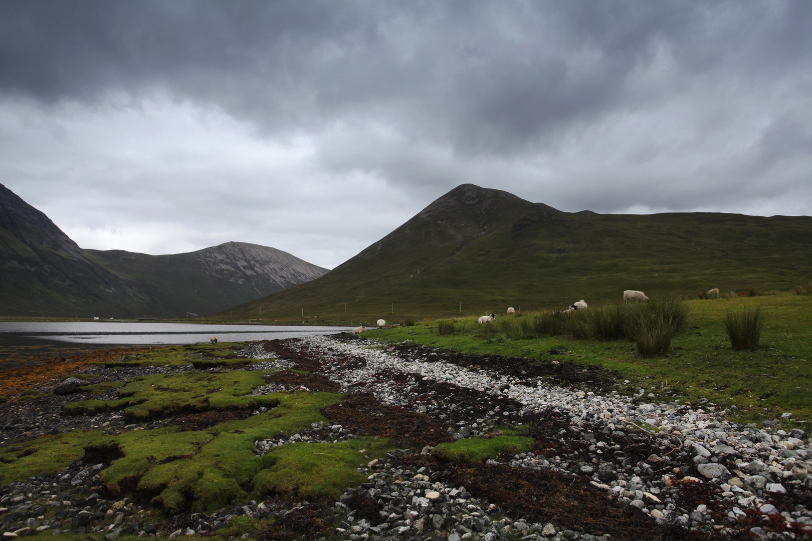
This easy-going circuit explores the quiet head of Loch Slapin and the low-lying ground around Loch na Sguabaidh and Lochan Sratha Mhòir on the Isle of Skye, giving a very different side of the island from the better-known mountain routes. Over roughly 12 km / 7.5 miles, with almost no overall ascent, it is more about space, water, changing light, and wide views than steep climbing. The route sits near the bridge at the head of Loch Slapin on the B8083, close to the small settlement of Torrin and the Strath Mòr track entrance, which is the most useful landmark for locating the start. Walkhighlands identifies the nearby start for Beinn na Cro as the bridge at the head of Loch Slapin, with parking just east of the bridge by the track through Strath Mòr. (walkhighlands.co.uk)
The setting is striking from the outset. Loch Slapin is a sea loch on Skye’s southeastern coast, and at its inland end the landscape opens into a broad, flat strath where freshwater lochans, marshy ground, burns, and tidal edges meet. That mix of habitats gives the walk a remote feel despite its modest distance and easy grade. The surrounding skyline is anything but modest: Blà Bheinn rises dramatically nearby, while Beinn na Cro and the Red Hills help frame the route, so even a low-level outing here feels distinctly Highland. (en.wikipedia.org)
Getting to the start is straightforward by car. From Broadford, follow the B8083 toward Torrin and Elgol; the bridge and track at the head of Loch Slapin are reached before continuing farther south toward Elgol. Broadford is the main practical approach point on Skye’s road network, and the B8083 is the road that runs from Broadford toward Elgol via the Loch Slapin side of the island. (en.wikipedia.org)
Public transport is possible but needs planning. Bus service 55 links Broadford with Torrin and Elgol, and current timetable data published via Stagecoach/Bustimes shows service through Broadford and onward toward Torrin and Elgol on weekdays, with limited frequency. Older travel references also describe the Broadford–Elgol journey as taking around 45 minutes and note only a few services per day, so hikers should check the latest timetable before setting out. (bustimes.org)
What the route feels like
Expect a mixture of estate track, rough path, grassy ground, and potentially wet sections near the lochans and burns. Even though the elevation gain is negligible, this is not necessarily a dry, fast 12 km / 7.5 mile stroll in all conditions. Ground around Strath Mòr and the head of Loch Slapin can be soft or boggy after rain, and the easy rating depends largely on calm weather, decent visibility, and sensible footwear. Nearby route descriptions in the same area repeatedly mention boggy or wet ground, which is a useful clue for planning here as well. (walkhighlands.co.uk)
The first part usually feels broad and open, with the tidal head of Loch Slapin behind you and freshwater features drawing you inland. Lochan Sratha Mhòir is one of those subtle Highland waters that can seem almost hidden in the folds of the moor, while Loch na Sguabaidh is larger and more expansive, often reflecting the surrounding hills when the wind drops. Because the route stays low, the views constantly shift between intimate details—rushes, peat, burns, stones, birdlife—and much bigger mountain backdrops. (geograph.org.uk)
Navigation is usually uncomplicated in clear weather if you follow the main line of travel carefully, but the openness of the terrain means paths can become faint in places. In mist, the lochans, marshy ground, and branching trods can make direction less obvious than the easy grade suggests, so carrying the route on HiiKER is a sensible precaution.
Landmarks, scenery, and wildlife
One of the most distinctive landmarks is the bridge and tidal area at the head of Loch Sl

Comments and Reviews
User comments, reviews and discussions about the Lochan Sratha Mhoir, Loch na Sguabaidh and Loch Slapin, Scotland.
average rating out of 5
0 rating(s)