
Download
3D Flyover
Add to list
More
9.2 km
~3 hrs 7 min
774 m
Out and Back
“Beinn Alligin delivers a fierce, sculpted scramble through Torridon’s sandstone horns above wild Loch Torridon.”
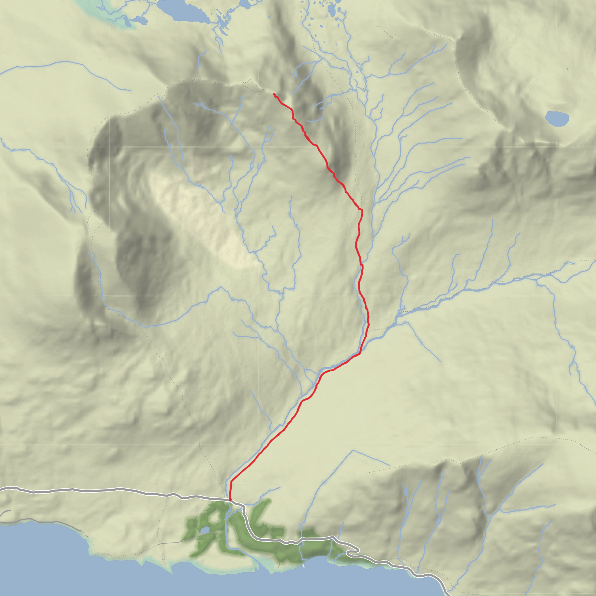
This is a short but serious mountain outing in the Torridon hills of the Northwest Highlands of Scotland, centered on the rocky pinnacles known as the Horns of Alligin on Beinn Alligin. Although your distance is only around 9 km / 5.6 miles, the combination of roughly 800 m / 2,625 ft of ascent, steep ground, rough mountain terrain, and exposed scrambling makes it a difficult day that suits experienced hillwalkers with a head for heights. The usual access point is the Coire Mhic Nobuil car park, beside the bridge over the Abhainn Coire Mhic Nobuil, about 3 km / 1.9 miles west of Torridon village on the minor road toward Inveralligin. That is the nearest clear landmark and practical trailhead for this route. (walkhighlands.co.uk)
From the start, the route heads into a dramatic glen beneath the south side of Beinn Alligin, with the mountain’s sandstone walls and the jagged outline of the Horns becoming more imposing as height is gained. Early ground is usually more straightforward underfoot, but the route soon steepens as it climbs toward the ridge. Expect a sustained ascent rather than a gentle warm-up, and in wet or windy weather the mountain can feel much more committing than the mileage suggests. The Torridonian sandstone here is often praised for being relatively solid, but steep descents and polished or damp rock still demand care. (highlandexplorer.scot)
What the terrain is like
The defining feature of this hike is the traverse of Na Rathanan, the Horns of Alligin: three rocky pinnacles that form one of the best-known scrambly ridges in Scotland. The ridge narrows in places, and progress becomes slower as walking gives way to hands-on movement over rock steps, ledges, and short descents. The first Horn is often the point where people decide whether the route matches their comfort level, as the scrambling becomes more exposed here. Some parties bypass part of the difficulties on a path below, but even the avoidance line can feel airy and should not be treated as an easy escape. (walkhighlands.co.uk)
Allow more time than the distance alone suggests. On paper, 9 km / 5.6 miles may sound modest, but steep climbing, route-finding, and careful movement over the pinnacles can make this a full mountain day. Strong winds, low cloud, or rain can significantly increase the seriousness of the outing, especially on the ridge where balance, visibility, and confidence all matter. For navigation, carrying the route on HiiKER is a sensible way to keep track of the approach, ridge line, and descent options. (highlandexplorer.scot)
Landmarks, scenery, and natural character
One of the great rewards of this route is how quickly the landscape opens out. Looking south, the waters of Loch Torridon and the scattered settlement pattern of the glen give a strong sense of the remoteness of Wester Ross. Around you are some of the most celebrated mountains in Scotland, with the wider Torridon group creating a skyline of steep corries, long ridges, and ancient rock architecture. Beinn Alligin is especially recognizable from afar because of the Horns themselves and the broad dome of Sgùrr Mhòr. (walkhighlands.co.uk)
The geology is a major part of the mountain’s character. The Torridon area is famous for very old sandstone landscapes shaped by glaciation, which explains the abrupt corrie headwalls, terraces, and broken ridges you see on this route. The result is a mountain that feels both rugged and sculpted, with huge visual contrast between grassy lower slopes, shattered rock bands, and the sharp crest of the Horns. (scotlandfarandnear.co.uk)
Wildlife can include red deer on the lower slopes and in the glens, while golden eagles and other upland birds are always a possibility in the wider Torridon area. Hikers should also be prepared for midges in still conditions lower down during warmer months, and for rapidly changing mountain weather at any time of year. (scotlandfarandnear.co.uk)
Historical and regional context
This landscape sits within one of the most storied mountain regions in the Highlands. The names themselves reflect the area’s deep Gaelic heritage: Na Rathanan refers to the Horns, and Coire Mhic Nobuil preserves older place-name traditions tied to family and landscape. The Torridon region also carries traces of Norse influence in nearby place names such as Diabaig, often linked to Old Norse roots meaning a deep bay. That mix of Gaelic and Norse naming reflects the long human history of the northwest coast, where seafaring, crofting, and seasonal movement through rugged terrain shaped settlement patterns for centuries.
Comments and Reviews
User comments, reviews and discussions about the Horns of Allign form Coire, Scotland.
average rating out of 5
0 rating(s)

