Download
Preview
Add to list
More
8.1 km
~1 hrs 55 min
188 m
Out and Back
“A wild island circuit of seabird cliffs, Atlantic drama, and reflective solitude under vast northern skies.”
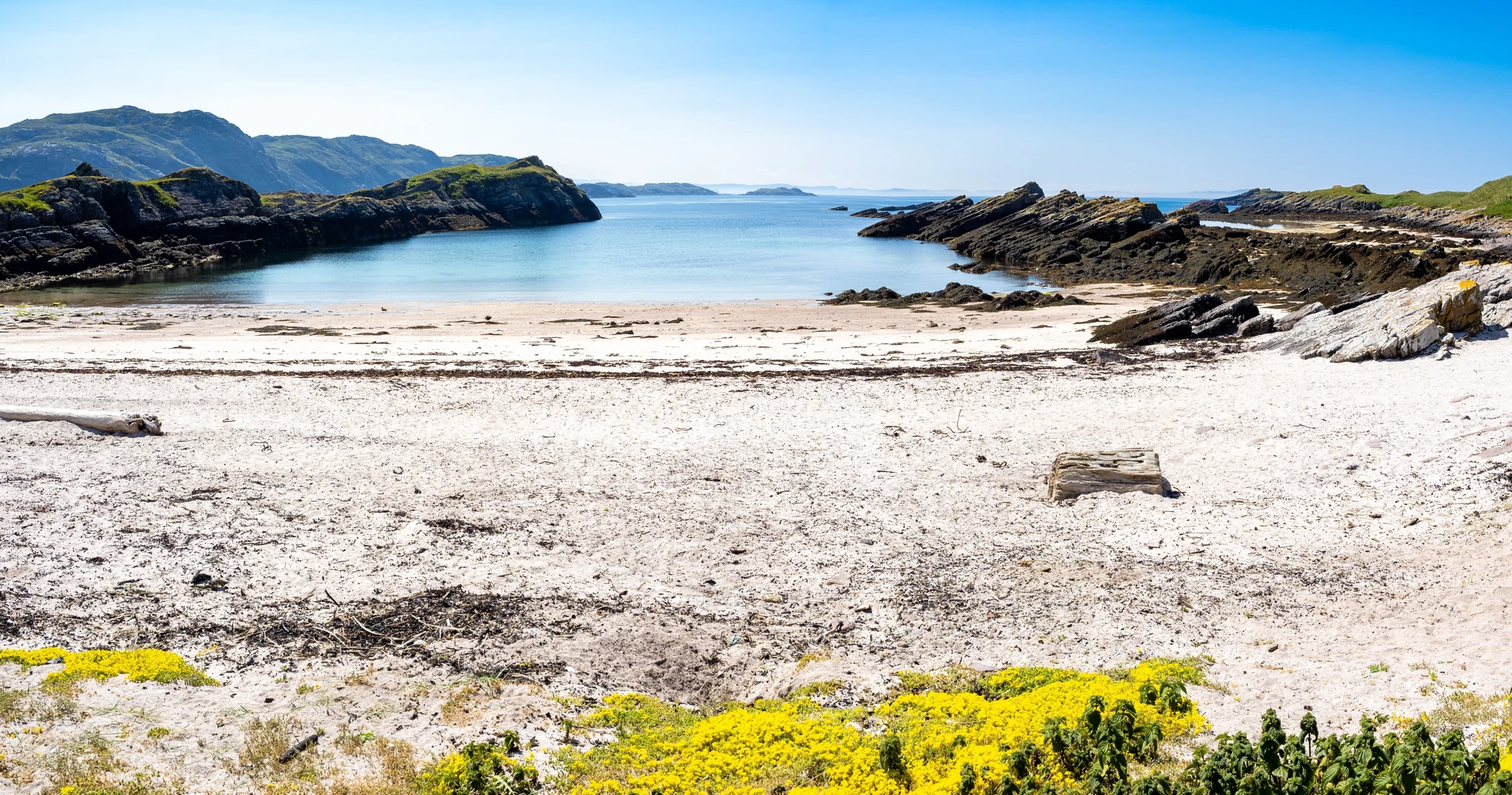
This roughly 8 km / 5 mile circuit on Handa Island is a coastal wildlife walk rather than a summit day, but the setting makes it feel far bigger than the numbers suggest. With around 200 metres / 656 feet of total ascent, the terrain is generally moderate, and the estimated medium difficulty comes less from steep climbing than from exposure, uneven ground, changeable weather, and the remoteness of the location. The walk begins from the Handa Island landing area reached by the small passenger ferry from Tarbet, the tiny mainland settlement and jetty near Scourie on the A894, commonly identified as Tarbet Pier, IV27 4SS. Visitors are typically met on arrival and given route guidance for the island paths. (handa-ferry.com)
The route usually follows the island’s waymarked walking circuit, heading out across open moor and machair-like grassland before reaching the dramatic cliff edge scenery for which Handa is best known. Although the island is not large, the landscape feels wild and elemental: peat underfoot, low heath, rocky outcrops, and long views back to the mountains of Assynt and northwest Sutherland. Much of the walking is straightforward, but sections can be boggy, rough, or slippery after rain, and the cliff-top stretches demand care in strong winds. Good waterproof footwear is more useful here than heavy mountain boots, and full waterproofs are worth carrying even on a promising forecast because Atlantic weather can change quickly. (gps-routes.co.uk)
What to expect on the route
From the landing area, the path trends inland and gradually gains height without any single sustained climb. The first 1.5 to 2 km / 0.9 to 1.2 miles are usually the gentlest part of the outing, giving you time to settle into the island’s rhythm. Boardwalk and improved path sections may appear in places, but this should still be treated as a natural trail. As the route reaches the higher western and northern side of the island, the scenery becomes much more dramatic, with sheer sandstone cliffs dropping into the Atlantic. This is where the walk earns its reputation. The sea stacks and geos are the visual highlights, and Geodh a' Bhrisidh is one of the striking inlets on this rugged coast, where the land appears split and broken by the sea. (gps-routes.co.uk)
The most memorable viewpoints are generally found between about 3 and 6 km / 1.9 and 3.7 miles into the circuit, where the cliff line becomes the dominant feature. Expect big, open panoramas rather than enclosed trail scenery. On clear days, the backdrop of the mainland mountains adds a lot to the experience, especially the distinctive Torridonian sandstone peaks across the water. The path then curves back toward the south side of the island, easing away from the cliff edge and returning across more open ground to the landing point. Because the route is a circuit, navigation is usually uncomplicated in decent visibility, but in mist or poor weather it is still wise to have the route loaded in HiiKER before setting out. (visitscotland.com)
Wildlife and seasonal interest
Handa is internationally important for seabirds and is managed as a Scottish Wildlife Trust reserve, with the island also protected as a Site of Special Scientific Interest and Special Protection Area. In the breeding season, the cliffs and stacks support huge numbers of seabirds, with guillemots and razorbills especially prominent, and puffins among the species many visitors hope to see. Summer is the classic time to visit for birdlife, when the island can host around 100,000 breeding seabirds. White-tailed sea eagles and other species may also be seen in the area. (visitscotland.com)
This is a walk where binoculars can be as useful as trekking poles. If you are visiting in seabird season, allow extra time for stops at the viewpoints because progress can be slow once the colonies come into view. Outside peak bird season, the island still offers a strong sense of solitude, coastal scenery, and maritime vegetation, but the atmosphere is quieter and more austere. Because Handa is a sensitive reserve, hikers should expect to stay on the established route and follow any seasonal guidance issued on arrival. (visitscotland.com)
Terrain, hazards, and preparation
Despite the modest elevation gain, this is not a casual promenade. The main things to look out for are cliff exposure, gusting wind, wet ground,

Comments and Reviews
User comments, reviews and discussions about the Geodh a' Bhrisidh in Handa Island, Scotland.
average rating out of 5
0 rating(s)